State guide
Public land that may allow hunting in Arkansas
103 named public land units in Arkansas from PAD-US 4.1: 57 state wildlife & game areas, 7 forests & grasslands, 11 wildlife refuges & WPAs, 1 BLM units, 22 lake & reservoir project lands, 5 other public land units. The largest are Ouachita National Forest, Ozark National Forest, Dale Bumpers White River National Wildlife Refuge.
- 103listed areas
- 3.8Macres (approx.)
- 57state wildlife & game areas
Arkansas deer season dates for 2026 (from the state agency) · Deer score calculator · How to score a buck
Regulations & licenses: Arkansas Game and Fish Commission
This site does not list seasons, bag limits, license or permit rules. Those change every year and differ by area. Check them with the state agency before you go, and confirm the specific area is open to the hunting you plan.
Where the listed areas are
One dot per area at its reference point; larger dots are larger areas. Outline: U.S. Census Bureau.
Acres by land type
Approximate acres for the portion of each unit inside Arkansas.
Photos from Arkansas public lands
All photo credits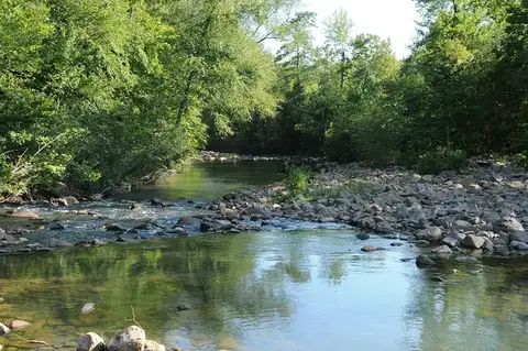
Photo: USDAgov · public domain · original source
Public-domain photos by U.S. federal agencies, taken in the place named on each card.
All 103 areas, largest first
- National Forest land
Ouachita National Forest
1,430,442 acres
U.S. Forest Service (USDA) · Scott County, Montgomery County + 9 more
Open access - National Forest land
Ozark National Forest
1,133,068 acres
U.S. Forest Service (USDA) · Newton County, Pope County + 14 more
Open access - National Wildlife Refuge
Dale Bumpers White River National Wildlife Refuge
157,155 acres
U.S. Fish and Wildlife Service · Arkansas County, Monroe County + 2 more
Restricted access - National Wildlife Refuge
Felsenthal National Wildlife Refuge
75,421 acres
U.S. Fish and Wildlife Service · Union County, Ashley County + 1 more
Restricted access - National Wildlife Refuge
Cache River National Wildlife Refuge
74,469 acres
U.S. Fish and Wildlife Service · Woodruff County, Monroe County + 2 more
Restricted access - Army Corps of Engineers project land
Bull Shoals Recreation Area
67,248 acres
U.S. Army Corps of Engineers · Marion County, Boone County + 1 more
Open access - Army Corps of Engineers project land
Dardanelle Recreation Area
57,179 acres
U.S. Army Corps of Engineers · Johnson County, Logan County + 3 more
Open access - Army Corps of Engineers project land
Norfork Recreation Area
49,594 acres
U.S. Army Corps of Engineers · Baxter County, Fulton County
Open access - Army Corps of Engineers project land
Greers Ferry Recreation Area
41,361 acres
U.S. Army Corps of Engineers · Cleburne County, Van Buren County
Open access - Army Corps of Engineers project land
Beaver Recreation Area
38,415 acres
U.S. Army Corps of Engineers · Benton County, Carroll County + 1 more
Open access - Army Corps of Engineers project land
Millwood Recreation Area
37,701 acres
U.S. Army Corps of Engineers · Little River County, Sevier County + 2 more
Open access - State wildlife / game area
Bayou Meto
31,992 acres
State: fish and wildlife agency · Arkansas County, Jefferson County
Restricted access - State wildlife / game area
Lake Greeson Wildlife Management Area
31,630 acres
State: department of natural resources · Pike County
Restricted access - National Wildlife Refuge
Pond Creek National Wildlife Refuge
27,470 acres
U.S. Fish and Wildlife Service · Sevier County
Restricted access - State wildlife / game area
Howard County Wildlife Management Area
27,436 acres
State: department of natural resources · Howard County
Restricted access - State wildlife / game area
Saint Francis Sunken Lands
27,347 acres
State: fish and wildlife agency · Poinsett County, Craighead County + 2 more
Restricted access - Army Corps of Engineers project land
Nimrod Recreation Area
25,536 acres
U.S. Army Corps of Engineers · Yell County, Perry County
Open access - State wildlife / game area
Dave Donaldson Black River Wildlife Management Area
25,179 acres
State: fish and wildlife agency · Clay County, Randolph County + 1 more
Restricted access - National Forest land
St. Francis National Forest
21,293 acres
U.S. Forest Service (USDA) · Lee County, Phillips County
Open access - State wildlife / game area
Poison Spring State Forest / Wildlife Management Area
18,702 acres
State: department of land · Ouachita County, Nevada County
Restricted access - State wildlife / game area
Sulphur River
18,143 acres
State: fish and wildlife agency · Miller County
Restricted access - Army Corps of Engineers project land
Ozark Recreation Area
17,657 acres
U.S. Army Corps of Engineers · Franklin County, Crawford County + 1 more
Open access - State wildlife / game area
Henry Gray/hurricane Lake
17,487 acres
State: fish and wildlife agency · White County
Open access - Army Corps of Engineers project land
Blue Mountain Recreation Area
17,282 acres
U.S. Army Corps of Engineers · Logan County, Yell County
Open access - State wildlife / game area
Gene Rush/buffalo River
17,011 acres
State: fish and wildlife agency · Newton County, Searcy County
Restricted access - National Wildlife Refuge
Bald Knob National Wildlife Refuge
15,445 acres
U.S. Fish and Wildlife Service · White County
Restricted access - State wildlife / game area
Petit Jean
15,146 acres
State: fish and wildlife agency · Yell County
Restricted access - State wildlife / game area
Lafayette Wildlife Management Area
14,721 acres
State: fish and wildlife agency · Lafayette County
Restricted access - State wildlife / game area
Madison County
14,198 acres
State: fish and wildlife agency · Madison County
Restricted access - National Wildlife Refuge
Overflow National Wildlife Refuge
13,595 acres
U.S. Fish and Wildlife Service · Ashley County
Restricted access - State wildlife / game area
Harold Alexander/spring River Wildlife Management Area
13,146 acres
State: fish and wildlife agency · Sharp County
Restricted access - State wildlife / game area
Gulf Mtn Wildlife Management Area
12,296 acres
State: fish and wildlife agency · Van Buren County
Restricted access - State wildlife / game area
Pine Tree Wildlife Demonstration Area
12,240 acres
State: fish and wildlife agency · St. Francis County
Restricted access - State wildlife / game area
Shirey Bay Rainey Brake
11,309 acres
State: fish and wildlife agency · Lawrence County
Restricted access - Army Corps of Engineers project land
Wilbur D. Mills Pool Recreation Area
11,118 acres
U.S. Army Corps of Engineers · Arkansas County, Desha County
Open access - National Wildlife Refuge
Big Lake National Wildlife Refuge
10,894 acres
U.S. Fish and Wildlife Service · Mississippi County
Restricted access - State wildlife / game area
Big Lake
10,797 acres
State: fish and wildlife agency · Mississippi County
Open access - State wildlife / game area
Dagmar
9,793 acres
State: fish and wildlife agency · Monroe County
Restricted access - State wildlife / game area
Choctaw Island
9,058 acres
State: fish and wildlife agency · Desha County
Restricted access - Army Corps of Engineers project land
Gillham Recreation Area
8,502 acres
U.S. Army Corps of Engineers · Howard County, Polk County
Open access - State wildlife / game area
Ed Gordon/pt. Remove
8,420 acres
State: fish and wildlife agency · Conway County
Restricted access - State wildlife / game area
Cut-off Creek
8,315 acres
State: fish and wildlife agency · Drew County
Restricted access - Army Corps of Engineers project land
Dequeen Recreation Area
7,450 acres
U.S. Army Corps of Engineers · Sevier County
Open access - State wildlife / game area
Rex Hancock/black Swamp Wildlife Management Area
6,260 acres
State: fish and wildlife agency · Woodruff County
Restricted access - National Wildlife Refuge
Holla Bend National Wildlife Refuge
6,054 acres
U.S. Fish and Wildlife Service · Pope County, Yell County
Restricted access - State wildlife / game area
Bois D'arc
5,892 acres
State: fish and wildlife agency · Hempstead County
Restricted access - National Wildlife Refuge
Wapanocca National Wildlife Refuge
5,671 acres
U.S. Fish and Wildlife Service · Crittenden County
Restricted access - Army Corps of Engineers project land
Murray Pool Recreation Area
5,670 acres
U.S. Army Corps of Engineers · Pulaski County, Faulkner County + 1 more
Open access - State wildlife / game area
Nimrod State Game Management Area
5,064 acres
State: fish and wildlife agency · Yell County, Perry County
Restricted access - National Forest land
Ozark Purchase Unit
4,913 acres
U.S. Forest Service (USDA) · Pope County
Open access - State wildlife / game area
Holland Bottoms
4,903 acres
State: fish and wildlife agency · Lonoke County, Pulaski County
Restricted access - State wildlife / game area
Rick Evans/grandview Prairie
4,901 acres
State: fish and wildlife agency · Hempstead County
Restricted access - Army Corps of Engineers project land
Pool 5 (Ark. Rv) Recreation Area
4,884 acres
U.S. Army Corps of Engineers · Pulaski County, Jefferson County
Open access - State wildlife / game area
Earl Buss/bayou Deview Game Management Area
4,567 acres
State: fish and wildlife agency · Poinsett County
Restricted access - Army Corps of Engineers project land
J.P. Hammerschmidt Recreation Area
4,460 acres
U.S. Army Corps of Engineers · Sebastian County, Crawford County
Open access - State wildlife / game area
Trusten Holder
4,372 acres
State: fish and wildlife agency · Arkansas County
Restricted access - State wildlife / game area
Camp Robinson Wildlife Demonstration Area
4,202 acres
State: fish and wildlife agency · Faulkner County
Restricted access - Army Corps of Engineers project land
Dierks Recreation Area
4,160 acres
U.S. Army Corps of Engineers · Sevier County, Howard County
Open access - State wildlife / game area
Steve N. Wilson/raft Creek
4,097 acres
State: fish and wildlife agency · White County
Restricted access - State wildlife / game area
William Brewer/scatter Creek
4,006 acres
State: fish and wildlife agency · Greene County
Restricted access - State wildlife / game area
Galla Creek
3,307 acres
State: fish and wildlife agency · Pope County, Yell County
Restricted access - Army Corps of Engineers project land
Table Rock Recreation Area
3,012 acres
U.S. Army Corps of Engineers · Carroll County, Boone County
Open access - State wildlife / game area
Seven Devils
2,892 acres
State: fish and wildlife agency · Drew County
Restricted access - State wildlife / game area
Harris Brake
2,808 acres
State: fish and wildlife agency · Perry County
Restricted access - State wildlife / game area
Loafer's Glory
2,580 acres
State: fish and wildlife agency · Searcy County
Restricted access - State wildlife / game area
Bell Slough
2,350 acres
State: fish and wildlife agency · Faulkner County
Restricted access - State wildlife / game area
Hope Upland
2,109 acres
State: fish and wildlife agency · Hempstead County
Restricted access - Other state land
Warren Prairie 12 (Plum Creek)
2,104 acres
State: department of conservation · Drew County
Open access - Army Corps of Engineers project land
Pool 3 (Ark. Rv) Recreation Area
1,917 acres
U.S. Army Corps of Engineers · Jefferson County
Open access - National Forest land
Stumpy Point Purchase Unit
1,522 acres
U.S. Forest Service (USDA) · Phillips County, Lee County
Open access - State wildlife / game area
Cypress Bayou
1,495 acres
State: fish and wildlife agency · Lonoke County, White County
Restricted access - State wildlife / game area
Little Bayou
1,383 acres
State: fish and wildlife agency · Ashley County
Restricted access - BLM public land
BLM Southeastern States District Office Public Lands
1,148 acres
Bureau of Land Management · Searcy County, Marion County + 7 more
Open access - State wildlife / game area
Jamestown
1,091 acres
State: fish and wildlife agency · Independence County
Restricted access - State wildlife / game area
Robert Hankins/mud Creek Wildlife Demonstration Area
1,056 acres
State: fish and wildlife agency · Randolph County
Restricted access - State wildlife / game area
Bayou Desarc
949 acres
State: fish and wildlife agency · Prairie County
Restricted access - Army Corps of Engineers project land
Pool 4 (Ark. Rv) Recreation Area
862 acres
U.S. Army Corps of Engineers · Jefferson County
Open access - State forest
Holland Bottoms Willow Oak Forest Preserve
635 acres
State: other or unknown agency · Lonoke County
Restricted access - National Forest land
Richland Creek Purchase Unit
583 acres
U.S. Forest Service (USDA) · Searcy County
Open access - State wildlife / game area
Ozan
581 acres
State: fish and wildlife agency · Hempstead County
Restricted access - State wildlife / game area
Little River
578 acres
State: fish and wildlife agency · Hempstead County, Little River County
Restricted access - State wildlife / game area
Spring Bank
552 acres
State: fish and wildlife agency · Lafayette County, Miller County
Restricted access - Army Corps of Engineers project land
Terry Pool (Ark. Rv) Recreation Area
481 acres
U.S. Army Corps of Engineers · Pulaski County
Open access - State wildlife / game area
Prairie Bayou
441 acres
State: fish and wildlife agency · Lonoke County
Restricted access - State wildlife / game area
Departee Creek
424 acres
State: fish and wildlife agency · White County
Restricted access - State wildlife / game area
Kelly's Slab
373 acres
State: fish and wildlife agency · Marion County
Restricted access - State wildlife / game area
Big Creek Wildlife Management Area
285 acres
State: fish and wildlife agency · Lee County
Restricted access - State wildlife / game area
Brushy Creek
220 acres
State: fish and wildlife agency · Cross County
Restricted access - State wildlife / game area
Lee County
217 acres
State: fish and wildlife agency · Lee County
Restricted access - State wildlife / game area
Ethel
176 acres
State: fish and wildlife agency · Arkansas County
Restricted access - Army Corps of Engineers project land
Toad Suck Ferry Pool Recreation Area
164 acres
U.S. Army Corps of Engineers · Conway County, Perry County
Open access - State wildlife / game area
Blevins
128 acres
State: fish and wildlife agency · Hempstead County
Restricted access - National Wildlife Refuge
Logan Cave National Wildlife Refuge
126 acres
U.S. Fish and Wildlife Service · Benton County
Restricted access - State wildlife / game area
White Hall
115 acres
State: fish and wildlife agency · Poinsett County
Restricted access - State wildlife / game area
Ring Slough
85 acres
State: fish and wildlife agency · Clay County
Restricted access - Other state land
Devil's Eyebrow 3 (Mack)
81 acres
State: department of conservation · Benton County
Open access - Other state land
Warren Prairie 10 (Searcy)
80 acres
State: department of conservation · Drew County
Open access - State wildlife / game area
Cat Tail Marsh
79 acres
State: fish and wildlife agency · Greene County
Restricted access - Army Corps of Engineers project land
Norrell Pool Recreation Area
64 acres
U.S. Army Corps of Engineers · Arkansas County
Open access - National Wildlife Refuge
White River National Wildlife Refuge 13
64 acres
U.S. Fish and Wildlife Service · Desha County
Restricted access - State wildlife / game area
River Bend
64 acres
State: fish and wildlife agency · Perry County
Restricted access - Other state land
Devil's Eyebrow 4 (Mckenzie)
58 acres
State: department of conservation · Benton County
Open access
Acreage is calculated from simplified PAD-US boundaries for the portion inside Arkansas. “Access” is the PAD-US public access field, not a statement about hunting. National wildlife refuges are generally coded “restricted” in PAD-US because of seasonal or area closures.
Browse by county
- Arkansas County
- Ashley County
- Baxter County
- Benton County
- Clay County
- Conway County
- Crawford County
- Desha County
- Drew County
- Faulkner County
- Franklin County
- Greene County
- Hempstead County
- Howard County
- Jefferson County
- Lee County
- Logan County
- Lonoke County
- Marion County
- Monroe County
- Perry County
- Phillips County
- Pike County
- Poinsett County
- Pope County
- Pulaski County
- Searcy County
- Sebastian County
- Sevier County
- Van Buren County
- Washington County
- White County
- Yell County