State guide
Public land that may allow hunting in Minnesota
1,458 named public land units in Minnesota from PAD-US 4.1: 1,337 state wildlife & game areas, 56 forests & grasslands, 63 wildlife refuges & WPAs, 1 BLM units, 1 other public land units. The largest are Superior National Forest, Miscellaneous, Chippewa National Forest.
- 1,458listed areas
- 7.6Macres (approx.)
- 1,337state wildlife & game areas
Minnesota deer season dates for 2026 (from the state agency) · Deer score calculator · How to score a buck
Regulations & licenses: Minnesota Department of Natural Resources
This site does not list seasons, bag limits, license or permit rules. Those change every year and differ by area. Check them with the state agency before you go, and confirm the specific area is open to the hunting you plan.
Where the listed areas are
One dot per area at its reference point; larger dots are larger areas. Outline: U.S. Census Bureau.
Acres by land type
Approximate acres for the portion of each unit inside Minnesota.
Photos from Minnesota public lands
All photo credits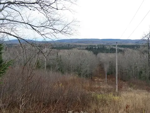
Photo: Superior National Forest · public domain · original source 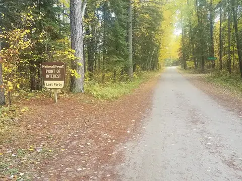
Photo: usfs_Eastern_Region · public domain · original source
Public-domain photos by U.S. federal agencies, taken in the place named on each card.
All 1,458 areas, largest first
- National Forest land
Superior National Forest
2,091,738 acres
U.S. Forest Service (USDA) · Lake County, St. Louis County + 1 more
Open access - Other state land
Miscellaneous
737,188 acres
State: department of natural resources · St. Louis County, Itasca County + 23 more
Open access - National Forest land
Chippewa National Forest
659,924 acres
U.S. Forest Service (USDA) · Itasca County, Cass County + 1 more
Open access - State forest
Pine Island State Forest
632,001 acres
State: department of natural resources · Koochiching County
Open access - State forest
Koochiching State Forest
318,390 acres
State: department of natural resources · Koochiching County
Open access - State forest
Kabetogama State Forest
157,795 acres
State: department of natural resources · St. Louis County, Koochiching County
Open access - State forest
Lake of the Woods State Forest
138,732 acres
State: department of natural resources · Lake of the Woods County
Open access - State forest
Savanna State Forest
128,764 acres
State: department of natural resources · Aitkin County, St. Louis County
Open access - State forest
Bowstring State Forest
116,037 acres
State: department of natural resources · Cass County, Itasca County
Open access - State forest
Finland State Forest
98,601 acres
State: department of natural resources · Lake County, Cook County
Open access - State forest
George Washington State Forest
95,432 acres
State: department of natural resources · Itasca County
Open access - State forest
Nemadji State Forest
88,300 acres
State: department of natural resources · Pine County, Carlton County
Open access - State forest
Hill River State Forest
79,422 acres
State: department of natural resources · Aitkin County
Open access - State wildlife / game area
Roseau River State Wildlife Management Area
75,161 acres
State: fish and wildlife agency · Roseau County
Restricted access - State forest
Red Lake State Forest
72,570 acres
State: department of natural resources · Beltrami County
Open access - National Forest land
Kabetogama Purchase Unit
68,231 acres
U.S. Forest Service (USDA) · St. Louis County
Open access - National Wildlife Refuge
Agassiz National Wildlife Refuge
61,819 acres
U.S. Fish and Wildlife Service · Marshall County
Restricted access - State forest
Paul Bunyan State Forest
60,830 acres
State: department of natural resources · Hubbard County
Open access - State forest
Solana State Forest
57,565 acres
State: department of natural resources · Aitkin County
Open access - State wildlife / game area
Thief Lake State Wildlife Management Area
54,930 acres
State: fish and wildlife agency · Marshall County
Restricted access - State forest
Sturgeon River State Forest
53,960 acres
State: department of natural resources · St. Louis County
Open access - State forest
Lost River State Forest
52,155 acres
State: department of natural resources · Roseau County
Open access - State forest
R J D Memorial Hardwood State Forest
48,745 acres
State: department of natural resources · Houston County, Wabasha County + 4 more
Open access - State forest
Big Fork State Forest
45,200 acres
State: department of natural resources · Itasca County
Open access - National Wildlife Refuge
Tamarac National Wildlife Refuge
43,520 acres
U.S. Fish and Wildlife Service · Becker County
Restricted access - State forest
Fond Du Lac State Forest
42,719 acres
State: department of natural resources · Carlton County, St. Louis County
Open access - State forest
White Earth State Forest
41,854 acres
State: department of natural resources · Clearwater County, Mahnomen County + 1 more
Open access - State forest
Cloquet Valley State Forest
39,617 acres
State: department of natural resources · St. Louis County
Open access - State forest
Pat Bayle State Forest
38,316 acres
State: department of natural resources · Cook County
Open access - State wildlife / game area
Wapiti State Wildlife Management Area
31,745 acres
State: fish and wildlife agency · Beltrami County
Restricted access - National Wildlife Refuge
Sherburne National Wildlife Refuge
30,677 acres
U.S. Fish and Wildlife Service · Sherburne County
Restricted access - State wildlife / game area
Beaches Lake State Wildlife Management Area
30,611 acres
State: fish and wildlife agency · Kittson County
Restricted access - State forest
Land O'Lakes State Forest
29,417 acres
State: department of natural resources · Cass County, Crow Wing County
Open access - Waterfowl Production Area
Otter Tail County Waterfowl Production Area
24,297 acres
U.S. Fish and Wildlife Service · Otter Tail County
Restricted access - State forest
Bear Island State Forest
24,209 acres
State: department of natural resources · St. Louis County, Lake County
Open access - State wildlife / game area
Carlos Avery State Wildlife Management Area
24,105 acres
State: fish and wildlife agency · Anoka County, Chisago County
Restricted access - National Wildlife Refuge
Glacial Ridge National Wildlife Refuge
23,266 acres
U.S. Fish and Wildlife Service · Polk County
Restricted access - State forest
Waukenabo State Forest
22,928 acres
State: department of natural resources · Aitkin County
Open access - State wildlife / game area
Moose River State Wildlife Management Area
21,210 acres
State: fish and wildlife agency · Beltrami County
Restricted access - State forest
Rum River State Forest
21,133 acres
State: department of natural resources · Mille Lacs County, Kanabec County + 1 more
Open access - National Wildlife Refuge
Upper Mississippi River National Wildlife And Fish Refuge
19,757 acres
U.S. Fish and Wildlife Service · Houston County, Wabasha County + 1 more
Restricted access - State forest
Foot Hills State Forest
18,615 acres
State: department of natural resources · Cass County
Open access - State forest
Buena Vista State Forest
18,520 acres
State: department of natural resources · Beltrami County
Open access - National Wildlife Refuge
Rice Lake National Wildlife Refuge
18,092 acres
U.S. Fish and Wildlife Service · Aitkin County
Restricted access - State forest
Chengwatana State Forest
17,056 acres
State: department of natural resources · Pine County, Chisago County
Open access - State wildlife / game area
Elm Lake State Wildlife Management Area
15,753 acres
State: fish and wildlife agency · Marshall County
Restricted access - State wildlife / game area
Huntersville State Forest
15,028 acres
State: department of natural resources · Wadena County, Hubbard County
Open access - State forest
Smoky Hills State Forest
14,933 acres
State: department of natural resources · Becker County
Open access - State wildlife / game area
Palmville State Wildlife Management Area
14,880 acres
State: fish and wildlife agency · Roseau County, Marshall County
Restricted access - Waterfowl Production Area
Kandiyohi County Waterfowl Production Area
14,530 acres
U.S. Fish and Wildlife Service · Kandiyohi County
Restricted access - Waterfowl Production Area
Becker County Waterfowl Production Area
14,331 acres
U.S. Fish and Wildlife Service · Becker County
Restricted access - Waterfowl Production Area
Pope County Waterfowl Production Area
14,229 acres
U.S. Fish and Wildlife Service · Pope County
Restricted access - State forest
Northwest Angle State Forest
14,178 acres
State: department of natural resources · Lake of the Woods County
Open access - State wildlife / game area
Carp Swamp State Wildlife Management Area
14,005 acres
State: fish and wildlife agency · Lake of the Woods County
Restricted access - State forest
Two Inlets State Forest
13,832 acres
State: department of natural resources · Becker County
Open access - State wildlife / game area
Caribou State Wildlife Management Area
13,611 acres
State: fish and wildlife agency · Kittson County
Restricted access - Waterfowl Production Area
Polk County Waterfowl Production Area
13,580 acres
U.S. Fish and Wildlife Service · Polk County
Restricted access - Waterfowl Production Area
Polk County Waterfowl Production Area Of Mn
13,573 acres
U.S. Fish and Wildlife Service · Polk County
Restricted access - Waterfowl Production Area
Clay County Waterfowl Production Area Of Mn
13,466 acres
U.S. Fish and Wildlife Service · Clay County
Restricted access - Waterfowl Production Area
Big Stone County Waterfowl Production Area
12,898 acres
U.S. Fish and Wildlife Service · Big Stone County
Restricted access - Waterfowl Production Area
Clay County Waterfowl Production Area Of Minnesota
12,797 acres
U.S. Fish and Wildlife Service · Clay County
Restricted access - State forest
Smokey Bear State Forest
11,673 acres
State: department of natural resources · Koochiching County
Open access - Waterfowl Production Area
Douglas County Waterfowl Production Area Of Mn
11,659 acres
U.S. Fish and Wildlife Service · Douglas County
Restricted access - National Wildlife Refuge
Big Stone National Wildlife Refuge
11,657 acres
U.S. Fish and Wildlife Service · Lac qui Parle County, Big Stone County
Restricted access - National Forest land
Pigeon River Purchase Unit
11,477 acres
U.S. Forest Service (USDA) · Cook County
Open access - Waterfowl Production Area
Douglas County Waterfowl Production Area
11,454 acres
U.S. Fish and Wildlife Service · Douglas County
Restricted access - Waterfowl Production Area
Grant County Waterfowl Production Area
11,448 acres
U.S. Fish and Wildlife Service · Grant County
Restricted access - State wildlife / game area
Graceton State Wildlife Management Area
10,715 acres
State: fish and wildlife agency · Lake of the Woods County
Restricted access - State wildlife / game area
East Park State Wildlife Management Area
10,410 acres
State: fish and wildlife agency · Marshall County
Restricted access - National Wildlife Refuge
Minnesota Valley National Wildlife Refuge
10,371 acres
U.S. Fish and Wildlife Service · Scott County, Carver County + 2 more
Restricted access - Waterfowl Production Area
Stearns County Waterfowl Production Area
10,170 acres
U.S. Fish and Wildlife Service · Stearns County
Restricted access - Waterfowl Production Area
Stevens County Waterfowl Production Area
9,803 acres
U.S. Fish and Wildlife Service · Stevens County
Restricted access - State forest
Battleground State Forest
9,660 acres
State: department of natural resources · Cass County
Open access - State wildlife / game area
Nereson State Wildlife Management Area
9,574 acres
State: fish and wildlife agency · Roseau County
Restricted access - State forest
Pillsbury State Forest
9,354 acres
State: department of natural resources · Cass County
Open access - State wildlife / game area
Twin Lakes State Wildlife Management Area
8,851 acres
State: fish and wildlife agency · Kittson County
Restricted access - Waterfowl Production Area
Swift County Waterfowl Production Area
8,671 acres
U.S. Fish and Wildlife Service · Swift County
Restricted access - State forest
Mississippi Headwaters State Forest
8,528 acres
State: department of natural resources · Beltrami County, Clearwater County + 1 more
Open access - State forest
Snake River State Forest
7,893 acres
State: department of natural resources · Kanabec County
Open access - State wildlife / game area
Skull Lake State Wildlife Management Area
7,446 acres
State: fish and wildlife agency · Kittson County
Restricted access - Waterfowl Production Area
Mahnomen County Waterfowl Production Area
6,851 acres
U.S. Fish and Wildlife Service · Mahnomen County
Restricted access - State forest
Crow Wing State Forest
6,532 acres
State: department of natural resources · Crow Wing County
Open access - State forest
Lyons State Forest
6,514 acres
State: department of natural resources · Wadena County
Open access - State wildlife / game area
Eckvoll State Wildlife Management Area
6,502 acres
State: fish and wildlife agency · Marshall County
Restricted access - State wildlife / game area
Huntly State Wildlife Management Area
6,502 acres
State: fish and wildlife agency · Marshall County
Restricted access - State forest
Welsh Lake State Forest
6,267 acres
State: department of natural resources · Cass County
Open access - State forest
Sand Dunes State Forest
5,804 acres
State: department of natural resources · Sherburne County
Open access - State wildlife / game area
Meadow Brook State Wildlife Management Area
5,775 acres
State: fish and wildlife agency · Cass County
Restricted access - State forest
General C.C. Andrews State Forest
5,731 acres
State: department of natural resources · Pine County
Open access - BLM public land
BLM Northeastern States District Office Public Lands
5,495 acres
Bureau of Land Management · Lake of the Woods County, St. Louis County + 6 more
Open access - Waterfowl Production Area
Meeker County Waterfowl Production Area
5,379 acres
U.S. Fish and Wildlife Service · Meeker County
Restricted access - National Wildlife Refuge
Northern Tallgrass Prairie National Wildlife Refuge
5,321 acres
U.S. Fish and Wildlife Service · Lincoln County, Rock County + 8 more
Restricted access - Waterfowl Production Area
Jackson County Waterfowl Production Area Of Mn
5,265 acres
U.S. Fish and Wildlife Service · Jackson County
Restricted access - State wildlife / game area
Talcot Lake State Wildlife Management Area
5,259 acres
State: fish and wildlife agency · Cottonwood County, Murray County
Restricted access - Waterfowl Production Area
Jackson County Waterfowl Production Area
5,211 acres
U.S. Fish and Wildlife Service · Jackson County
Restricted access - State forest
Wealthwood State Forest
5,128 acres
State: department of natural resources · Aitkin County
Open access - State forest
Badoura State Forest
4,572 acres
State: department of natural resources · Hubbard County
Open access - State wildlife / game area
Hamre State Wildlife Management Area
4,514 acres
State: fish and wildlife agency · Beltrami County
Restricted access - State wildlife / game area
Carver Highlands Wildlife Management Area
4,438 acres
State: department of natural resources · Carver County, Hennepin County
Open access - Waterfowl Production Area
Lac Qui Parle County Waterfowl Production Area
4,360 acres
U.S. Fish and Wildlife Service · Lac qui Parle County
Restricted access - Waterfowl Production Area
Traverse County Waterfowl Production Area
4,163 acres
U.S. Fish and Wildlife Service · Traverse County
Restricted access - State wildlife / game area
Carmelee State Wildlife Management Area
3,903 acres
State: fish and wildlife agency · Beltrami County
Restricted access - State wildlife / game area
Rothsay State Wildlife Management Area
3,884 acres
State: fish and wildlife agency · Wilkin County
Restricted access - Waterfowl Production Area
Cottonwood County Waterfowl Production Area
3,758 acres
U.S. Fish and Wildlife Service · Cottonwood County
Restricted access - State wildlife / game area
Four Brooks State Wildlife Management Area
3,654 acres
State: fish and wildlife agency · Mille Lacs County
Restricted access - Waterfowl Production Area
Blue Earth County Waterfowl Production Area
3,653 acres
U.S. Fish and Wildlife Service · Blue Earth County
Restricted access - State wildlife / game area
Espelie State Wildlife Management Area
3,648 acres
State: fish and wildlife agency · Marshall County
Restricted access - State wildlife / game area
Pelan State Wildlife Management Area
3,634 acres
State: fish and wildlife agency · Kittson County
Restricted access - State wildlife / game area
Willow-Run State Wildlife Management Area
3,563 acres
State: fish and wildlife agency · Beltrami County
Restricted access - State wildlife / game area
Grygla State Wildlife Management Area
3,443 acres
State: fish and wildlife agency · Marshall County
Restricted access - National Wildlife Refuge
Hamden Slough National Wildlife Refuge
3,424 acres
U.S. Fish and Wildlife Service · Becker County
Restricted access - State wildlife / game area
Hubbel Pond State Wildlife Management Area
3,405 acres
State: fish and wildlife agency · Becker County
Restricted access - Waterfowl Production Area
Wright County Waterfowl Production Area
3,401 acres
U.S. Fish and Wildlife Service · Wright County
Restricted access - Waterfowl Production Area
Wright County Waterfowl Production Area Of Mn
3,397 acres
U.S. Fish and Wildlife Service · Wright County
Restricted access - State wildlife / game area
Crow Wing Chain State Wildlife Management Area
3,299 acres
State: fish and wildlife agency · Hubbard County
Restricted access - State wildlife / game area
Dalbo State Wildlife Management Area
3,162 acres
State: fish and wildlife agency · Isanti County
Restricted access - Waterfowl Production Area
Murray County Waterfowl Production Area
3,059 acres
U.S. Fish and Wildlife Service · Murray County
Restricted access - State wildlife / game area
Halma Swamp State Wildlife Management Area
3,030 acres
State: fish and wildlife agency · Kittson County
Restricted access - State wildlife / game area
Swan Lake State Wildlife Management Area
3,005 acres
State: fish and wildlife agency · Nicollet County
Restricted access - State wildlife / game area
Danvers State Wildlife Management Area
2,954 acres
State: fish and wildlife agency · Swift County
Restricted access - State wildlife / game area
Walnut Lake State Wildlife Management Area
2,859 acres
State: fish and wildlife agency · Faribault County
Restricted access - State wildlife / game area
Vermillion Highlands Research Recreation and State Wildlife Management Area
2,841 acres
State: fish and wildlife agency · Dakota County
Restricted access - State wildlife / game area
Sem State Wildlife Management Area
2,832 acres
State: fish and wildlife agency · Marshall County
Restricted access - State wildlife / game area
Polk State Wildlife Management Area
2,759 acres
State: fish and wildlife agency · Polk County
Restricted access - Waterfowl Production Area
Freeborn County Waterfowl Production Area
2,725 acres
U.S. Fish and Wildlife Service · Freeborn County
Restricted access - State wildlife / game area
New Maine State Wildlife Management Area
2,665 acres
State: fish and wildlife agency · Marshall County
Restricted access - State wildlife / game area
Kunkel State Wildlife Management Area
2,631 acres
State: fish and wildlife agency · Mille Lacs County, Sherburne County
Restricted access - Waterfowl Production Area
Wilkin County Waterfowl Production Area
2,539 acres
U.S. Fish and Wildlife Service · Wilkin County
Restricted access - State forest
Remer State Forest
2,467 acres
State: department of natural resources · Cass County
Open access - State forest
Whiteface River State Forest
2,466 acres
State: department of natural resources · St. Louis County
Open access - State wildlife / game area
Chicog State Wildlife Management Area
2,440 acres
State: fish and wildlife agency · Polk County
Restricted access - State wildlife / game area
Manston Marsh State Wildlife Management Area
2,323 acres
State: fish and wildlife agency · Wilkin County
Restricted access - State wildlife / game area
Burgen Lake Prairie State Wildlife Management Area
2,322 acres
State: fish and wildlife agency · Wadena County
Restricted access - Waterfowl Production Area
Lyon County Waterfowl Production Area
2,307 acres
U.S. Fish and Wildlife Service · Lyon County
Restricted access - State wildlife / game area
Lee State Wildlife Management Area
2,248 acres
State: fish and wildlife agency · Beltrami County
Restricted access - National Wildlife Refuge
Crane Meadows National Wildlife Refuge
2,209 acres
U.S. Fish and Wildlife Service · Morrison County
Restricted access - State wildlife / game area
Split Rock River State Aquatic Management Area (Lake)
2,178 acres
State: fish and wildlife agency · Lake County
Restricted access - State wildlife / game area
Mentor Prairie State Wildlife Management Area
2,141 acres
State: fish and wildlife agency · Polk County
Restricted access - State wildlife / game area
Orwell State Wildlife Management Area
2,115 acres
State: fish and wildlife agency · Otter Tail County
Restricted access - National Wildlife Refuge
Rydell National Wildlife Refuge
2,035 acres
U.S. Fish and Wildlife Service · Polk County
Restricted access - State wildlife / game area
Sandstone State Wildlife Management Area
2,031 acres
State: fish and wildlife agency · Pine County
Restricted access - Waterfowl Production Area
Renville County Waterfowl Production Area
1,993 acres
U.S. Fish and Wildlife Service · Renville County
Restricted access - Waterfowl Production Area
Lincoln County Waterfowl Production Area
1,972 acres
U.S. Fish and Wildlife Service · Lincoln County
Restricted access - Waterfowl Production Area
Mcleod County Waterfowl Production Area
1,951 acres
U.S. Fish and Wildlife Service · McLeod County
Restricted access - State wildlife / game area
Prosper State Wildlife Management Area
1,936 acres
State: fish and wildlife agency · Lake of the Woods County
Restricted access - State wildlife / game area
Waubun State Wildlife Management Area
1,925 acres
State: fish and wildlife agency · Mahnomen County
Restricted access - State wildlife / game area
Percy State Wildlife Management Area
1,875 acres
State: fish and wildlife agency · Kittson County
Restricted access - State wildlife / game area
East Beaver River State Aquatic Management Area (Lake)
1,867 acres
State: fish and wildlife agency · Lake County
Restricted access - State wildlife / game area
Little Willow River State Wildlife Management Area
1,850 acres
State: fish and wildlife agency · Aitkin County
Restricted access - State forest
Golden Anniversary State Forest
1,840 acres
State: department of natural resources · Itasca County
Open access - State wildlife / game area
Beaver River State Aquatic Management Area (Lake)
1,828 acres
State: fish and wildlife agency · Lake County
Restricted access - State wildlife / game area
Moylan State Wildlife Management Area
1,716 acres
State: fish and wildlife agency · Marshall County
Restricted access - State wildlife / game area
Neal State Wildlife Management Area
1,672 acres
State: fish and wildlife agency · Norman County
Restricted access - State wildlife / game area
Barnesville State Wildlife Management Area
1,633 acres
State: fish and wildlife agency · Clay County
Restricted access - Waterfowl Production Area
Norman County Waterfowl Production Area
1,579 acres
U.S. Fish and Wildlife Service · Norman County
Restricted access - State wildlife / game area
Agassiz-Olson State Wildlife Management Area
1,530 acres
State: fish and wildlife agency · Norman County
Restricted access - State wildlife / game area
Florian State Wildlife Management Area
1,527 acres
State: fish and wildlife agency · Marshall County
Restricted access - State wildlife / game area
Elmo State Wildlife Management Area
1,514 acres
State: fish and wildlife agency · Otter Tail County
Restricted access - State wildlife / game area
Little Elk State Wildlife Management Area
1,473 acres
State: fish and wildlife agency · Morrison County
Restricted access - State wildlife / game area
Cedar Bend State Wildlife Management Area
1,470 acres
State: fish and wildlife agency · Roseau County
Restricted access - State wildlife / game area
Staples State Wildlife Management Area
1,429 acres
State: fish and wildlife agency · Todd County
Restricted access - State wildlife / game area
Birchdale State Wildlife Management Area
1,422 acres
State: fish and wildlife agency · Crow Wing County
Restricted access - State wildlife / game area
Devils Playground State Wildlife Management Area
1,422 acres
State: fish and wildlife agency · Kittson County
Restricted access - State wildlife / game area
Flowing Prairie State Wildlife Management Area
1,407 acres
State: fish and wildlife agency · Clay County
Restricted access - State wildlife / game area
Grey Eagle State Wildlife Management Area
1,401 acres
State: fish and wildlife agency · Todd County
Restricted access - State wildlife / game area
Willowsippi State Wildlife Management Area
1,400 acres
State: fish and wildlife agency · Aitkin County
Restricted access - State wildlife / game area
Maple Meadows State Wildlife Management Area
1,394 acres
State: fish and wildlife agency · Polk County
Restricted access - Waterfowl Production Area
Sibley County Waterfowl Production Area
1,384 acres
U.S. Fish and Wildlife Service · Sibley County
Restricted access - State wildlife / game area
Liberty State Wildlife Management Area
1,378 acres
State: fish and wildlife agency · Polk County
Restricted access - State forest
Lake Jeanette State Forest
1,363 acres
State: department of natural resources · St. Louis County
Open access - State wildlife / game area
Gun-dog State Wildlife Management Area
1,360 acres
State: fish and wildlife agency · Beltrami County
Restricted access - State wildlife / game area
Inman (Wunderlich) State Wildlife Management Area
1,354 acres
State: fish and wildlife agency · Otter Tail County
Restricted access - State wildlife / game area
Kettle Lake State Wildlife Management Area
1,312 acres
State: fish and wildlife agency · Carlton County
Restricted access - State wildlife / game area
Ras-Lynn State Wildlife Management Area
1,298 acres
State: fish and wildlife agency · McLeod County
Restricted access - State wildlife / game area
Lamprey Pass State Wildlife Management Area
1,290 acres
State: fish and wildlife agency · Anoka County, Washington County
Restricted access - State wildlife / game area
Saw-whet State Wildlife Management Area
1,286 acres
State: fish and wildlife agency · Beltrami County
Restricted access - State wildlife / game area
Wambach State Wildlife Management Area
1,285 acres
State: fish and wildlife agency · Mahnomen County
Restricted access - State wildlife / game area
Sucker River State Aquatic Management Area (St. Louis)
1,268 acres
State: fish and wildlife agency · St. Louis County
Restricted access - State wildlife / game area
Beaver Creek State Wildlife Management Area
1,238 acres
State: fish and wildlife agency · Fillmore County, Murray County
Restricted access - State wildlife / game area
Erskine State Wildlife Management Area
1,235 acres
State: fish and wildlife agency · Polk County
Restricted access - State wildlife / game area
Boyd Sartell State Wildlife Management Area
1,226 acres
State: fish and wildlife agency · Rice County
Restricted access - State wildlife / game area
Benville State Wildlife Management Area
1,193 acres
State: fish and wildlife agency · Beltrami County
Restricted access - State wildlife / game area
Lamberton State Wildlife Management Area
1,191 acres
State: fish and wildlife agency · Redwood County
Restricted access - State wildlife / game area
Camp Kerk State Wildlife Management Area
1,187 acres
State: fish and wildlife agency · Swift County
Restricted access - State wildlife / game area
Knife River, West Branch State Aquatic Management Area (Lake/St. Louis)
1,171 acres
State: fish and wildlife agency · St. Louis County
Restricted access - State wildlife / game area
Manitou River State Aquatic Management Area (Lake)
1,156 acres
State: fish and wildlife agency · Lake County
Restricted access - State wildlife / game area
Skime State Wildlife Management Area
1,155 acres
State: fish and wildlife agency · Roseau County
Restricted access - State wildlife / game area
Old Red Lake Trail State Wildlife Management Area
1,137 acres
State: fish and wildlife agency · Clearwater County
Restricted access - State wildlife / game area
Thorson Prairie State Wildlife Management Area
1,107 acres
State: fish and wildlife agency · Polk County
Restricted access - Waterfowl Production Area
Yellow Medicine County Waterfowl Production Area
1,096 acres
U.S. Fish and Wildlife Service · Yellow Medicine County
Restricted access - State wildlife / game area
Vermillion River State Wildlife Management Area
1,080 acres
State: fish and wildlife agency · Dakota County
Restricted access - State wildlife / game area
Coon Creek State Wildlife Management Area
1,054 acres
State: fish and wildlife agency · Lyon County, Lincoln County
Restricted access - State wildlife / game area
Florida Creek State Wildlife Management Area
1,051 acres
State: fish and wildlife agency · Lac qui Parle County
Restricted access - State wildlife / game area
Panicum Prairie State Wildlife Management Area
1,043 acres
State: fish and wildlife agency · Freeborn County
Restricted access - State wildlife / game area
Duck Lake State Wildlife Management Area
1,033 acres
State: fish and wildlife agency · Crow Wing County
Restricted access - State wildlife / game area
Roger M. Holmes State Wildlife Management Area
1,030 acres
State: fish and wildlife agency · Douglas County
Restricted access - Waterfowl Production Area
Faribault County Waterfowl Production Area
1,025 acres
U.S. Fish and Wildlife Service · Faribault County
Restricted access - State wildlife / game area
Eastern State Wildlife Management Area
1,025 acres
State: fish and wildlife agency · Otter Tail County
Restricted access - State wildlife / game area
Felton State Wildlife Management Area
1,015 acres
State: fish and wildlife agency · Clay County
Restricted access - State wildlife / game area
Suconnix State Wildlife Management Area
1,005 acres
State: fish and wildlife agency · Wright County
Restricted access - State wildlife / game area
Burnham State Wildlife Management Area
990 acres
State: fish and wildlife agency · Polk County
Restricted access - State wildlife / game area
Crane State Wildlife Management Area
984 acres
State: fish and wildlife agency · Red Lake County, Polk County
Restricted access - State wildlife / game area
Higinbotham State Wildlife Management Area
984 acres
State: fish and wildlife agency · Pennington County
Restricted access - State wildlife / game area
Long Prairie River State Wildlife Management Area
970 acres
State: fish and wildlife agency · Todd County
Restricted access - State wildlife / game area
Dugdale State Wildlife Management Area
964 acres
State: fish and wildlife agency · Polk County
Restricted access - State wildlife / game area
Dovray State Wildlife Management Area
960 acres
State: fish and wildlife agency · Murray County
Restricted access - State wildlife / game area
Spring Creek State Wildlife Management Area
960 acres
State: fish and wildlife agency · Becker County
Restricted access - State wildlife / game area
Moonan State Wildlife Management Area
956 acres
State: fish and wildlife agency · Waseca County
Restricted access - State wildlife / game area
Sax State Wildlife Management Area
952 acres
State: fish and wildlife agency · St. Louis County
Restricted access - State wildlife / game area
Cedar Rock State Wildlife Management Area
950 acres
State: fish and wildlife agency · Redwood County
Restricted access - State wildlife / game area
Twin Valley State Wildlife Management Area
918 acres
State: fish and wildlife agency · Norman County
Restricted access - State wildlife / game area
Timber Lake State Wildlife Management Area
913 acres
State: fish and wildlife agency · Jackson County
Restricted access - State wildlife / game area
Swan River Deer Yard State Wildlife Management Area
910 acres
State: fish and wildlife agency · Itasca County
Restricted access - State wildlife / game area
Dietrich Lange State Wildlife Management Area
907 acres
State: fish and wildlife agency · Kandiyohi County
Restricted access - State wildlife / game area
Zim State Wildlife Management Area
907 acres
State: fish and wildlife agency · St. Louis County
Restricted access - State wildlife / game area
Dead Lake State Wildlife Management Area
904 acres
State: fish and wildlife agency · Otter Tail County
Restricted access - State wildlife / game area
Gold Portage State Wildlife Management Area
903 acres
State: fish and wildlife agency · Koochiching County, St. Louis County
Restricted access - State wildlife / game area
Sauk River State Wildlife Management Area
901 acres
State: fish and wildlife agency · Stearns County
Restricted access - State wildlife / game area
Expandere State Wildlife Management Area
892 acres
State: fish and wildlife agency · Cottonwood County
Restricted access - Waterfowl Production Area
Todd County Waterfowl Production Area
886 acres
U.S. Fish and Wildlife Service · Todd County, Stearns County
Restricted access - Waterfowl Production Area
Steele County Waterfowl Production Area
882 acres
U.S. Fish and Wildlife Service · Steele County
Restricted access - State wildlife / game area
Tympanuchus State Wildlife Management Area
848 acres
State: fish and wildlife agency · Polk County
Restricted access - State wildlife / game area
Bonasa State Wildlife Management Area
847 acres
State: fish and wildlife agency · Roseau County
Restricted access - State wildlife / game area
William M. Rath State Wildlife Management Area
840 acres
State: fish and wildlife agency · Pine County
Restricted access - State wildlife / game area
Forada State Wildlife Management Area
828 acres
State: fish and wildlife agency · Douglas County
Restricted access - State wildlife / game area
Gordie Mikkelson State Wildlife Management Area
819 acres
State: fish and wildlife agency · Anoka County
Restricted access - State wildlife / game area
Dry Sand State Wildlife Management Area
799 acres
State: fish and wildlife agency · Cass County, Wadena County
Restricted access - State wildlife / game area
Victory State Wildlife Management Area
792 acres
State: fish and wildlife agency · Big Stone County
Restricted access - State wildlife / game area
Green Valley State Wildlife Management Area
788 acres
State: fish and wildlife agency · Lyon County
Restricted access - State wildlife / game area
Salt Lake State Wildlife Management Area
782 acres
State: fish and wildlife agency · Lac qui Parle County
Restricted access - State wildlife / game area
Wood Lake State Wildlife Management Area
775 acres
State: fish and wildlife agency · Brown County, Watonwan County
Restricted access - State wildlife / game area
Vallers State Wildlife Management Area
771 acres
State: fish and wildlife agency · Lyon County
Restricted access - State wildlife / game area
Baptism River State Aquatic Management Area (Lake)
756 acres
State: fish and wildlife agency · Lake County
Restricted access - State wildlife / game area
Mustinka State Wildlife Management Area
751 acres
State: fish and wildlife agency · Grant County
Restricted access - State wildlife / game area
Darwin S. Myers
747 acres
State: fish and wildlife agency · St. Louis County
Restricted access - State wildlife / game area
Mosquito Creek State Wildlife Management Area
746 acres
State: fish and wildlife agency · Clearwater County
Restricted access - Waterfowl Production Area
Nobles County Waterfowl Production Area
745 acres
U.S. Fish and Wildlife Service · Nobles County
Restricted access - State wildlife / game area
Pelican Lake State Wildlife Management Area
741 acres
State: fish and wildlife agency · Wright County
Restricted access - State wildlife / game area
Tiger Lake State Wildlife Management Area
741 acres
State: fish and wildlife agency · Redwood County
Restricted access - State wildlife / game area
Bradshaw Lake State Wildlife Management Area
737 acres
State: fish and wildlife agency · Scott County
Restricted access - State wildlife / game area
Ereaux State Wildlife Management Area
732 acres
State: fish and wildlife agency · Morrison County
Restricted access - State wildlife / game area
Two Rivers State Wildlife Management Area
726 acres
State: fish and wildlife agency · Redwood County
Restricted access - State wildlife / game area
Amor State Wildlife Management Area
720 acres
State: fish and wildlife agency · Otter Tail County
Restricted access - State wildlife / game area
Rush State Wildlife Management Area
715 acres
State: fish and wildlife agency · Mahnomen County
Restricted access - State wildlife / game area
Pliny State Wildlife Management Area
703 acres
State: fish and wildlife agency · Aitkin County
Restricted access - State wildlife / game area
Woodland State Wildlife Management Area
701 acres
State: fish and wildlife agency · Wright County
Restricted access - State wildlife / game area
Clare Johnson - Carl W. Schmidt State Wildlife Management Area
700 acres
State: fish and wildlife agency · Morrison County
Restricted access - State wildlife / game area
Bethel State Wildlife Management Area
695 acres
State: fish and wildlife agency · Anoka County, Isanti County
Restricted access - State wildlife / game area
Rice Creek State Wildlife Management Area
679 acres
State: fish and wildlife agency · Kanabec County, Isanti County
Restricted access - State wildlife / game area
Amiret State Wildlife Management Area
670 acres
State: fish and wildlife agency · Lyon County
Restricted access - State wildlife / game area
Lake Maria State Wildlife Management Area
670 acres
State: fish and wildlife agency · Murray County
Restricted access - State wildlife / game area
Ferndale Ridge State Wildlife Management Area
669 acres
State: fish and wildlife agency · Houston County
Restricted access - State wildlife / game area
Mcgregor State Wildlife Management Area
662 acres
State: fish and wildlife agency · Aitkin County
Restricted access - State wildlife / game area
Ricehaven State Wildlife Management Area
660 acres
State: fish and wildlife agency · St. Louis County
Restricted access - State wildlife / game area
Rush Lake State Wildlife Management Area
657 acres
State: fish and wildlife agency · Chisago County
Restricted access - State wildlife / game area
Valley State Wildlife Management Area
656 acres
State: fish and wildlife agency · Marshall County
Restricted access - State wildlife / game area
Lind State Wildlife Management Area
651 acres
State: fish and wildlife agency · Roseau County
Restricted access - State wildlife / game area
Rice-Skunk State Wildlife Management Area
651 acres
State: fish and wildlife agency · Morrison County
Restricted access - State wildlife / game area
Bohemian State Wildlife Management Area
649 acres
State: fish and wildlife agency · Yellow Medicine County, Lincoln County
Restricted access - State wildlife / game area
David B. Vesall State Wildlife Management Area
645 acres
State: fish and wildlife agency · Lac qui Parle County
Restricted access - State wildlife / game area
Sand Prairie State Wildlife Management Area
645 acres
State: fish and wildlife agency · Sherburne County
Restricted access - State wildlife / game area
Littlefork River State Wildlife Management Area
644 acres
State: fish and wildlife agency · Koochiching County
Restricted access - State wildlife / game area
Aurora State Wildlife Management Area
642 acres
State: fish and wildlife agency · Steele County
Restricted access - State wildlife / game area
Bjornson State Wildlife Management Area
642 acres
State: fish and wildlife agency · Clay County
Restricted access - State wildlife / game area
Mulligan Slough State Wildlife Management Area
641 acres
State: fish and wildlife agency · Brown County, Watonwan County
Restricted access - State forest
Emily State Forest
640 acres
State: department of natural resources · Crow Wing County
Open access - State wildlife / game area
Hole-In-Mountain State Wildlife Management Area
640 acres
State: fish and wildlife agency · Lincoln County
Restricted access - State wildlife / game area
Daggett Brook State Wildlife Management Area
632 acres
State: fish and wildlife agency · Cass County
Restricted access - State wildlife / game area
Woross State Wildlife Management Area
626 acres
State: fish and wildlife agency · Aitkin County
Restricted access - State wildlife / game area
Shetek State Wildlife Management Area
621 acres
State: fish and wildlife agency · Murray County
Restricted access - State wildlife / game area
Gregory State Wildlife Management Area
619 acres
State: fish and wildlife agency · Mahnomen County
Restricted access - State wildlife / game area
Minnesota Veterans State Wildlife Management Area
617 acres
State: fish and wildlife agency · Wright County, Stearns County
Restricted access - State wildlife / game area
TState Aquatic Management Arearac State Wildlife Management Area
617 acres
State: fish and wildlife agency · Stearns County
Restricted access - State wildlife / game area
Bench State Wildlife Management Area
616 acres
State: fish and wildlife agency · Swift County
Restricted access - State wildlife / game area
Rock Marsh State Wildlife Management Area
615 acres
State: fish and wildlife agency · Pine County
Restricted access - State wildlife / game area
Doran State Wildlife Management Area
614 acres
State: fish and wildlife agency · Otter Tail County
Restricted access - State wildlife / game area
Clay County State Wildlife Management Area
613 acres
State: fish and wildlife agency · Clay County
Restricted access - State wildlife / game area
BenLacs State Wildlife Management Area
609 acres
State: fish and wildlife agency · Benton County, Mille Lacs County
Restricted access - State wildlife / game area
Heron Lake State Wildlife Management Area
609 acres
State: fish and wildlife agency · Jackson County
Restricted access - State wildlife / game area
Trail State Wildlife Management Area
609 acres
State: fish and wildlife agency · Polk County
Restricted access - State wildlife / game area
Grace Marshes State Wildlife Management Area
604 acres
State: fish and wildlife agency · Chippewa County
Restricted access - State wildlife / game area
Yaeger Lake State Wildlife Management Area
600 acres
State: fish and wildlife agency · Wadena County
Restricted access - State wildlife / game area
Ogema Springs State Wildlife Management Area
598 acres
State: fish and wildlife agency · Becker County
Restricted access - State wildlife / game area
Daub's Lake State Wildlife Management Area
595 acres
State: fish and wildlife agency · Redwood County
Restricted access - State wildlife / game area
Meadow Creek State Wildlife Management Area
594 acres
State: fish and wildlife agency · Lyon County
Restricted access - State wildlife / game area
Anderson Lake State Wildlife Management Area
593 acres
State: fish and wildlife agency · Lincoln County
Restricted access - State wildlife / game area
Bashaw State Wildlife Management Area
587 acres
State: fish and wildlife agency · Brown County
Restricted access - State wildlife / game area
Sodus State Wildlife Management Area
584 acres
State: fish and wildlife agency · Lyon County
Restricted access - State wildlife / game area
Hardwood Creek State Wildlife Management Area
582 acres
State: fish and wildlife agency · Washington County
Restricted access - State wildlife / game area
Rice Area Sportsmens Club State Wildlife Management Area
581 acres
State: fish and wildlife agency · Morrison County
Restricted access - State wildlife / game area
Winter State Wildlife Management Area
581 acres
State: fish and wildlife agency · Pipestone County
Restricted access - State wildlife / game area
Phyllis Voosen State Wildlife Management Area
577 acres
State: fish and wildlife agency · Redwood County
Restricted access - State wildlife / game area
Santer State Wildlife Management Area
577 acres
State: fish and wildlife agency · Todd County
Restricted access - State wildlife / game area
Ottawa State Wildlife Management Area
576 acres
State: fish and wildlife agency · Le Sueur County
Restricted access - State wildlife / game area
Sedan State Wildlife Management Area
576 acres
State: fish and wildlife agency · Pope County
Restricted access - State wildlife / game area
Lyons State Wildlife Management Area
571 acres
State: fish and wildlife agency · Lyon County
Restricted access - State wildlife / game area
Rosenau-Lambrecht State Wildlife Management Area
570 acres
State: fish and wildlife agency · Brown County
Restricted access - State wildlife / game area
Buffalo Lake State Wildlife Management Area
565 acres
State: fish and wildlife agency · Murray County
Restricted access - State wildlife / game area
H.C. Southwick State Wildlife Management Area
565 acres
State: fish and wildlife agency · Murray County
Restricted access - State wildlife / game area
Gilfillan Lake State Wildlife Management Area
564 acres
State: fish and wildlife agency · Blue Earth County
Restricted access - State wildlife / game area
Herlein-Boote State Wildlife Management Area
564 acres
State: fish and wildlife agency · Nobles County
Restricted access - State wildlife / game area
Reservation Dam State Wildlife Management Area
563 acres
State: fish and wildlife agency · Traverse County
Restricted access - State wildlife / game area
Dittmer State Wildlife Management Area
562 acres
State: fish and wildlife agency · Mahnomen County
Restricted access - State wildlife / game area
Prairie Lake Deer Yard State Wildlife Management Area
562 acres
State: fish and wildlife agency · Itasca County
Restricted access - State wildlife / game area
Larix State Wildlife Management Area
559 acres
State: fish and wildlife agency · Polk County
Restricted access - State wildlife / game area
Burleene State Wildlife Management Area
556 acres
State: fish and wildlife agency · Todd County
Restricted access - State wildlife / game area
Wo Wacintanka State Wildlife Management Area
552 acres
State: fish and wildlife agency · Freeborn County
Restricted access - State wildlife / game area
Altona State Wildlife Management Area
550 acres
State: fish and wildlife agency · Pipestone County, Lincoln County
Restricted access - State wildlife / game area
Albion State Wildlife Management Area
545 acres
State: fish and wildlife agency · Wright County
Restricted access - State wildlife / game area
Kibler State Wildlife Management Area
545 acres
State: fish and wildlife agency · Lac qui Parle County
Restricted access - State wildlife / game area
Janet Johnson Memorial State Wildlife Management Area
543 acres
State: fish and wildlife agency · Chisago County
Restricted access - State wildlife / game area
Ringo-Nest State Wildlife Management Area
542 acres
State: fish and wildlife agency · Kandiyohi County
Restricted access - Waterfowl Production Area
Martin County Waterfowl Production Area
537 acres
U.S. Fish and Wildlife Service · Martin County
Restricted access - State wildlife / game area
Clair Rollings State Wildlife Management Area
535 acres
State: fish and wildlife agency · Swift County
Restricted access - State wildlife / game area
French Lake State Wildlife Management Area
534 acres
State: fish and wildlife agency · Aitkin County
Restricted access - State wildlife / game area
Red River of the North State Wildlife Management Area
532 acres
State: fish and wildlife agency · Marshall County
Restricted access - Waterfowl Production Area
Marshall County Waterfowl Production Area
528 acres
U.S. Fish and Wildlife Service · Marshall County
Restricted access - State wildlife / game area
Dora Lake State Wildlife Management Area
528 acres
State: fish and wildlife agency · Le Sueur County
Restricted access - State forest
Birch Lakes State Forest
523 acres
State: department of natural resources · Stearns County, Todd County
Open access - State wildlife / game area
French River Headwaters State Aquatic Management Area (St. Louis)
522 acres
State: fish and wildlife agency · St. Louis County
Restricted access - State wildlife / game area
Atherton State Wildlife Management Area
521 acres
State: fish and wildlife agency · Wilkin County
Restricted access - State wildlife / game area
Gollnick State Wildlife Management Area
521 acres
State: fish and wildlife agency · Lac qui Parle County
Restricted access - State wildlife / game area
Huntersville State Wildlife Management Area
521 acres
State: fish and wildlife agency · Wadena County
Restricted access - State wildlife / game area
Fenmont State Wildlife Management Area
519 acres
State: fish and wildlife agency · Nobles County, Murray County
Restricted access - State wildlife / game area
Faribault State Wildlife Management Area
516 acres
State: fish and wildlife agency · Rice County
Restricted access - State wildlife / game area
Spectacle State Wildlife Management Area
514 acres
State: fish and wildlife agency · Isanti County
Restricted access - State wildlife / game area
Walter State Wildlife Management Area
510 acres
State: fish and wildlife agency · Lac qui Parle County
Restricted access - State wildlife / game area
West Graham State Wildlife Management Area
508 acres
State: fish and wildlife agency · Nobles County
Restricted access - State wildlife / game area
Border State Wildlife Management Area
504 acres
State: fish and wildlife agency · Roseau County, Lake of the Woods County
Restricted access - State wildlife / game area
Follies State Wildlife Management Area
504 acres
State: fish and wildlife agency · Kandiyohi County, Stearns County
Restricted access - State wildlife / game area
Fermoy State Wildlife Management Area
496 acres
State: fish and wildlife agency · St. Louis County
Restricted access - State wildlife / game area
Shaokatan State Wildlife Management Area
495 acres
State: fish and wildlife agency · Lincoln County
Restricted access - State wildlife / game area
Rock Dell State Wildlife Management Area
492 acres
State: fish and wildlife agency · Olmsted County
Restricted access - State wildlife / game area
Perch Creek State Wildlife Management Area
491 acres
State: fish and wildlife agency · Martin County
Restricted access - State wildlife / game area
Goose Prairie State Wildlife Management Area
490 acres
State: fish and wildlife agency · Clay County
Restricted access - State wildlife / game area
Marget Lake State Wildlife Management Area
490 acres
State: fish and wildlife agency · Isanti County
Restricted access - Waterfowl Production Area
Rice County Waterfowl Production Area
489 acres
U.S. Fish and Wildlife Service · Rice County
Restricted access - State wildlife / game area
Root River State Wildlife Management Area
486 acres
State: fish and wildlife agency · Houston County
Restricted access - State wildlife / game area
Bowstring Deer Yard State Wildlife Management Area
484 acres
State: fish and wildlife agency · Itasca County
Restricted access - State wildlife / game area
Lester River State Aquatic Management Area (St. Louis)
483 acres
State: fish and wildlife agency · St. Louis County
Restricted access - State wildlife / game area
Lone Tree State Wildlife Management Area
483 acres
State: fish and wildlife agency · Nobles County
Restricted access - State wildlife / game area
Sioux Nation State Wildlife Management Area
483 acres
State: fish and wildlife agency · Yellow Medicine County
Restricted access - State wildlife / game area
Cartney State Wildlife Management Area
481 acres
State: fish and wildlife agency · Mower County
Restricted access - State wildlife / game area
Hunters Paradise State Wildlife Management Area
481 acres
State: fish and wildlife agency · Traverse County
Restricted access - State wildlife / game area
Ulen State Wildlife Management Area
480 acres
State: fish and wildlife agency · Clay County
Restricted access - State wildlife / game area
McDougall State Wildlife Management Area
479 acres
State: fish and wildlife agency · Morrison County
Restricted access - State wildlife / game area
Little Nokasippi River State Wildlife Management Area
473 acres
State: fish and wildlife agency · Crow Wing County
Restricted access - State wildlife / game area
Stearns Prairie Heritage State Wildlife Management Area
470 acres
State: fish and wildlife agency · Stearns County
Restricted access - State wildlife / game area
Rocky Point State Wildlife Management Area
467 acres
State: fish and wildlife agency · Lake of the Woods County
Restricted access - State forest
Insula Lake State Forest
465 acres
State: department of natural resources · Lake County
Open access - State wildlife / game area
Alberta State Wildlife Management Area
463 acres
State: fish and wildlife agency · Stevens County
Restricted access - State wildlife / game area
Stokman State Wildlife Management Area
463 acres
State: fish and wildlife agency · Blue Earth County, Faribault County
Restricted access - State wildlife / game area
Silver Creek State Wildlife Management Area
459 acres
State: fish and wildlife agency · Lake of the Woods County
Restricted access - State wildlife / game area
Cuyuna Scout Camp State Aquatic Management Area (Crow Wing)
458 acres
State: fish and wildlife agency · Crow Wing County
Restricted access - State wildlife / game area
Haydenville State Wildlife Management Area
457 acres
State: fish and wildlife agency · Lac qui Parle County
Restricted access - State wildlife / game area
Bayport State Wildlife Management Area
451 acres
State: fish and wildlife agency · Washington County
Restricted access - State wildlife / game area
Burbank State Wildlife Management Area
449 acres
State: fish and wildlife agency · Kandiyohi County
Restricted access - State wildlife / game area
Miller Richter State Wildlife Management Area
448 acres
State: fish and wildlife agency · Yellow Medicine County
Restricted access - State wildlife / game area
Gully State Wildlife Management Area
446 acres
State: fish and wildlife agency · Polk County
Restricted access - State wildlife / game area
Terrace State Wildlife Management Area
444 acres
State: fish and wildlife agency · Pipestone County
Restricted access - Waterfowl Production Area
Carver County Waterfowl Production Area
443 acres
U.S. Fish and Wildlife Service · Carver County
Restricted access - State wildlife / game area
Devil Track River State Aquatic Management Area (Cook)
441 acres
State: fish and wildlife agency · Cook County
Restricted access - State wildlife / game area
Bremen State Wildlife Management Area
439 acres
State: fish and wildlife agency · Pine County
Restricted access - State wildlife / game area
Greenleaf State Wildlife Management Area
439 acres
State: fish and wildlife agency · Meeker County
Restricted access - State wildlife / game area
Lower Rice State Wildlife Management Area
439 acres
State: fish and wildlife agency · Clearwater County
Restricted access - State wildlife / game area
Grandview State Wildlife Management Area
438 acres
State: fish and wildlife agency · Lyon County
Restricted access - State wildlife / game area
Budolfson State Wildlife Management Area
437 acres
State: fish and wildlife agency · Murray County, Cottonwood County
Restricted access - State wildlife / game area
Little Whiteface River State Wildlife Management Area
437 acres
State: fish and wildlife agency · St. Louis County
Restricted access - State wildlife / game area
Island Lake Fmha State Wildlife Management Area
436 acres
State: fish and wildlife agency · Mahnomen County, Clearwater County
Restricted access - State wildlife / game area
Knapp State Wildlife Management Area
436 acres
State: fish and wildlife agency · Meeker County, Wright County
Restricted access - State wildlife / game area
Moran State Wildlife Management Area
428 acres
State: fish and wildlife agency · Red Lake County
Restricted access - State wildlife / game area
Head Lake State Wildlife Management Area
425 acres
State: fish and wildlife agency · Otter Tail County
Restricted access - State wildlife / game area
Tilden State Wildlife Management Area
424 acres
State: fish and wildlife agency · Polk County
Restricted access - State wildlife / game area
Huot State Wildlife Management Area
419 acres
State: fish and wildlife agency · Red Lake County
Restricted access - Waterfowl Production Area
Lesueur County Waterfowl Production Area
418 acres
U.S. Fish and Wildlife Service · Le Sueur County
Restricted access - State wildlife / game area
Faith State Wildlife Management Area
417 acres
State: fish and wildlife agency · Norman County
Restricted access - State wildlife / game area
Simon Lake State Wildlife Management Area
417 acres
State: fish and wildlife agency · Pope County
Restricted access - State wildlife / game area
Rock River State Wildlife Management Area
415 acres
State: fish and wildlife agency · Rock County
Restricted access - State wildlife / game area
Caron State Wildlife Management Area
412 acres
State: fish and wildlife agency · Martin County
Restricted access - State wildlife / game area
Kobliska State Wildlife Management Area
410 acres
State: fish and wildlife agency · Todd County
Restricted access - State wildlife / game area
Little Swan State Wildlife Management Area
406 acres
State: fish and wildlife agency · Cottonwood County
Restricted access - State wildlife / game area
Sioux Valley State Wildlife Management Area
406 acres
State: fish and wildlife agency · Jackson County
Restricted access - State wildlife / game area
Graham State Wildlife Management Area
405 acres
State: fish and wildlife agency · Benton County
Restricted access - State wildlife / game area
Badger State Wildlife Management Area
403 acres
State: fish and wildlife agency · Murray County
Restricted access - State wildlife / game area
Rako State Wildlife Management Area
402 acres
State: fish and wildlife agency · Lake of the Woods County
Restricted access - State wildlife / game area
Tyler State Wildlife Management Area
402 acres
State: fish and wildlife agency · Lincoln County
Restricted access - State wildlife / game area
Chandler State Wildlife Management Area
401 acres
State: fish and wildlife agency · Murray County
Restricted access - State wildlife / game area
Coburn State Wildlife Management Area
400 acres
State: fish and wildlife agency · Becker County, Mahnomen County
Restricted access - State wildlife / game area
Stump Lake State Aquatic Management Area (Cass)
399 acres
State: fish and wildlife agency · Cass County
Restricted access - State wildlife / game area
Haverhill State Wildlife Management Area
398 acres
State: fish and wildlife agency · Olmsted County
Restricted access - State wildlife / game area
Cascade River State Aquatic Management Area (Cook)
397 acres
State: fish and wildlife agency · Cook County
Restricted access - State wildlife / game area
Bluff Creek State Wildlife Management Area
397 acres
State: fish and wildlife agency · Otter Tail County
Restricted access - State wildlife / game area
Barrett State Wildlife Management Area
396 acres
State: fish and wildlife agency · Grant County
Restricted access - State wildlife / game area
John Peter Hoffman Spring Brook Valley State Wildlife Management Area
395 acres
State: fish and wildlife agency · Goodhue County
Restricted access - State wildlife / game area
Ramsey Mill Pond State Wildlife Management Area
393 acres
State: fish and wildlife agency · Mower County
Restricted access - State wildlife / game area
Somerset State Wildlife Management Area
393 acres
State: fish and wildlife agency · Steele County
Restricted access - State wildlife / game area
Wright State Wildlife Management Area
393 acres
State: fish and wildlife agency · Marshall County
Restricted access - State wildlife / game area
Davies State Wildlife Management Area
389 acres
State: fish and wildlife agency · Otter Tail County
Restricted access - State wildlife / game area
Upper Rice State Wildlife Management Area
389 acres
State: fish and wildlife agency · Clearwater County
Restricted access - State wildlife / game area
Sioux Prairie State Wildlife Management Area
386 acres
State: fish and wildlife agency · Lyon County
Restricted access - State wildlife / game area
Crooked Road State Wildlife Management Area
384 acres
State: fish and wildlife agency · Isanti County
Restricted access - State wildlife / game area
Erickson-Lidstrom Family State Wildlife Management Area
384 acres
State: fish and wildlife agency · Kanabec County
Restricted access - State wildlife / game area
Fritsche Creek State Wildlife Management Area
384 acres
State: fish and wildlife agency · Nicollet County
Restricted access - State wildlife / game area
Milan State Wildlife Management Area
384 acres
State: fish and wildlife agency · Chippewa County
Restricted access - State wildlife / game area
Kabekona State Wildlife Management Area
382 acres
State: fish and wildlife agency · Hubbard County
Restricted access - State wildlife / game area
Quilitz State Wildlife Management Area
382 acres
State: fish and wildlife agency · Lac qui Parle County
Restricted access - State wildlife / game area
Cedar Creek State Aquatic Management Area (Cook/Mille Lacs)
381 acres
State: fish and wildlife agency · Mille Lacs County, Cook County
Restricted access - State wildlife / game area
Krahmer State Wildlife Management Area
381 acres
State: fish and wildlife agency · Martin County
Restricted access - State wildlife / game area
Ivanhoe State Wildlife Management Area
380 acres
State: fish and wildlife agency · Lincoln County
Restricted access - State wildlife / game area
Marcoux State Wildlife Management Area
379 acres
State: fish and wildlife agency · Red Lake County
Restricted access - State wildlife / game area
Otter Creek State Aquatic Management Area (Carlton)
378 acres
State: fish and wildlife agency · Carlton County
Restricted access - State wildlife / game area
Middle Antelope Valley State Wildlife Management Area
378 acres
State: fish and wildlife agency · Yellow Medicine County
Restricted access - State wildlife / game area
Dorr State Wildlife Management Area
377 acres
State: fish and wildlife agency · Polk County
Restricted access - State wildlife / game area
Blue Earth River State Aquatic Management Area (Faribault)
374 acres
State: fish and wildlife agency · Faribault County
Restricted access - State wildlife / game area
Hesitation State Wildlife Management Area
373 acres
State: fish and wildlife agency · Crow Wing County
Restricted access - State wildlife / game area
Perched Valley State Wildlife Management Area
373 acres
State: fish and wildlife agency · Goodhue County
Restricted access - State wildlife / game area
Kertsonville State Wildlife Management Area
372 acres
State: fish and wildlife agency · Polk County
Restricted access - State wildlife / game area
SE Clifton State Wildlife Management Area
369 acres
State: fish and wildlife agency · Lyon County
Restricted access - State wildlife / game area
Sartell State Wildlife Management Area
368 acres
State: fish and wildlife agency · Benton County
Restricted access - State wildlife / game area
Oleander State Wildlife Management Area
366 acres
State: fish and wildlife agency · Kandiyohi County
Restricted access - State forest
D.A.R. State Forest
364 acres
State: department of natural resources · Pine County
Open access - State wildlife / game area
Madsen State Wildlife Management Area
361 acres
State: fish and wildlife agency · Meeker County
Restricted access - State wildlife / game area
Mound Prairie State Wildlife Management Area
361 acres
State: fish and wildlife agency · Houston County
Restricted access - Waterfowl Production Area
Chippewa County Waterfowl Production Area
360 acres
U.S. Fish and Wildlife Service · Chippewa County
Restricted access - State wildlife / game area
Hoglund State Wildlife Management Area
359 acres
State: fish and wildlife agency · Wright County
Restricted access - State wildlife / game area
Quistorff State Wildlife Management Area
359 acres
State: fish and wildlife agency · Todd County
Restricted access - State wildlife / game area
Spooner State Wildlife Management Area
359 acres
State: fish and wildlife agency · Lake of the Woods County
Restricted access - State wildlife / game area
Paul Hugo Farms State Wildlife Management Area
358 acres
State: fish and wildlife agency · Washington County
Restricted access - State wildlife / game area
Pelican Creek State Wildlife Management Area
358 acres
State: fish and wildlife agency · Grant County
Restricted access - State wildlife / game area
Polonia State Wildlife Management Area
357 acres
State: fish and wildlife agency · Roseau County
Restricted access - State wildlife / game area
Syre State Wildlife Management Area
357 acres
State: fish and wildlife agency · Norman County
Restricted access - State wildlife / game area
Flinks Slough State Wildlife Management Area
356 acres
State: fish and wildlife agency · Lac qui Parle County, Yellow Medicine County
Restricted access - State wildlife / game area
Spruce Creek State Wildlife Management Area
356 acres
State: fish and wildlife agency · Douglas County
Restricted access - State wildlife / game area
Thielke Lake State Wildlife Management Area
356 acres
State: fish and wildlife agency · Big Stone County
Restricted access - State wildlife / game area
Sweetwater State Wildlife Management Area
355 acres
State: fish and wildlife agency · Lac qui Parle County
Restricted access - State wildlife / game area
Menahga State Wildlife Management Area
353 acres
State: fish and wildlife agency · Wadena County
Restricted access - State wildlife / game area
Delft State Wildlife Management Area
352 acres
State: fish and wildlife agency · Cottonwood County
Restricted access - State wildlife / game area
Grass Lake State Wildlife Management Area
352 acres
State: fish and wildlife agency · Wright County
Restricted access - State wildlife / game area
Coot State Wildlife Management Area
351 acres
State: fish and wildlife agency · Lincoln County
Restricted access - State wildlife / game area
Beaver Falls State Wildlife Management Area
350 acres
State: fish and wildlife agency · Renville County
Restricted access - State wildlife / game area
Mule Lake State Wildlife Management Area
349 acres
State: fish and wildlife agency · Cass County
Restricted access - State wildlife / game area
Frank State Wildlife Management Area
348 acres
State: fish and wildlife agency · Becker County
Restricted access - State wildlife / game area
Klinker State Wildlife Management Area
346 acres
State: fish and wildlife agency · Murray County
Restricted access - State wildlife / game area
Hegg Lake State Wildlife Management Area
345 acres
State: fish and wildlife agency · Douglas County
Restricted access - State wildlife / game area
Sangl State Wildlife Management Area
342 acres
State: fish and wildlife agency · Jackson County
Restricted access - State wildlife / game area
Hay Point State Wildlife Management Area
341 acres
State: fish and wildlife agency · Aitkin County
Restricted access - State wildlife / game area
Bennett State Wildlife Management Area
339 acres
State: fish and wildlife agency · Cottonwood County
Restricted access - State wildlife / game area
Hantho State Wildlife Management Area
339 acres
State: fish and wildlife agency · Lac qui Parle County
Restricted access - State wildlife / game area
Smith State Wildlife Management Area
338 acres
State: fish and wildlife agency · Faribault County
Restricted access - State wildlife / game area
Phillbrook State Wildlife Management Area
336 acres
State: fish and wildlife agency · Todd County
Restricted access - State wildlife / game area
Hornstein State Wildlife Management Area
334 acres
State: fish and wildlife agency · Big Stone County
Restricted access - State wildlife / game area
Toe State Wildlife Management Area
334 acres
State: fish and wildlife agency · Jackson County
Restricted access - State wildlife / game area
Kube-swift State Wildlife Management Area
333 acres
State: fish and wildlife agency · Grant County
Restricted access - State wildlife / game area
Carex State Wildlife Management Area
332 acres
State: fish and wildlife agency · Freeborn County
Restricted access - State wildlife / game area
Owen-Hinz State Wildlife Management Area
332 acres
State: fish and wildlife agency · Todd County
Restricted access - State wildlife / game area
Richard J. Dorer State Wildlife Management Area
331 acres
State: fish and wildlife agency · Lincoln County
Restricted access - State wildlife / game area
Omro State Wildlife Management Area
330 acres
State: fish and wildlife agency · Yellow Medicine County
Restricted access - State wildlife / game area
Tosher Creek State Wildlife Management Area
330 acres
State: fish and wildlife agency · Kanabec County
Restricted access - State wildlife / game area
Straight River State Aquatic Management Area (Becker/Hubbard)
328 acres
State: fish and wildlife agency · Becker County, Hubbard County
Restricted access - State wildlife / game area
Lines State Wildlife Management Area
326 acres
State: fish and wildlife agency · Lyon County
Restricted access - State wildlife / game area
Lost Marsh State Wildlife Management Area
326 acres
State: fish and wildlife agency · Blue Earth County
Restricted access - State wildlife / game area
Noordmans State Wildlife Management Area
326 acres
State: fish and wildlife agency · Pope County
Restricted access - State wildlife / game area
Richardson State Wildlife Management Area
325 acres
State: fish and wildlife agency · Morrison County
Restricted access - State wildlife / game area
Vangsness State Wildlife Management Area
325 acres
State: fish and wildlife agency · Norman County
Restricted access - State wildlife / game area
Faxvog State Wildlife Management Area
323 acres
State: fish and wildlife agency · Redwood County
Restricted access - State wildlife / game area
Chetomba Creek State Wildlife Management Area
322 acres
State: fish and wildlife agency · Renville County
Restricted access - State wildlife / game area
Mahoney's Marsh State Wildlife Management Area
322 acres
State: fish and wildlife agency · Scott County
Restricted access - State wildlife / game area
Padua State Wildlife Management Area
322 acres
State: fish and wildlife agency · Stearns County
Restricted access - State wildlife / game area
Peloquin State Wildlife Management Area
322 acres
State: fish and wildlife agency · Itasca County
Restricted access - State wildlife / game area
Bill Freeman State Wildlife Management Area
321 acres
State: fish and wildlife agency · Stevens County
Restricted access - State wildlife / game area
Pickerel State Wildlife Management Area
321 acres
State: fish and wildlife agency · Becker County
Restricted access - State wildlife / game area
St. Thomas Lake State Wildlife Management Area
321 acres
State: fish and wildlife agency · Le Sueur County
Restricted access - State wildlife / game area
Folden Woods Marsh State Wildlife Management Area
320 acres
State: fish and wildlife agency · Otter Tail County
Restricted access - State wildlife / game area
Turtle Creek State Wildlife Management Area
320 acres
State: fish and wildlife agency · Todd County
Restricted access - State wildlife / game area
Aastad State Wildlife Management Area
319 acres
State: fish and wildlife agency · Otter Tail County
Restricted access - State wildlife / game area
Janssen State Wildlife Management Area
319 acres
State: fish and wildlife agency · Clay County
Restricted access - State wildlife / game area
Tatley State Wildlife Management Area
319 acres
State: fish and wildlife agency · Yellow Medicine County
Restricted access - State wildlife / game area
Rutledge State Wildlife Management Area
318 acres
State: fish and wildlife agency · Pine County
Restricted access - State wildlife / game area
Callaway State Wildlife Management Area
317 acres
State: fish and wildlife agency · Becker County
Restricted access - State wildlife / game area
County Line State Wildlife Management Area
317 acres
State: fish and wildlife agency · Murray County, Nobles County
Restricted access - State wildlife / game area
Maple River State Wildlife Management Area
317 acres
State: fish and wildlife agency · Blue Earth County
Restricted access - State wildlife / game area
Deerwood State Wildlife Management Area
316 acres
State: fish and wildlife agency · Kittson County, Marshall County
Restricted access - State wildlife / game area
Hamlin State Wildlife Management Area
316 acres
State: fish and wildlife agency · Lac qui Parle County
Restricted access - State wildlife / game area
Cranberry State Wildlife Management Area
314 acres
State: fish and wildlife agency · Isanti County
Restricted access - State wildlife / game area
Engelbrecht State Wildlife Management Area
314 acres
State: fish and wildlife agency · Douglas County
Restricted access - State wildlife / game area
Perham State Wildlife Management Area
314 acres
State: fish and wildlife agency · Otter Tail County
Restricted access - State wildlife / game area
Harold & Marie Deutsch State Wildlife Management Area
313 acres
State: fish and wildlife agency · Crow Wing County
Restricted access - State wildlife / game area
Banks State Wildlife Management Area
312 acres
State: fish and wildlife agency · Cottonwood County
Restricted access - State wildlife / game area
Oriniak State Wildlife Management Area
312 acres
State: fish and wildlife agency · Pennington County
Restricted access - State wildlife / game area
Peterson State Wildlife Management Area
312 acres
State: fish and wildlife agency · Nobles County
Restricted access - State wildlife / game area
Poor Farm State Wildlife Management Area
312 acres
State: fish and wildlife agency · Crow Wing County
Restricted access - State wildlife / game area
Four Corners State Wildlife Management Area
311 acres
State: fish and wildlife agency · Martin County
Restricted access - State wildlife / game area
Little Pine Lake State Wildlife Management Area
311 acres
State: fish and wildlife agency · Clearwater County
Restricted access - State wildlife / game area
Wieker State Wildlife Management Area
308 acres
State: fish and wildlife agency · Meeker County
Restricted access - State wildlife / game area
Valleau State Wildlife Management Area
307 acres
State: fish and wildlife agency · Jackson County
Restricted access - State wildlife / game area
Ash Lake State Wildlife Management Area
306 acres
State: fish and wildlife agency · Lincoln County
Restricted access - State wildlife / game area
Clifton State Wildlife Management Area
306 acres
State: fish and wildlife agency · Lyon County
Restricted access - State wildlife / game area
Little Sioux State Wildlife Management Area
306 acres
State: fish and wildlife agency · Jackson County
Restricted access - State wildlife / game area
Goethite State Wildlife Management Area
304 acres
State: fish and wildlife agency · Fillmore County
Restricted access - State wildlife / game area
Gruhl State Wildlife Management Area
304 acres
State: fish and wildlife agency · Clay County
Restricted access - State wildlife / game area
Tyro State Wildlife Management Area
304 acres
State: fish and wildlife agency · Yellow Medicine County
Restricted access - Waterfowl Production Area
Waseca County Waterfowl Production Area
302 acres
U.S. Fish and Wildlife Service · Waseca County
Restricted access - State wildlife / game area
Madrena State Wildlife Management Area
302 acres
State: fish and wildlife agency · Lac qui Parle County
Restricted access - State wildlife / game area
Regal Meadows State Wildlife Management Area
302 acres
State: fish and wildlife agency · Kandiyohi County
Restricted access - State wildlife / game area
Rohlik's Slough State Wildlife Management Area
302 acres
State: fish and wildlife agency · Redwood County
Restricted access - State wildlife / game area
Bass Brook State Wildlife Management Area
300 acres
State: fish and wildlife agency · Itasca County
Restricted access - State wildlife / game area
Eldorado State Wildlife Management Area
300 acres
State: fish and wildlife agency · Stevens County
Restricted access - State wildlife / game area
Pine County V&S 3 State Wildlife Management Area
299 acres
State: fish and wildlife agency · Pine County
Restricted access - State wildlife / game area
Strike State Wildlife Management Area
299 acres
State: fish and wildlife agency · Wadena County
Restricted access - State wildlife / game area
Vale State Wildlife Management Area
299 acres
State: fish and wildlife agency · Sibley County
Restricted access - State wildlife / game area
Pheasants Forever State Wildlife Management Area
297 acres
State: fish and wildlife agency · Dodge County
Restricted access - State wildlife / game area
Waseca State Wildlife Management Area
297 acres
State: fish and wildlife agency · Waseca County
Restricted access - State wildlife / game area
Baker's Lake State Wildlife Management Area
295 acres
State: fish and wildlife agency · McLeod County
Restricted access - State wildlife / game area
Dr. Johan C. Hvoslef State Wildlife Management Area
294 acres
State: fish and wildlife agency · Fillmore County
Restricted access - State wildlife / game area
Sween State Wildlife Management Area
294 acres
State: fish and wildlife agency · Chippewa County
Restricted access - State wildlife / game area
Knife River State Aquatic Management Area (Lake/St. Louis)
292 acres
State: fish and wildlife agency · St. Louis County, Lake County
Restricted access - State wildlife / game area
Ruthton State Wildlife Management Area
292 acres
State: fish and wildlife agency · Murray County
Restricted access - State wildlife / game area
S. Br. Root River State Aquatic Management Area (Fillmore)
291 acres
State: fish and wildlife agency · Fillmore County
Restricted access - State wildlife / game area
Bosque State Wildlife Management Area
291 acres
State: fish and wildlife agency · Lincoln County, Lyon County
Restricted access - State wildlife / game area
Jacobson State Wildlife Management Area
291 acres
State: fish and wildlife agency · Lyon County
Restricted access - State wildlife / game area
Pine County V&S 4 State Wildlife Management Area
291 acres
State: fish and wildlife agency · Pine County
Restricted access - State wildlife / game area
Rodewald State Wildlife Management Area
291 acres
State: fish and wildlife agency · Meeker County
Restricted access - State wildlife / game area
Metz State Wildlife Management Area
290 acres
State: fish and wildlife agency · Traverse County
Restricted access - State wildlife / game area
Sheas Lake State Wildlife Management Area
288 acres
State: fish and wildlife agency · Le Sueur County
Restricted access - State wildlife / game area
Wachter State Wildlife Management Area
288 acres
State: fish and wildlife agency · Nobles County
Restricted access - State wildlife / game area
Cromwell State Wildlife Management Area
286 acres
State: fish and wildlife agency · Clay County
Restricted access - State wildlife / game area
Findley State Wildlife Management Area
286 acres
State: fish and wildlife agency · Waseca County
Restricted access - State wildlife / game area
Lake Yankton State Wildlife Management Area
286 acres
State: fish and wildlife agency · Lyon County
Restricted access - State wildlife / game area
Marvin W. Schubring Memorial State Wildlife Management Area
286 acres
State: fish and wildlife agency · Isanti County
Restricted access - State wildlife / game area
Bear Creek State Wildlife Management Area
285 acres
State: fish and wildlife agency · Roseau County
Restricted access - State wildlife / game area
Enerson State Wildlife Management Area
284 acres
State: fish and wildlife agency · Polk County
Restricted access - State wildlife / game area
Poposki State Wildlife Management Area
284 acres
State: fish and wildlife agency · Lincoln County
Restricted access - State wildlife / game area
Whispering Ridge State Aquatic Management Area (Redwood)
283 acres
State: fish and wildlife agency · Redwood County
Restricted access - State wildlife / game area
Erlandson State Wildlife Management Area
283 acres
State: fish and wildlife agency · Otter Tail County
Restricted access - State wildlife / game area
Budde Meadows State Wildlife Management Area
282 acres
State: fish and wildlife agency · Mahnomen County
Restricted access - State wildlife / game area
Regal Flats State Wildlife Management Area
282 acres
State: fish and wildlife agency · Kandiyohi County
Restricted access - State wildlife / game area
Michaelson Farm State Wildlife Management Area
281 acres
State: fish and wildlife agency · Benton County
Restricted access - State wildlife / game area
Beaulieu State Wildlife Management Area
280 acres
State: fish and wildlife agency · Mahnomen County
Restricted access - State wildlife / game area
Onstad State Wildlife Management Area
280 acres
State: fish and wildlife agency · Polk County
Restricted access - State wildlife / game area
Chain-O-Sloughs State Wildlife Management Area
279 acres
State: fish and wildlife agency · Lincoln County
Restricted access - State wildlife / game area
Great Scott State Wildlife Management Area
278 acres
State: fish and wildlife agency · St. Louis County
Restricted access - State wildlife / game area
Little Marais State Wildlife Management Area
278 acres
State: fish and wildlife agency · Lake County
Restricted access - State wildlife / game area
Neitermeier State Wildlife Management Area
278 acres
State: fish and wildlife agency · Morrison County
Restricted access - State wildlife / game area
North Germany State Wildlife Management Area
278 acres
State: fish and wildlife agency · Wadena County
Restricted access - State wildlife / game area
Lake Five State Wildlife Management Area
277 acres
State: fish and wildlife agency · Kanabec County
Restricted access - State wildlife / game area
Volkman State Wildlife Management Area
277 acres
State: fish and wildlife agency · Pope County
Restricted access - State wildlife / game area
Prairie Marshes State Wildlife Management Area
276 acres
State: fish and wildlife agency · Lyon County
Restricted access - State wildlife / game area
Agder State Wildlife Management Area
274 acres
State: fish and wildlife agency · Marshall County
Restricted access - State wildlife / game area
Diamond Lake State Wildlife Management Area
274 acres
State: fish and wildlife agency · Le Sueur County
Restricted access - State wildlife / game area
Helsene State Wildlife Management Area
273 acres
State: fish and wildlife agency · Grant County
Restricted access - State wildlife / game area
Gales State Wildlife Management Area
272 acres
State: fish and wildlife agency · Redwood County
Restricted access - State wildlife / game area
Nora State Wildlife Management Area
272 acres
State: fish and wildlife agency · Pope County
Restricted access - State wildlife / game area
Laurs Lake State Wildlife Management Area
271 acres
State: fish and wildlife agency · Jackson County
Restricted access - State wildlife / game area
Naylor State Wildlife Management Area
271 acres
State: fish and wildlife agency · Dodge County
Restricted access - State wildlife / game area
Stoney Run State Wildlife Management Area
271 acres
State: fish and wildlife agency · Yellow Medicine County
Restricted access - State wildlife / game area
Hitterdahl State Wildlife Management Area
270 acres
State: fish and wildlife agency · Clay County
Restricted access - State wildlife / game area
Hjermstad State Wildlife Management Area
270 acres
State: fish and wildlife agency · Murray County
Restricted access - State wildlife / game area
Benderberg State Wildlife Management Area
268 acres
State: fish and wildlife agency · Chippewa County
Restricted access - State wildlife / game area
Cannon River State Wildlife Management Area
268 acres
State: fish and wildlife agency · Rice County
Restricted access - State wildlife / game area
Brakke State Wildlife Management Area
267 acres
State: fish and wildlife agency · Lyon County
Restricted access - State wildlife / game area
Macsville State Wildlife Management Area
267 acres
State: fish and wildlife agency · Grant County
Restricted access - State wildlife / game area
Magnusson State Wildlife Management Area
267 acres
State: fish and wildlife agency · Clay County
Restricted access - State wildlife / game area
Baxter State Wildlife Management Area
266 acres
State: fish and wildlife agency · Lac qui Parle County
Restricted access - State wildlife / game area
Rush Creek State Aquatic Management Area (Winona)
265 acres
State: fish and wildlife agency · Winona County, Fillmore County
Restricted access - State wildlife / game area
Urness State Wildlife Management Area
265 acres
State: fish and wildlife agency · Douglas County
Restricted access - State wildlife / game area
Chen Bay State Wildlife Management Area
260 acres
State: fish and wildlife agency · Lincoln County
Restricted access - State wildlife / game area
River Valley State Wildlife Management Area
260 acres
State: fish and wildlife agency · Brown County
Restricted access - State wildlife / game area
Dove Lake State Wildlife Management Area
258 acres
State: fish and wildlife agency · Le Sueur County
Restricted access - State wildlife / game area
Perch Lake State Wildlife Management Area
256 acres
State: fish and wildlife agency · Clearwater County
Restricted access - State wildlife / game area
Cotton-Jack State Wildlife Management Area
255 acres
State: fish and wildlife agency · Jackson County
Restricted access - State wildlife / game area
Farnham Lake State Wildlife Management Area
255 acres
State: fish and wildlife agency · Cass County, Wadena County
Restricted access - State wildlife / game area
North Fork State Wildlife Management Area
255 acres
State: fish and wildlife agency · Stearns County
Restricted access - State wildlife / game area
Borchardt -Rosin State Wildlife Management Area
254 acres
State: fish and wildlife agency · Lac qui Parle County
Restricted access - State wildlife / game area
Lowry State Wildlife Management Area
253 acres
State: fish and wildlife agency · Pope County
Restricted access - State wildlife / game area
Cold Springs State Wildlife Management Area
252 acres
State: fish and wildlife agency · Renville County
Restricted access - State wildlife / game area
Hurricane Lake State Wildlife Management Area
252 acres
State: fish and wildlife agency · Cottonwood County
Restricted access - State wildlife / game area
Westline State Wildlife Management Area
252 acres
State: fish and wildlife agency · Redwood County
Restricted access - State wildlife / game area
Rost State Wildlife Management Area
251 acres
State: fish and wildlife agency · Lincoln County
Restricted access - State wildlife / game area
Loncrace State Wildlife Management Area
250 acres
State: fish and wildlife agency · Mahnomen County
Restricted access - State wildlife / game area
Oshkosh State Wildlife Management Area
249 acres
State: fish and wildlife agency · Yellow Medicine County
Restricted access - State wildlife / game area
Woodstock State Wildlife Management Area
249 acres
State: fish and wildlife agency · Pipestone County
Restricted access - State wildlife / game area
West Valley State Wildlife Management Area
248 acres
State: fish and wildlife agency · Marshall County
Restricted access - State wildlife / game area
Cannon River State Aquatic Management Area (Rice)
247 acres
State: fish and wildlife agency · Rice County
Restricted access - State wildlife / game area
Belle River State Wildlife Management Area
247 acres
State: fish and wildlife agency · Douglas County
Restricted access - State wildlife / game area
Wood Eye State Wildlife Management Area
247 acres
State: fish and wildlife agency · Wadena County
Restricted access - State wildlife / game area
Bean Dam State Wildlife Management Area
246 acres
State: fish and wildlife agency · Kanabec County
Restricted access - State wildlife / game area
Ivan Jindra Memorial State Wildlife Management Area
245 acres
State: fish and wildlife agency · Mille Lacs County
Restricted access - State wildlife / game area
Schneewind State Wildlife Management Area
245 acres
State: fish and wildlife agency · Carver County
Restricted access - State wildlife / game area
St. Leo State Wildlife Management Area
245 acres
State: fish and wildlife agency · Yellow Medicine County
Restricted access - State wildlife / game area
Dolven State Wildlife Management Area
243 acres
State: fish and wildlife agency · Stevens County
Restricted access - State wildlife / game area
Maple Lake State Wildlife Management Area
243 acres
State: fish and wildlife agency · Wright County
Restricted access - State wildlife / game area
Pednor State Wildlife Management Area
243 acres
State: fish and wildlife agency · Becker County
Restricted access - State wildlife / game area
Stony Brook State Aquatic Management Area (Cass)
242 acres
State: fish and wildlife agency · Cass County
Restricted access - State wildlife / game area
Westport State Wildlife Management Area
242 acres
State: fish and wildlife agency · Pope County
Restricted access - State wildlife / game area
French River State Aquatic Management Area (St. Louis)
241 acres
State: fish and wildlife agency · St. Louis County
Restricted access - State wildlife / game area
Christopher Kurilla State Wildlife Management Area
241 acres
State: fish and wildlife agency · Stearns County
Restricted access - State wildlife / game area
Mervin State Wildlife Management Area
241 acres
State: fish and wildlife agency · Carlton County
Restricted access - State wildlife / game area
Coyour Memorial State Wildlife Management Area
240 acres
State: fish and wildlife agency · Otter Tail County
Restricted access - State wildlife / game area
Elgin Woods State Wildlife Management Area
240 acres
State: fish and wildlife agency · Todd County
Restricted access - State wildlife / game area
Mudlac State Wildlife Management Area
240 acres
State: fish and wildlife agency · Marshall County
Restricted access - State wildlife / game area
Swamp River State Aquatic Management Area (Cook)
239 acres
State: fish and wildlife agency · Cook County
Restricted access - State wildlife / game area
East Chain State Wildlife Management Area
239 acres
State: fish and wildlife agency · Martin County
Restricted access - State wildlife / game area
Klages State Wildlife Management Area
239 acres
State: fish and wildlife agency · Big Stone County
Restricted access - State wildlife / game area
Sonnenberg State Wildlife Management Area
239 acres
State: fish and wildlife agency · Otter Tail County
Restricted access - State wildlife / game area
West Union State Wildlife Management Area
239 acres
State: fish and wildlife agency · Todd County
Restricted access - State wildlife / game area
Skunk Lake State Wildlife Management Area
238 acres
State: fish and wildlife agency · Jackson County
Restricted access - State wildlife / game area
Archerville State Wildlife Management Area
237 acres
State: fish and wildlife agency · Lincoln County, Yellow Medicine County
Restricted access - State wildlife / game area
Herschberger State Wildlife Management Area
237 acres
State: fish and wildlife agency · Lincoln County
Restricted access - State wildlife / game area
Lower Dean State Wildlife Management Area
237 acres
State: fish and wildlife agency · Crow Wing County
Restricted access - State wildlife / game area
Oxbow State Wildlife Management Area
237 acres
State: fish and wildlife agency · Jackson County
Restricted access - State wildlife / game area
Swan State Wildlife Management Area
237 acres
State: fish and wildlife agency · Steele County
Restricted access - State wildlife / game area
Cupido State Wildlife Management Area
236 acres
State: fish and wildlife agency · Norman County
Restricted access - State wildlife / game area
Hay Snake State Wildlife Management Area
236 acres
State: fish and wildlife agency · Kanabec County
Restricted access - State wildlife / game area
Lawler State Wildlife Management Area
236 acres
State: fish and wildlife agency · Aitkin County
Restricted access - State wildlife / game area
Gordon W. Yeager State Wildlife Management Area
235 acres
State: fish and wildlife agency · Olmsted County
Restricted access - State wildlife / game area
Vision State Wildlife Management Area
235 acres
State: fish and wildlife agency · Stearns County
Restricted access - State wildlife / game area
Buetow State Aquatic Management Area (Cass)
234 acres
State: fish and wildlife agency · Cass County
Restricted access - State wildlife / game area
Boesch State Wildlife Management Area
234 acres
State: fish and wildlife agency · Brown County
Restricted access - State wildlife / game area
Poplar Creek State Wildlife Management Area
234 acres
State: fish and wildlife agency · Pipestone County
Restricted access - State wildlife / game area
Lake Guckeen State Wildlife Management Area
233 acres
State: fish and wildlife agency · Faribault County
Restricted access - State wildlife / game area
Taffe State Wildlife Management Area
233 acres
State: fish and wildlife agency · Big Stone County
Restricted access - State wildlife / game area
Tribute State Wildlife Management Area
233 acres
State: fish and wildlife agency · Stearns County
Restricted access - State wildlife / game area
Big Stone State Wildlife Management Area
232 acres
State: fish and wildlife agency · Big Stone County
Restricted access - State wildlife / game area
Spencer Brook State Wildlife Management Area
232 acres
State: fish and wildlife agency · Isanti County
Restricted access - State wildlife / game area
Warsaw State Wildlife Management Area
231 acres
State: fish and wildlife agency · Goodhue County
Restricted access - State wildlife / game area
Rolling Hills State Wildlife Management Area
230 acres
State: fish and wildlife agency · Lyon County
Restricted access - State wildlife / game area
Snowshoe State Wildlife Management Area
229 acres
State: fish and wildlife agency · Marshall County
Restricted access - State wildlife / game area
Spartan State Wildlife Management Area
229 acres
State: fish and wildlife agency · Chippewa County
Restricted access - State wildlife / game area
Skunk Creek State Aquatic Management Area (Lake)
228 acres
State: fish and wildlife agency · Lake County
Restricted access - State wildlife / game area
Ewy Lake State Wildlife Management Area
228 acres
State: fish and wildlife agency · Watonwan County
Restricted access - State wildlife / game area
Madison State Wildlife Management Area
227 acres
State: fish and wildlife agency · Lac qui Parle County
Restricted access - State wildlife / game area
Persen State Wildlife Management Area
226 acres
State: fish and wildlife agency · Swift County
Restricted access - State wildlife / game area
Little Jo State Wildlife Management Area
225 acres
State: fish and wildlife agency · Pope County
Restricted access - State wildlife / game area
Lower Antelope Valley State Wildlife Management Area
224 acres
State: fish and wildlife agency · Yellow Medicine County
Restricted access - State wildlife / game area
Popple Lake State Wildlife Management Area
223 acres
State: fish and wildlife agency · Morrison County
Restricted access - State wildlife / game area
Providence State Wildlife Management Area
223 acres
State: fish and wildlife agency · Lac qui Parle County
Restricted access - State wildlife / game area
Iona State Wildlife Management Area
221 acres
State: fish and wildlife agency · Todd County
Restricted access - State wildlife / game area
Wrightstown State Wildlife Management Area
221 acres
State: fish and wildlife agency · Otter Tail County
Restricted access - State wildlife / game area
Hovland State Wildlife Management Area
220 acres
State: fish and wildlife agency · Polk County
Restricted access - State wildlife / game area
Schweigert State Wildlife Management Area
219 acres
State: fish and wildlife agency · Nobles County
Restricted access - State wildlife / game area
Byrne Lake State Wildlife Management Area
218 acres
State: fish and wildlife agency · Swift County
Restricted access - State wildlife / game area
James B. Fern State Wildlife Management Area
218 acres
State: fish and wildlife agency · Beltrami County
Restricted access - State wildlife / game area
Floodwood State Wildlife Management Area
217 acres
State: fish and wildlife agency · St. Louis County
Restricted access - State wildlife / game area
Milest State Wildlife Management Area
216 acres
State: fish and wildlife agency · Rice County
Restricted access - State wildlife / game area
Zion State Wildlife Management Area
216 acres
State: fish and wildlife agency · Stearns County
Restricted access - State wildlife / game area
Little Otter Creek State Aquatic Management Area (Carlton)
215 acres
State: fish and wildlife agency · Carlton County
Restricted access - State wildlife / game area
Reisdorph State Wildlife Management Area
215 acres
State: fish and wildlife agency · Big Stone County
Restricted access - State wildlife / game area
Hope State Wildlife Management Area
214 acres
State: fish and wildlife agency · Lincoln County, Lyon County
Restricted access - State wildlife / game area
Lanners State Wildlife Management Area
214 acres
State: fish and wildlife agency · Yellow Medicine County
Restricted access - State wildlife / game area
Sponsa State Wildlife Management Area
214 acres
State: fish and wildlife agency · Morrison County
Restricted access - State wildlife / game area
Bullhead Lake State Aquatic Management Area (Becker)
213 acres
State: fish and wildlife agency · Becker County
Restricted access - State wildlife / game area
Bur Oak State Wildlife Management Area
213 acres
State: fish and wildlife agency · Le Sueur County
Restricted access - State wildlife / game area
Glendorado State Wildlife Management Area
213 acres
State: fish and wildlife agency · Benton County
Restricted access - State wildlife / game area
Hasselton State Wildlife Management Area
213 acres
State: fish and wildlife agency · Polk County
Restricted access - State wildlife / game area
Perry State Wildlife Management Area
213 acres
State: fish and wildlife agency · Lac qui Parle County
Restricted access - State wildlife / game area
Pine County V&S 1 State Wildlife Management Area
213 acres
State: fish and wildlife agency · Pine County
Restricted access - State wildlife / game area
Happy Valley State Wildlife Management Area
212 acres
State: fish and wildlife agency · Stearns County
Restricted access - State wildlife / game area
Daniel Shay State Wildlife Management Area
211 acres
State: fish and wildlife agency · Stearns County
Restricted access - State wildlife / game area
Kemen State Wildlife Management Area
211 acres
State: fish and wildlife agency · Lac qui Parle County
Restricted access - State wildlife / game area
Bertha Moody State Aquatic Management Area (Crow Wing)
210 acres
State: fish and wildlife agency · Crow Wing County
Restricted access - State wildlife / game area
Oxcart Crossing State Wildlife Management Area
210 acres
State: fish and wildlife agency · Stearns County
Restricted access - State wildlife / game area
Caraway State Wildlife Management Area
209 acres
State: fish and wildlife agency · Jackson County
Restricted access - State wildlife / game area
Riverside State Aquatic Management Area (Redwood)
208 acres
State: fish and wildlife agency · Redwood County
Restricted access - State wildlife / game area
Popular State Wildlife Management Area
208 acres
State: fish and wildlife agency · Meeker County
Restricted access - State wildlife / game area
Rockwell State Wildlife Management Area
208 acres
State: fish and wildlife agency · Norman County
Restricted access - State wildlife / game area
Nycklemoe State Wildlife Management Area
207 acres
State: fish and wildlife agency · Otter Tail County
Restricted access - State wildlife / game area
A Shau Valley State Wildlife Management Area
206 acres
State: fish and wildlife agency · Stearns County, Wright County
Restricted access - State wildlife / game area
John A. Scharf Memorial State Wildlife Management Area
206 acres
State: fish and wildlife agency · Stevens County
Restricted access - State wildlife / game area
Loerch State Wildlife Management Area
206 acres
State: fish and wildlife agency · Crow Wing County
Restricted access - State wildlife / game area
Nelson State Wildlife Management Area
205 acres
State: fish and wildlife agency · Murray County
Restricted access - State wildlife / game area
Kakaik State Wildlife Management Area
204 acres
State: fish and wildlife agency · Polk County
Restricted access - State wildlife / game area
O A Vee Memorial State Wildlife Management Area
204 acres
State: fish and wildlife agency · Blue Earth County
Restricted access - State wildlife / game area
Chub Lake State Wildlife Management Area
203 acres
State: fish and wildlife agency · Dakota County
Restricted access - State wildlife / game area
Robert and Marilyn Burman State Wildlife Management Area
203 acres
State: fish and wildlife agency · Anoka County
Restricted access - State wildlife / game area
Becklin Homestead State Wildlife Management Area
202 acres
State: fish and wildlife agency · Isanti County
Restricted access - State wildlife / game area
Lawrence Lake State Wildlife Management Area
202 acres
State: fish and wildlife agency · Todd County
Restricted access - State wildlife / game area
Timm's Lake State Wildlife Management Area
202 acres
State: fish and wildlife agency · Yellow Medicine County, Redwood County
Restricted access - State wildlife / game area
Copeland State Wildlife Management Area
200 acres
State: fish and wildlife agency · Otter Tail County
Restricted access - State wildlife / game area
Heron Meadows State Wildlife Management Area
200 acres
State: fish and wildlife agency · Jackson County
Restricted access - State wildlife / game area
Jossart State Wildlife Management Area
200 acres
State: fish and wildlife agency · Swift County
Restricted access - State wildlife / game area
Klabunde State Wildlife Management Area
200 acres
State: fish and wildlife agency · Redwood County
Restricted access - State wildlife / game area
Prairie Dell State Wildlife Management Area
200 acres
State: fish and wildlife agency · Lincoln County
Restricted access - State wildlife / game area
Vermilya State Wildlife Management Area
200 acres
State: fish and wildlife agency · Olmsted County
Restricted access - State wildlife / game area
Chosen Valley State Wildlife Management Area
199 acres
State: fish and wildlife agency · Fillmore County
Restricted access - State wildlife / game area
New Folden State Wildlife Management Area
199 acres
State: fish and wildlife agency · Marshall County
Restricted access - State wildlife / game area
Otsego State Wildlife Management Area
199 acres
State: fish and wildlife agency · Wright County
Restricted access - State wildlife / game area
Keller State Wildlife Management Area
198 acres
State: fish and wildlife agency · Olmsted County
Restricted access - State wildlife / game area
Cuka State Wildlife Management Area
197 acres
State: fish and wildlife agency · Chippewa County
Restricted access - State wildlife / game area
Robina Lake State Wildlife Management Area
197 acres
State: fish and wildlife agency · Hennepin County
Restricted access - State wildlife / game area
Wesley E. Olson State Wildlife Management Area
197 acres
State: fish and wildlife agency · Big Stone County
Restricted access - State wildlife / game area
Lowville State Wildlife Management Area
194 acres
State: fish and wildlife agency · Murray County
Restricted access - State wildlife / game area
Milton Kjeldahl State Wildlife Management Area
194 acres
State: fish and wildlife agency · Stearns County
Restricted access - State wildlife / game area
Mound Springs State Wildlife Management Area
194 acres
State: fish and wildlife agency · Yellow Medicine County
Restricted access - State wildlife / game area
Rockwood State Wildlife Management Area
194 acres
State: fish and wildlife agency · Wadena County, Hubbard County
Restricted access - State wildlife / game area
Viking State Wildlife Management Area
194 acres
State: fish and wildlife agency · Douglas County
Restricted access - State wildlife / game area
Waldbillig State Wildlife Management Area
194 acres
State: fish and wildlife agency · Koochiching County
Restricted access - State wildlife / game area
Whiteface River State Aquatic Management Area (St. Louis)
193 acres
State: fish and wildlife agency · St. Louis County
Restricted access - State wildlife / game area
Robert J. Lick State Wildlife Management Area
193 acres
State: fish and wildlife agency · Rice County
Restricted access - State wildlife / game area
White Bear State Wildlife Management Area
193 acres
State: fish and wildlife agency · Pope County
Restricted access - State wildlife / game area
Athens State Wildlife Management Area
192 acres
State: fish and wildlife agency · Isanti County
Restricted access - State wildlife / game area
Rooney Run State Wildlife Management Area
192 acres
State: fish and wildlife agency · Martin County
Restricted access - State wildlife / game area
Blakesley State Wildlife Management Area
191 acres
State: fish and wildlife agency · Grant County
Restricted access - Waterfowl Production Area
Brown County Waterfowl Production Area Of Mn
190 acres
U.S. Fish and Wildlife Service · Brown County
Restricted access - State wildlife / game area
Belgium State Wildlife Management Area
190 acres
State: fish and wildlife agency · Polk County
Restricted access - State wildlife / game area
Camp Miller State Aquatic Management Area - Open (Pine)
189 acres
State: fish and wildlife agency · Pine County
Restricted access - State wildlife / game area
Crane Meadows State Wildlife Management Area
189 acres
State: fish and wildlife agency · Morrison County
Restricted access - State wildlife / game area
Paddy Marsh State Wildlife Management Area
189 acres
State: fish and wildlife agency · Le Sueur County
Restricted access - State wildlife / game area
Gores State Aquatic Management Area (Dakota)
186 acres
State: fish and wildlife agency · Dakota County
Restricted access - State wildlife / game area
Born State Wildlife Management Area
186 acres
State: fish and wildlife agency · Blue Earth County
Restricted access - State wildlife / game area
Caerulean State Wildlife Management Area
186 acres
State: fish and wildlife agency · Lac qui Parle County
Restricted access - State wildlife / game area
Atlanta State Wildlife Management Area
185 acres
State: fish and wildlife agency · Becker County
Restricted access - State wildlife / game area
Moccasin State Wildlife Management Area
185 acres
State: fish and wildlife agency · Norman County
Restricted access - State wildlife / game area
Pick State Wildlife Management Area
185 acres
State: fish and wildlife agency · Blue Earth County
Restricted access - State wildlife / game area
David H. Steen State Wildlife Management Area
184 acres
State: fish and wildlife agency · Big Stone County
Restricted access - State wildlife / game area
Hereim State Wildlife Management Area
184 acres
State: fish and wildlife agency · Roseau County
Restricted access - State wildlife / game area
Prairie State Wildlife Management Area
184 acres
State: fish and wildlife agency · Big Stone County
Restricted access - State wildlife / game area
Sena State Wildlife Management Area
184 acres
State: fish and wildlife agency · Chippewa County
Restricted access - State wildlife / game area
Skoog State Wildlife Management Area
184 acres
State: fish and wildlife agency · Big Stone County
Restricted access - State wildlife / game area
Ranum State Wildlife Management Area
183 acres
State: fish and wildlife agency · Norman County
Restricted access - State wildlife / game area
Spirit Prairie State Wildlife Management Area
183 acres
State: fish and wildlife agency · Stearns County
Restricted access - State wildlife / game area
Brandon State Wildlife Management Area
182 acres
State: fish and wildlife agency · Douglas County
Restricted access - State wildlife / game area
Karnitz State Wildlife Management Area
182 acres
State: fish and wildlife agency · Scott County
Restricted access - State wildlife / game area
Antler State Wildlife Management Area
180 acres
State: fish and wildlife agency · Lincoln County, Yellow Medicine County
Restricted access - State wildlife / game area
Bergdahl State Wildlife Management Area
180 acres
State: fish and wildlife agency · Watonwan County
Restricted access - State wildlife / game area
Lake Bella State Wildlife Management Area
178 acres
State: fish and wildlife agency · Nobles County
Restricted access - State wildlife / game area
Monson State Wildlife Management Area
178 acres
State: fish and wildlife agency · Swift County
Restricted access - State wildlife / game area
Sagaiigan State Wildlife Management Area
178 acres
State: fish and wildlife agency · Polk County
Restricted access - State wildlife / game area
Minneota State Wildlife Management Area
176 acres
State: fish and wildlife agency · Jackson County
Restricted access - State wildlife / game area
Ten-Well State Wildlife Management Area
176 acres
State: fish and wildlife agency · Lac qui Parle County
Restricted access - State wildlife / game area
Anchor Lake State Wildlife Management Area
175 acres
State: fish and wildlife agency · St. Louis County
Restricted access - State wildlife / game area
Granite Prairie State Wildlife Management Area
174 acres
State: fish and wildlife agency · Renville County
Restricted access - State wildlife / game area
Winnebago Creek State Wildlife Management Area
174 acres
State: fish and wildlife agency · Houston County
Restricted access - State wildlife / game area
Ida Lake State Aquatic Management Area (Blue Earth)
173 acres
State: fish and wildlife agency · Blue Earth County
Restricted access - State wildlife / game area
Farwell State Wildlife Management Area
172 acres
State: fish and wildlife agency · Pope County
Restricted access - State wildlife / game area
Northeast Four Corners State Wildlife Management Area
172 acres
State: fish and wildlife agency · Lac qui Parle County
Restricted access - State wildlife / game area
Willow Lake State Wildlife Management Area
172 acres
State: fish and wildlife agency · Redwood County
Restricted access - State wildlife / game area
25th Anniversary State Wildlife Management Area
171 acres
State: fish and wildlife agency · Lac qui Parle County
Restricted access - State wildlife / game area
Lena Larson State Wildlife Management Area
171 acres
State: fish and wildlife agency · Mower County
Restricted access - State wildlife / game area
Chippewa Pond State Wildlife Management Area
170 acres
State: fish and wildlife agency · Grant County
Restricted access - State wildlife / game area
Ehrenberg State Wildlife Management Area
170 acres
State: fish and wildlife agency · Swift County
Restricted access - State wildlife / game area
Whited State Wildlife Management Area
170 acres
State: fish and wildlife agency · Kanabec County
Restricted access - State wildlife / game area
Red Rock Lake State Wildlife Management Area
169 acres
State: fish and wildlife agency · Douglas County
Restricted access - State wildlife / game area
Teal Scurry State Wildlife Management Area
169 acres
State: fish and wildlife agency · Meeker County
Restricted access - State wildlife / game area
Gooseberry River State Aquatic Management Area (Lake)
168 acres
State: fish and wildlife agency · Lake County
Restricted access - State wildlife / game area
Horseshoe Lake State Aquatic Management Area (Le Sueur)
168 acres
State: fish and wildlife agency · Le Sueur County
Restricted access - State wildlife / game area
Otrey State Wildlife Management Area
168 acres
State: fish and wildlife agency · Big Stone County
Restricted access - State wildlife / game area
Skree State Wildlife Management Area
168 acres
State: fish and wildlife agency · Clay County
Restricted access - State wildlife / game area
Little Knife State Aquatic Management Area (Kanabec)
167 acres
State: fish and wildlife agency · Kanabec County
Restricted access - State wildlife / game area
Berskow State Wildlife Management Area
166 acres
State: fish and wildlife agency · Grant County
Restricted access - State wildlife / game area
Birds Eye Lake State Aquatic Management Area (Itasca)
165 acres
State: fish and wildlife agency · Itasca County
Restricted access - State wildlife / game area
Cedar Mountain State Wildlife Management Area
165 acres
State: fish and wildlife agency · Redwood County
Restricted access - State wildlife / game area
Freemont State Wildlife Management Area
165 acres
State: fish and wildlife agency · Sherburne County
Restricted access - State wildlife / game area
Schottler State Wildlife Management Area
165 acres
State: fish and wildlife agency · Mower County
Restricted access - State wildlife / game area
Almora State Wildlife Management Area
164 acres
State: fish and wildlife agency · Otter Tail County
Restricted access - State wildlife / game area
Bob Gehlen State Wildlife Management Area
164 acres
State: fish and wildlife agency · Sibley County, McLeod County
Restricted access - State wildlife / game area
Cedar II State Wildlife Management Area
164 acres
State: fish and wildlife agency · Marshall County
Restricted access - State wildlife / game area
Hawley State Wildlife Management Area
164 acres
State: fish and wildlife agency · Clay County
Restricted access - State wildlife / game area
Horning Pit State Wildlife Management Area
164 acres
State: fish and wildlife agency · Stevens County
Restricted access - State wildlife / game area
Owens State Wildlife Management Area
164 acres
State: fish and wildlife agency · St. Louis County
Restricted access - State wildlife / game area
Verona State Wildlife Management Area
164 acres
State: fish and wildlife agency · Brown County
Restricted access - State wildlife / game area
Whitefield State Wildlife Management Area
164 acres
State: fish and wildlife agency · Kandiyohi County
Restricted access - State wildlife / game area
Wild Wings State Wildlife Management Area
164 acres
State: fish and wildlife agency · Lac qui Parle County
Restricted access - State wildlife / game area
Evans Slough State Wildlife Management Area
163 acres
State: fish and wildlife agency · Blue Earth County
Restricted access - State wildlife / game area
Legacy State Wildlife Management Area
163 acres
State: fish and wildlife agency · Lincoln County
Restricted access - State wildlife / game area
Rice Lake State Wildlife Management Area
163 acres
State: fish and wildlife agency · Faribault County
Restricted access - State wildlife / game area
Upper Antelope Valley State Wildlife Management Area
163 acres
State: fish and wildlife agency · Yellow Medicine County
Restricted access - State wildlife / game area
Quade State Wildlife Management Area
162 acres
State: fish and wildlife agency · Waseca County
Restricted access - State wildlife / game area
Shelburne State Wildlife Management Area
162 acres
State: fish and wildlife agency · Lyon County
Restricted access - State wildlife / game area
Summers State Wildlife Management Area
162 acres
State: fish and wildlife agency · Jackson County
Restricted access - State wildlife / game area
Nokassippi River State Aquatic Management Area (Crow Wing)
161 acres
State: fish and wildlife agency · Crow Wing County
Restricted access - State wildlife / game area
Elmer Weltz State Wildlife Management Area
161 acres
State: fish and wildlife agency · Lyon County
Restricted access - State wildlife / game area
Jewett State Wildlife Management Area
161 acres
State: fish and wildlife agency · Aitkin County
Restricted access - State wildlife / game area
Stipa State Wildlife Management Area
161 acres
State: fish and wildlife agency · Polk County
Restricted access - State wildlife / game area
Eagle Creek State Aquatic Management Area (Scott)
160 acres
State: fish and wildlife agency · Scott County
Restricted access - State wildlife / game area
Hartford State Wildlife Management Area
160 acres
State: fish and wildlife agency · Todd County
Restricted access - State wildlife / game area
Long Lake State Wildlife Management Area
160 acres
State: fish and wildlife agency · Beltrami County
Restricted access - State wildlife / game area
Prairie Ridge State Wildlife Management Area
160 acres
State: fish and wildlife agency · Otter Tail County
Restricted access - State wildlife / game area
Seymour Lake State Wildlife Management Area
160 acres
State: fish and wildlife agency · Martin County
Restricted access - State wildlife / game area
Shypoke State Wildlife Management Area
160 acres
State: fish and wildlife agency · Polk County
Restricted access - State wildlife / game area
Spohn State Wildlife Management Area
160 acres
State: fish and wildlife agency · Todd County
Restricted access - State wildlife / game area
Victor Winter State Wildlife Management Area
160 acres
State: fish and wildlife agency · Stearns County
Restricted access - State wildlife / game area
Wrenshall State Wildlife Management Area
160 acres
State: fish and wildlife agency · Carlton County
Restricted access - State wildlife / game area
Buck Family Memorial State Wildlife Management Area
159 acres
State: fish and wildlife agency · Goodhue County
Restricted access - State wildlife / game area
Eden State Wildlife Management Area
159 acres
State: fish and wildlife agency · Pipestone County
Restricted access - State wildlife / game area
Joe River State Wildlife Management Area
159 acres
State: fish and wildlife agency · Kittson County
Restricted access - State wildlife / game area
Le Blanc State Wildlife Management Area
159 acres
State: fish and wildlife agency · Clearwater County
Restricted access - State wildlife / game area
Sharp State Wildlife Management Area
159 acres
State: fish and wildlife agency · Marshall County
Restricted access - State wildlife / game area
Steenerson State Wildlife Management Area
159 acres
State: fish and wildlife agency · Beltrami County
Restricted access - State wildlife / game area
Sturgeon Lake State Wildlife Management Area
159 acres
State: fish and wildlife agency · Pine County
Restricted access - State wildlife / game area
Windy Acres State Wildlife Management Area
159 acres
State: fish and wildlife agency · Nobles County
Restricted access - State wildlife / game area
Wisneski State Wildlife Management Area
159 acres
State: fish and wildlife agency · Benton County
Restricted access - State wildlife / game area
Fulda State Wildlife Management Area
158 acres
State: fish and wildlife agency · Nobles County
Restricted access - State wildlife / game area
Leudtke State Wildlife Management Area
158 acres
State: fish and wildlife agency · Martin County
Restricted access - State wildlife / game area
Platt Lake State Wildlife Management Area
158 acres
State: fish and wildlife agency · Todd County
Restricted access - State wildlife / game area
Timber Doodle State Wildlife Management Area
158 acres
State: fish and wildlife agency · Polk County
Restricted access - State wildlife / game area
W. R. Taylor Memorial State Wildlife Management Area
158 acres
State: fish and wildlife agency · Watonwan County
Restricted access - State wildlife / game area
Arrowhead Lake State Aquatic Management Area (Crow Wing)
157 acres
State: fish and wildlife agency · Crow Wing County
Restricted access - State wildlife / game area
Bail Out State Wildlife Management Area
157 acres
State: fish and wildlife agency · Lac qui Parle County
Restricted access - State wildlife / game area
Dye State Wildlife Management Area
157 acres
State: fish and wildlife agency · Carlton County
Restricted access - State wildlife / game area
Thostenson State Wildlife Management Area
157 acres
State: fish and wildlife agency · Lincoln County
Restricted access - State wildlife / game area
Leeds State Wildlife Management Area
156 acres
State: fish and wildlife agency · Murray County
Restricted access - State wildlife / game area
Mud Creek State Wildlife Management Area
156 acres
State: fish and wildlife agency · Dakota County
Restricted access - State wildlife / game area
Schindel State Wildlife Management Area
156 acres
State: fish and wildlife agency · Lincoln County
Restricted access - State wildlife / game area
Schoeberl State Wildlife Management Area
156 acres
State: fish and wildlife agency · Murray County
Restricted access - State wildlife / game area
St. Michael Meadows State Wildlife Management Area
156 acres
State: fish and wildlife agency · Wright County
Restricted access - State wildlife / game area
Kabekona River State Aquatic Management Area (Hubbard)
155 acres
State: fish and wildlife agency · Hubbard County
Restricted access - State wildlife / game area
Crow River State Wildlife Management Area
155 acres
State: fish and wildlife agency · Stearns County
Restricted access - State wildlife / game area
Herberger Lake State Wildlife Management Area
155 acres
State: fish and wildlife agency · Douglas County
Restricted access - State wildlife / game area
Tillemans State Wildlife Management Area
155 acres
State: fish and wildlife agency · Lyon County, Lincoln County
Restricted access - State wildlife / game area
Butternut State Wildlife Management Area
154 acres
State: fish and wildlife agency · Meeker County
Restricted access - State wildlife / game area
Kitten Creek State Wildlife Management Area
154 acres
State: fish and wildlife agency · Wadena County
Restricted access - State wildlife / game area
Lowe State Wildlife Management Area
154 acres
State: fish and wildlife agency · Hubbard County, Becker County
Restricted access - State wildlife / game area
Lowell State Wildlife Management Area
154 acres
State: fish and wildlife agency · Crow Wing County
Restricted access - State wildlife / game area
Orville Erickson State Wildlife Management Area
154 acres
State: fish and wildlife agency · Stevens County
Restricted access - State wildlife / game area
Peat Bog State Wildlife Management Area
154 acres
State: fish and wildlife agency · Rice County
Restricted access - State wildlife / game area
Russ Blanford State Wildlife Management Area
154 acres
State: fish and wildlife agency · Rock County
Restricted access - State wildlife / game area
Balm Lake State Aquatic Management Area (Beltrami)
153 acres
State: fish and wildlife agency · Beltrami County
Restricted access - State wildlife / game area
George Cook State Wildlife Management Area
152 acres
State: fish and wildlife agency · Cass County
Restricted access - State wildlife / game area
Gora Prairie State Wildlife Management Area
152 acres
State: fish and wildlife agency · Redwood County
Restricted access - State wildlife / game area
Mallard Hole State Wildlife Management Area
152 acres
State: fish and wildlife agency · Big Stone County
Restricted access - State wildlife / game area
Upper Cormorant State Aquatic Management Area (Becker)
151 acres
State: fish and wildlife agency · Becker County
Restricted access - State wildlife / game area
Benjamin Thovson Memorial State Wildlife Management Area
151 acres
State: fish and wildlife agency · Yellow Medicine County
Restricted access - State wildlife / game area
Furgamme State Wildlife Management Area
151 acres
State: fish and wildlife agency · Lyon County
Restricted access - State wildlife / game area
Halls Lake State Wildlife Management Area
151 acres
State: fish and wildlife agency · Freeborn County
Restricted access - State wildlife / game area
Buckhorn Lake State Wildlife Management Area
150 acres
State: fish and wildlife agency · Todd County
Restricted access - State wildlife / game area
Dalton Johnson State Wildlife Management Area
150 acres
State: fish and wildlife agency · Kandiyohi County
Restricted access - State wildlife / game area
Hobza State Wildlife Management Area
150 acres
State: fish and wildlife agency · Blue Earth County
Restricted access - State wildlife / game area
Posen State Wildlife Management Area
150 acres
State: fish and wildlife agency · Yellow Medicine County
Restricted access - State wildlife / game area
Great Northern State Wildlife Management Area
149 acres
State: fish and wildlife agency · Douglas County
Restricted access - State wildlife / game area
Sebeka State Wildlife Management Area
149 acres
State: fish and wildlife agency · Wadena County
Restricted access - State wildlife / game area
Stokke State Wildlife Management Area
149 acres
State: fish and wildlife agency · Yellow Medicine County
Restricted access - State wildlife / game area
Springwater State Wildlife Management Area
148 acres
State: fish and wildlife agency · Rock County
Restricted access - State wildlife / game area
Sokota State Wildlife Management Area
146 acres
State: fish and wildlife agency · Lincoln County
Restricted access - State wildlife / game area
Altnow Marsh State Wildlife Management Area
145 acres
State: fish and wildlife agency · Sibley County
Restricted access - State wildlife / game area
Godfrey State Wildlife Management Area
145 acres
State: fish and wildlife agency · Polk County
Restricted access - State wildlife / game area
Riverside State Wildlife Management Area
145 acres
State: fish and wildlife agency · Lac qui Parle County
Restricted access - State wildlife / game area
Wilts State Wildlife Management Area
145 acres
State: fish and wildlife agency · Grant County
Restricted access - State wildlife / game area
Wakan Wakpa State Aquatic Management Area (Chippewa)
144 acres
State: fish and wildlife agency · Chippewa County
Restricted access - State wildlife / game area
Lasher Lake State Wildlife Management Area
144 acres
State: fish and wildlife agency · Todd County
Restricted access - State wildlife / game area
Red Eye State Wildlife Management Area
144 acres
State: fish and wildlife agency · Wadena County
Restricted access - State wildlife / game area
Brandsvold State Wildlife Management Area
143 acres
State: fish and wildlife agency · Polk County
Restricted access - State wildlife / game area
Christopherson State Wildlife Management Area
143 acres
State: fish and wildlife agency · Yellow Medicine County
Restricted access - Waterfowl Production Area
Mower County Waterfowl Production Area
142 acres
U.S. Fish and Wildlife Service · Mower County
Restricted access - State wildlife / game area
Henry Vos State Wildlife Management Area
142 acres
State: fish and wildlife agency · Murray County
Restricted access - State wildlife / game area
Numo State Wildlife Management Area
142 acres
State: fish and wildlife agency · Chippewa County
Restricted access - State wildlife / game area
Thorpe State Wildlife Management Area
142 acres
State: fish and wildlife agency · Winona County
Restricted access - State wildlife / game area
Murphy State Wildlife Management Area
141 acres
State: fish and wildlife agency · Le Sueur County
Restricted access - State wildlife / game area
Sacred Heart State Wildlife Management Area
141 acres
State: fish and wildlife agency · Renville County
Restricted access - State wildlife / game area
Fossum State Wildlife Management Area
140 acres
State: fish and wildlife agency · Watonwan County
Restricted access - State wildlife / game area
Pool 4 State Wildlife Management Area
140 acres
State: fish and wildlife agency · Wabasha County
Restricted access - State wildlife / game area
Valdine State Wildlife Management Area
140 acres
State: fish and wildlife agency · Otter Tail County
Restricted access - State wildlife / game area
Balsam Lake State Aquatic Management Area (Lake)
139 acres
State: fish and wildlife agency · Lake County
Restricted access - State wildlife / game area
Gallinago State Wildlife Management Area
139 acres
State: fish and wildlife agency · Murray County
Restricted access - State wildlife / game area
Hill River State Wildlife Management Area
139 acres
State: fish and wildlife agency · Polk County
Restricted access - State wildlife / game area
Dismal Swamp State Wildlife Management Area
138 acres
State: fish and wildlife agency · Big Stone County
Restricted access - State wildlife / game area
So. Fork Root River State Aquatic Management Area (Fillmore)
137 acres
State: fish and wildlife agency · Fillmore County
Restricted access - State wildlife / game area
Nosek State Wildlife Management Area
137 acres
State: fish and wildlife agency · Fillmore County
Restricted access - State wildlife / game area
Ceylon State Wildlife Management Area
136 acres
State: fish and wildlife agency · Martin County
Restricted access - State wildlife / game area
Factor State Wildlife Management Area
136 acres
State: fish and wildlife agency · Le Sueur County
Restricted access - State wildlife / game area
James Willey State Wildlife Management Area
136 acres
State: fish and wildlife agency · Nobles County
Restricted access - State wildlife / game area
Kelly-meyer State Wildlife Management Area
136 acres
State: fish and wildlife agency · Wright County
Restricted access - State wildlife / game area
Michel Marsh State Wildlife Management Area
136 acres
State: fish and wildlife agency · Scott County
Restricted access - State wildlife / game area
Minn-kota State Wildlife Management Area
136 acres
State: fish and wildlife agency · Lincoln County
Restricted access - State wildlife / game area
Tiedemann State Wildlife Management Area
136 acres
State: fish and wildlife agency · Goodhue County
Restricted access - State wildlife / game area
Klason State Wildlife Management Area
135 acres
State: fish and wildlife agency · Stevens County
Restricted access - State wildlife / game area
Pats Pasture State Wildlife Management Area
134 acres
State: fish and wildlife agency · Cottonwood County
Restricted access - State wildlife / game area
Chadderdon State Wildlife Management Area
133 acres
State: fish and wildlife agency · Le Sueur County
Restricted access - State wildlife / game area
Cin State Wildlife Management Area
133 acres
State: fish and wildlife agency · Stevens County
Restricted access - State wildlife / game area
Jensen Memorial State Wildlife Management Area
133 acres
State: fish and wildlife agency · Otter Tail County
Restricted access - State wildlife / game area
Reserve State Wildlife Management Area
133 acres
State: fish and wildlife agency · Yellow Medicine County
Restricted access - State wildlife / game area
Big Rock State Wildlife Management Area
132 acres
State: fish and wildlife agency · Yellow Medicine County
Restricted access - State wildlife / game area
Edward Raymond Mohs State Wildlife Management Area
132 acres
State: fish and wildlife agency · Stearns County
Restricted access - State wildlife / game area
Proehl's Woods State Wildlife Management Area
132 acres
State: fish and wildlife agency · Sibley County
Restricted access - State wildlife / game area
Riecks Slough State Wildlife Management Area
132 acres
State: fish and wildlife agency · Brown County
Restricted access - State wildlife / game area
Sheets Lake State Wildlife Management Area
132 acres
State: fish and wildlife agency · Todd County
Restricted access - State wildlife / game area
Brawner Lake State Wildlife Management Area
131 acres
State: fish and wildlife agency · Lyon County
Restricted access - State wildlife / game area
Lengby State Wildlife Management Area
131 acres
State: fish and wildlife agency · Polk County
Restricted access - State wildlife / game area
Seha State Wildlife Management Area
131 acres
State: fish and wildlife agency · Le Sueur County
Restricted access - State wildlife / game area
Mission Lake State Wildlife Management Area
130 acres
State: fish and wildlife agency · Crow Wing County
Restricted access - State wildlife / game area
Miltona Lake State Aquatic Management Area (Douglas)
129 acres
State: fish and wildlife agency · Douglas County
Restricted access - State wildlife / game area
Trout Run Creek State Aquatic Management Area (Fillmore/Winona)
129 acres
State: fish and wildlife agency · Fillmore County, Winona County
Restricted access - State wildlife / game area
Upper Iowa River State Wildlife Management Area
129 acres
State: fish and wildlife agency · Fillmore County
Restricted access - State wildlife / game area
Clearwater River State Aquatic Management Area (Beltrami/Clearwater)
128 acres
State: fish and wildlife agency · Beltrami County, Clearwater County
Restricted access - State wildlife / game area
Whiskey Creek State Aquatic Management Area (Crow Wing)
128 acres
State: fish and wildlife agency · Crow Wing County
Restricted access - State wildlife / game area
Luescher-Barnum State Wildlife Management Area
128 acres
State: fish and wildlife agency · Redwood County
Restricted access - State wildlife / game area
Laura Lake State Aquatic Management Area (Cass)
127 acres
State: fish and wildlife agency · Cass County
Restricted access - State wildlife / game area
Discovery State Wildlife Management Area
127 acres
State: fish and wildlife agency · Stearns County
Restricted access - State wildlife / game area
Kandi State Wildlife Management Area
127 acres
State: fish and wildlife agency · Kandiyohi County
Restricted access - State wildlife / game area
Ray Cook State Wildlife Management Area
127 acres
State: fish and wildlife agency · Crow Wing County
Restricted access - State wildlife / game area
Irruption State Wildlife Management Area
126 acres
State: fish and wildlife agency · Murray County
Restricted access - State wildlife / game area
Teal Lake State Wildlife Management Area
126 acres
State: fish and wildlife agency · Jackson County
Restricted access - State wildlife / game area
Hollerberg Lake State Wildlife Management Area
125 acres
State: fish and wildlife agency · Swift County
Restricted access - State wildlife / game area
Willmar State Wildlife Management Area
125 acres
State: fish and wildlife agency · Kandiyohi County
Restricted access - State wildlife / game area
Donna Lake State Aquatic Management Area (St. Louis)
124 acres
State: fish and wildlife agency · St. Louis County
Restricted access - State wildlife / game area
Presbyterian Clearwater Forest State Aquatic Management Area (Crow Wing)
124 acres
State: fish and wildlife agency · Crow Wing County
Restricted access - State wildlife / game area
Arnolds Lake State Wildlife Management Area
124 acres
State: fish and wildlife agency · Cottonwood County
Restricted access - State wildlife / game area
Rooster Flats State Wildlife Management Area
124 acres
State: fish and wildlife agency · Lyon County
Restricted access - State wildlife / game area
Towner State Wildlife Management Area
124 acres
State: fish and wildlife agency · Grant County
Restricted access - State wildlife / game area
Spire Valley State Aquatic Management Area (Cass)
123 acres
State: fish and wildlife agency · Cass County
Restricted access - State wildlife / game area
Stony Creek State Aquatic Management Area (Lake)
123 acres
State: fish and wildlife agency · Lake County
Restricted access - State wildlife / game area
Great Oasis State Wildlife Management Area
123 acres
State: fish and wildlife agency · Murray County
Restricted access - State wildlife / game area
Linde State Wildlife Management Area
123 acres
State: fish and wildlife agency · Waseca County
Restricted access - State wildlife / game area
Malardi Lake State Wildlife Management Area
123 acres
State: fish and wildlife agency · Wright County
Restricted access - State wildlife / game area
Mule John State Wildlife Management Area
122 acres
State: fish and wildlife agency · Polk County
Restricted access - State wildlife / game area
Ondatra State Wildlife Management Area
122 acres
State: fish and wildlife agency · Roseau County
Restricted access - State wildlife / game area
Wirock State Wildlife Management Area
122 acres
State: fish and wildlife agency · Murray County
Restricted access - State wildlife / game area
Alice Hamm State Wildlife Management Area
121 acres
State: fish and wildlife agency · Stearns County
Restricted access - State wildlife / game area
Bee Lake State Wildlife Management Area
121 acres
State: fish and wildlife agency · Polk County
Restricted access - State wildlife / game area
Clair T. Rollings Chippewa Co. State Wildlife Management Area
121 acres
State: fish and wildlife agency · Chippewa County
Restricted access - State wildlife / game area
Eastside State Wildlife Management Area
121 acres
State: fish and wildlife agency · Olmsted County
Restricted access - State wildlife / game area
John Erickson State Wildlife Management Area
121 acres
State: fish and wildlife agency · Nobles County
Restricted access - State wildlife / game area
Kujas Lake State Wildlife Management Area
121 acres
State: fish and wildlife agency · McLeod County
Restricted access - State wildlife / game area
Mahgre State Wildlife Management Area
121 acres
State: fish and wildlife agency · Mahnomen County
Restricted access - State wildlife / game area
McGowan State Wildlife Management Area
121 acres
State: fish and wildlife agency · Pine County
Restricted access - State wildlife / game area
Reiner State Wildlife Management Area
121 acres
State: fish and wildlife agency · Pennington County
Restricted access - State wildlife / game area
Sarah-Mason State Wildlife Management Area
121 acres
State: fish and wildlife agency · Murray County
Restricted access - State wildlife / game area
Southeast Hanska State Wildlife Management Area
121 acres
State: fish and wildlife agency · Brown County
Restricted access - State wildlife / game area
Taxidae State Wildlife Management Area
121 acres
State: fish and wildlife agency · Roseau County
Restricted access - State wildlife / game area
Barnes Springs State Aquatic Management Area (Pine)
120 acres
State: fish and wildlife agency · Pine County
Restricted access - State wildlife / game area
Lester Lake State Aquatic Management Area (Hubbard)
120 acres
State: fish and wildlife agency · Hubbard County
Restricted access - State wildlife / game area
Toad Lake State Aquatic Management Area (Becker)
120 acres
State: fish and wildlife agency · Becker County
Restricted access - State wildlife / game area
Agassiz-Nelson State Wildlife Management Area
120 acres
State: fish and wildlife agency · Norman County
Restricted access - State wildlife / game area
Litchfield State Wildlife Management Area
120 acres
State: fish and wildlife agency · Meeker County
Restricted access - State wildlife / game area
Cabinrock State Wildlife Management Area
119 acres
State: fish and wildlife agency · Kandiyohi County
Restricted access - State wildlife / game area
Clare Johnson State Wildlife Management Area
119 acres
State: fish and wildlife agency · Lincoln County
Restricted access - State wildlife / game area
Emerson State Wildlife Management Area
119 acres
State: fish and wildlife agency · Brown County
Restricted access - State wildlife / game area
Evansville State Wildlife Management Area
119 acres
State: fish and wildlife agency · Douglas County
Restricted access - State wildlife / game area
Pletz Slough State Wildlife Management Area
119 acres
State: fish and wildlife agency · Jackson County
Restricted access - State wildlife / game area
Schmalz State Wildlife Management Area
119 acres
State: fish and wildlife agency · Renville County
Restricted access - State wildlife / game area
Thomson State Wildlife Management Area
119 acres
State: fish and wildlife agency · Big Stone County
Restricted access - State wildlife / game area
Winding Creek State Wildlife Management Area
119 acres
State: fish and wildlife agency · Brown County
Restricted access - State wildlife / game area
Alvstad State Wildlife Management Area
118 acres
State: fish and wildlife agency · Grant County
Restricted access - State wildlife / game area
Mammenga State Wildlife Management Area
118 acres
State: fish and wildlife agency · Redwood County
Restricted access - State wildlife / game area
Mueller State Wildlife Management Area
118 acres
State: fish and wildlife agency · Waseca County
Restricted access - State wildlife / game area
Prairie Rose State Wildlife Management Area
118 acres
State: fish and wildlife agency · Steele County
Restricted access - State wildlife / game area
Ann & Leo Donahue State Wildlife Management Area
117 acres
State: fish and wildlife agency · Freeborn County
Restricted access - State wildlife / game area
Dalby State Wildlife Management Area
117 acres
State: fish and wildlife agency · Norman County
Restricted access - State wildlife / game area
Deer Lane State Wildlife Management Area
117 acres
State: fish and wildlife agency · Lyon County
Restricted access - State wildlife / game area
La Grande State Wildlife Management Area
117 acres
State: fish and wildlife agency · Douglas County
Restricted access - State wildlife / game area
Lake Sixteen State Wildlife Management Area
117 acres
State: fish and wildlife agency · Otter Tail County
Restricted access - State wildlife / game area
Long Branch Creek State Wildlife Management Area
117 acres
State: fish and wildlife agency · Otter Tail County
Restricted access - Waterfowl Production Area
Dakota County Waterfowl Production Area
116 acres
U.S. Fish and Wildlife Service · Dakota County, Scott County
Restricted access - State wildlife / game area
Byholt Marsh State Wildlife Management Area
115 acres
State: fish and wildlife agency · Chippewa County
Restricted access - State wildlife / game area
Reed State Wildlife Management Area
115 acres
State: fish and wildlife agency · Kandiyohi County
Restricted access - State wildlife / game area
Henry O. Bjoring State Wildlife Management Area
114 acres
State: fish and wildlife agency · Beltrami County
Restricted access - State wildlife / game area
Crooked Creek State Aquatic Management Area (Houston)
113 acres
State: fish and wildlife agency · Houston County
Restricted access - State wildlife / game area
Foley State Wildlife Management Area
113 acres
State: fish and wildlife agency · Traverse County
Restricted access - State wildlife / game area
Hendricks State Wildlife Management Area
113 acres
State: fish and wildlife agency · Lincoln County
Restricted access - State wildlife / game area
Hi-View State Wildlife Management Area
113 acres
State: fish and wildlife agency · Otter Tail County
Restricted access - State wildlife / game area
Johnsonville State Wildlife Management Area
113 acres
State: fish and wildlife agency · Redwood County
Restricted access - State wildlife / game area
Manchester State Wildlife Management Area
113 acres
State: fish and wildlife agency · Freeborn County
Restricted access - State wildlife / game area
Revanche State Wildlife Management Area
113 acres
State: fish and wildlife agency · Sibley County
Restricted access - State wildlife / game area
Shanghai Lake State Wildlife Management Area
113 acres
State: fish and wildlife agency · Le Sueur County
Restricted access - State wildlife / game area
Jenson State Wildlife Management Area
112 acres
State: fish and wildlife agency · Grant County
Restricted access - State wildlife / game area
Webb Lake State Aquatic Management Area (Cass)
111 acres
State: fish and wildlife agency · Cass County
Restricted access - State wildlife / game area
Magaksica State Wildlife Management Area
111 acres
State: fish and wildlife agency · Freeborn County
Restricted access - State wildlife / game area
Pogones Marsh State Wildlife Management Area
111 acres
State: fish and wildlife agency · Steele County
Restricted access - State wildlife / game area
Sedan Pond State Wildlife Management Area
111 acres
State: fish and wildlife agency · Pope County
Restricted access - State wildlife / game area
Swartout State Wildlife Management Area
111 acres
State: fish and wildlife agency · Wright County
Restricted access - State wildlife / game area
Pebbles State Wildlife Management Area
110 acres
State: fish and wildlife agency · McLeod County
Restricted access - State wildlife / game area
Upgaard State Wildlife Management Area
110 acres
State: fish and wildlife agency · Crow Wing County
Restricted access - State wildlife / game area
Woman Lake State Wildlife Management Area
110 acres
State: fish and wildlife agency · Cass County
Restricted access - State wildlife / game area
Andrea State Wildlife Management Area
109 acres
State: fish and wildlife agency · Wilkin County
Restricted access - State wildlife / game area
Gabriel Anderson State Wildlife Management Area
109 acres
State: fish and wildlife agency · Lyon County, Yellow Medicine County
Restricted access - State wildlife / game area
Roy Lenzen State Wildlife Management Area
109 acres
State: fish and wildlife agency · Yellow Medicine County
Restricted access - State wildlife / game area
Sunburg State Wildlife Management Area
109 acres
State: fish and wildlife agency · Kandiyohi County
Restricted access - State wildlife / game area
Burke State Wildlife Management Area
108 acres
State: fish and wildlife agency · Pipestone County
Restricted access - State wildlife / game area
Curry State Wildlife Management Area
108 acres
State: fish and wildlife agency · Watonwan County
Restricted access - State wildlife / game area
Gennessee State Wildlife Management Area
108 acres
State: fish and wildlife agency · Kandiyohi County
Restricted access - State wildlife / game area
Red Buffalo State Wildlife Management Area
108 acres
State: fish and wildlife agency · Lac qui Parle County
Restricted access - State wildlife / game area
Earl Swain State Wildlife Management Area
107 acres
State: fish and wildlife agency · Le Sueur County
Restricted access - State wildlife / game area
Miltona State Wildlife Management Area
107 acres
State: fish and wildlife agency · Douglas County
Restricted access - State wildlife / game area
Adolph Lofthus State Wildlife Management Area
106 acres
State: fish and wildlife agency · Murray County
Restricted access - State wildlife / game area
Carter State Wildlife Management Area
106 acres
State: fish and wildlife agency · Clearwater County
Restricted access - State wildlife / game area
Rau Prairie Pothole State Wildlife Management Area
106 acres
State: fish and wildlife agency · Kandiyohi County
Restricted access - State wildlife / game area
Rogge State Wildlife Management Area
106 acres
State: fish and wildlife agency · Lincoln County
Restricted access - State wildlife / game area
Shelly Island State Wildlife Management Area
106 acres
State: fish and wildlife agency · Becker County
Restricted access - State wildlife / game area
Frank Rose State Aquatic Management Area (Marshall)
105 acres
State: fish and wildlife agency · Marshall County
Restricted access - State wildlife / game area
Benson State Wildlife Management Area
105 acres
State: fish and wildlife agency · Stevens County, Pope County
Restricted access - State wildlife / game area
Bois De Sioux State Wildlife Management Area
105 acres
State: fish and wildlife agency · Traverse County
Restricted access - State wildlife / game area
Marsh State Wildlife Management Area
105 acres
State: fish and wildlife agency · Scott County
Restricted access - State wildlife / game area
Weeks State Wildlife Management Area
105 acres
State: fish and wildlife agency · Lincoln County
Restricted access - State wildlife / game area
Winfield State Wildlife Management Area
105 acres
State: fish and wildlife agency · Renville County
Restricted access - State wildlife / game area
Gilbert Lake State Aquatic Management Area (Crow Wing)
104 acres
State: fish and wildlife agency · Crow Wing County
Restricted access - State wildlife / game area
Miller Creek State Aquatic Management Area (Wabasha)
104 acres
State: fish and wildlife agency · Wabasha County
Restricted access - State wildlife / game area
Aurzada Prairie State Wildlife Management Area
104 acres
State: fish and wildlife agency · Todd County
Restricted access - State wildlife / game area
Boike State Wildlife Management Area
104 acres
State: fish and wildlife agency · Chippewa County
Restricted access - State wildlife / game area
Illinois Lake State Wildlife Management Area
104 acres
State: fish and wildlife agency · Jackson County
Restricted access - State wildlife / game area
Ritter State Wildlife Management Area
104 acres
State: fish and wildlife agency · Stearns County
Restricted access - State wildlife / game area
Kvernmo State Wildlife Management Area
103 acres
State: fish and wildlife agency · Lincoln County
Restricted access - State wildlife / game area
Senn-Rich State Wildlife Management Area
103 acres
State: fish and wildlife agency · Waseca County
Restricted access - State wildlife / game area
Bud Jensen State Wildlife Management Area
102 acres
State: fish and wildlife agency · Dodge County
Restricted access - State wildlife / game area
Lieuna State Wildlife Management Area
102 acres
State: fish and wildlife agency · St. Louis County
Restricted access - State wildlife / game area
Wild Rose State Wildlife Management Area
102 acres
State: fish and wildlife agency · Chisago County
Restricted access - State wildlife / game area
West Beaver Creek Beaver Creek (Houston)
101 acres
State: fish and wildlife agency · Houston County
Restricted access - State wildlife / game area
Dead Coon Marshes State Wildlife Management Area
101 acres
State: fish and wildlife agency · Lincoln County
Restricted access - State wildlife / game area
Dobe State Wildlife Management Area
101 acres
State: fish and wildlife agency · Isanti County
Restricted access - State wildlife / game area
Exceder State Wildlife Management Area
101 acres
State: fish and wildlife agency · Martin County
Restricted access - State wildlife / game area
Kinbrae State Wildlife Management Area
101 acres
State: fish and wildlife agency · Nobles County
Restricted access - State wildlife / game area
Minowa State Wildlife Management Area
101 acres
State: fish and wildlife agency · Martin County
Restricted access - State wildlife / game area
Sand Creek State Aquatic Management Area (Pine)
100 acres
State: fish and wildlife agency · Pine County
Restricted access - State wildlife / game area
Woman Lake State Aquatic Management Area (Cass)
100 acres
State: fish and wildlife agency · Cass County
Restricted access - State wildlife / game area
Creekside State Wildlife Management Area
100 acres
State: fish and wildlife agency · Lac qui Parle County
Restricted access - State wildlife / game area
Save the Wetlands State Wildlife Management Area
100 acres
State: fish and wildlife agency · Faribault County
Restricted access - State wildlife / game area
Alvarado State Wildlife Management Area
99 acres
State: fish and wildlife agency · Polk County
Restricted access - State wildlife / game area
Kensington State Wildlife Management Area
99 acres
State: fish and wildlife agency · Douglas County
Restricted access - State wildlife / game area
Rock Lake Marsh State Wildlife Management Area
99 acres
State: fish and wildlife agency · Lyon County
Restricted access - State wildlife / game area
Salt & Pepper State Wildlife Management Area
99 acres
State: fish and wildlife agency · Murray County
Restricted access - State wildlife / game area
Trongard State Wildlife Management Area
99 acres
State: fish and wildlife agency · Renville County
Restricted access - State wildlife / game area
Tutt State Wildlife Management Area
99 acres
State: fish and wildlife agency · Murray County
Restricted access - State wildlife / game area
Everglade Marshes State Wildlife Management Area
98 acres
State: fish and wildlife agency · Stevens County
Restricted access - State wildlife / game area
John Murtaugh Memorial State Wildlife Management Area
98 acres
State: fish and wildlife agency · Goodhue County
Restricted access - State wildlife / game area
Kraft State Wildlife Management Area
98 acres
State: fish and wildlife agency · Pine County
Restricted access - State wildlife / game area
Tjosaas State Wildlife Management Area
98 acres
State: fish and wildlife agency · Swift County
Restricted access - State wildlife / game area
Wolf Lake State Wildlife Management Area
98 acres
State: fish and wildlife agency · Cottonwood County, Hubbard County
Restricted access - State wildlife / game area
Pine Mountain State Aquatic Management Area (Cass)
97 acres
State: fish and wildlife agency · Cass County
Restricted access - State wildlife / game area
Mud River State Aquatic Management Area (Aitkin)
96 acres
State: fish and wildlife agency · Aitkin County
Restricted access - State wildlife / game area
Haberman State Wildlife Management Area
96 acres
State: fish and wildlife agency · Murray County
Restricted access - State wildlife / game area
Church State Wildlife Management Area
95 acres
State: fish and wildlife agency · Lac qui Parle County
Restricted access - State wildlife / game area
Hay Creek State Aquatic Management Area (Crow Wing)
94 acres
State: fish and wildlife agency · Crow Wing County
Restricted access - State wildlife / game area
Hazel Lake State Aquatic Management Area (Cass)
94 acres
State: fish and wildlife agency · Cass County
Restricted access - State wildlife / game area
Grundmeyer State Wildlife Management Area
94 acres
State: fish and wildlife agency · Sibley County
Restricted access - State wildlife / game area
Lillejord State Wildlife Management Area
94 acres
State: fish and wildlife agency · Lac qui Parle County
Restricted access - State wildlife / game area
Groth State Wildlife Management Area
93 acres
State: fish and wildlife agency · Nobles County
Restricted access - State wildlife / game area
Home State Wildlife Management Area
93 acres
State: fish and wildlife agency · Norman County
Restricted access - State wildlife / game area
Interstate Highway 94 Borrow Pit State Wildlife Management Area
93 acres
State: fish and wildlife agency · Clay County
Restricted access - State wildlife / game area
Lewisville State Wildlife Management Area
93 acres
State: fish and wildlife agency · Watonwan County
Restricted access - State wildlife / game area
Rosaasen Slough State Wildlife Management Area
93 acres
State: fish and wildlife agency · Renville County
Restricted access - State wildlife / game area
Schumann State Wildlife Management Area
93 acres
State: fish and wildlife agency · Olmsted County
Restricted access - State wildlife / game area
PokegState Aquatic Management Area Lake AMA (Itasca)
92 acres
State: fish and wildlife agency · Itasca County
Restricted access - State wildlife / game area
Fred Hoffenkamp State Wildlife Management Area
92 acres
State: fish and wildlife agency · Nobles County
Restricted access - State wildlife / game area
McLeod Pheasants Forever State Wildlife Management Area
92 acres
State: fish and wildlife agency · McLeod County
Restricted access - State wildlife / game area
Penn State Wildlife Management Area
92 acres
State: fish and wildlife agency · McLeod County
Restricted access - State wildlife / game area
Mill Creek State Aquatic Management Area (Fillmore/Olmsted)
91 acres
State: fish and wildlife agency · Olmsted County, Fillmore County
Restricted access - State wildlife / game area
Boon Lake Slough State Wildlife Management Area
91 acres
State: fish and wildlife agency · Renville County
Restricted access - State wildlife / game area
Cordova State Wildlife Management Area
91 acres
State: fish and wildlife agency · Le Sueur County
Restricted access - State wildlife / game area
Devils Run State Wildlife Management Area
91 acres
State: fish and wildlife agency · Murray County
Restricted access - State wildlife / game area
Halva Marsh State Wildlife Management Area
91 acres
State: fish and wildlife agency · McLeod County
Restricted access - State wildlife / game area
Eul State Wildlife Management Area
90 acres
State: fish and wildlife agency · Stevens County
Restricted access - State wildlife / game area
Graham Creek State Wildlife Management Area
90 acres
State: fish and wildlife agency · Jackson County
Restricted access - State wildlife / game area
Muddy Creek State Wildlife Management Area
90 acres
State: fish and wildlife agency · Stevens County
Restricted access - State wildlife / game area
Oak Isle State Wildlife Management Area
90 acres
State: fish and wildlife agency · Sibley County
Restricted access - State wildlife / game area
Cuba State Wildlife Management Area
89 acres
State: fish and wildlife agency · Becker County
Restricted access - State wildlife / game area
Lembke State Wildlife Management Area
89 acres
State: fish and wildlife agency · Blue Earth County
Restricted access - State wildlife / game area
Schnepf State Wildlife Management Area
89 acres
State: fish and wildlife agency · Douglas County
Restricted access - State wildlife / game area
Wisel Creek State Aquatic Management Area (Fillmore)
88 acres
State: fish and wildlife agency · Fillmore County
Restricted access - State wildlife / game area
Gromer's Draw State Wildlife Management Area
88 acres
State: fish and wildlife agency · Pipestone County
Restricted access - State wildlife / game area
Lambert Prairie State Wildlife Management Area
88 acres
State: fish and wildlife agency · Nobles County
Restricted access - State wildlife / game area
Oak Glen State Wildlife Management Area
88 acres
State: fish and wildlife agency · Steele County
Restricted access - State wildlife / game area
Caron Lake State Aquatic Management Area (Rice)
87 acres
State: fish and wildlife agency · Rice County
Restricted access - State wildlife / game area
Etna Creek State Aquatic Management Area (Fillmore)
87 acres
State: fish and wildlife agency · Fillmore County
Restricted access - State wildlife / game area
Emardville State Wildlife Management Area
87 acres
State: fish and wildlife agency · Red Lake County
Restricted access - State wildlife / game area
Gopher Ridge State Wildlife Management Area
87 acres
State: fish and wildlife agency · Kandiyohi County
Restricted access - State wildlife / game area
Marbel State Wildlife Management Area
87 acres
State: fish and wildlife agency · Roseau County
Restricted access - State wildlife / game area
Old Koschak Farm State Wildlife Management Area
87 acres
State: fish and wildlife agency · St. Louis County
Restricted access - State wildlife / game area
Shuck State Wildlife Management Area
87 acres
State: fish and wildlife agency · Grant County
Restricted access - State wildlife / game area
Bootleg Lake State Wildlife Management Area
86 acres
State: fish and wildlife agency · Jackson County
Restricted access - State wildlife / game area
Provencher State Wildlife Management Area
86 acres
State: fish and wildlife agency · Meeker County
Restricted access - State wildlife / game area
Yohi State Wildlife Management Area
86 acres
State: fish and wildlife agency · Kandiyohi County
Restricted access - State wildlife / game area
Cory Brook State Aquatic Management Area (Cass)
85 acres
State: fish and wildlife agency · Cass County
Restricted access - State wildlife / game area
Four Mile Bay State Wildlife Management Area
85 acres
State: fish and wildlife agency · Lake of the Woods County
Restricted access - State wildlife / game area
Geneva State Wildlife Management Area
85 acres
State: fish and wildlife agency · Freeborn County
Restricted access - State wildlife / game area
Minnriver State Wildlife Management Area
85 acres
State: fish and wildlife agency · Nicollet County
Restricted access - State wildlife / game area
Salix State Wildlife Management Area
85 acres
State: fish and wildlife agency · Lincoln County
Restricted access - State wildlife / game area
St. Patrick's State Wildlife Management Area
85 acres
State: fish and wildlife agency · Scott County
Restricted access - State wildlife / game area
Vernon State Wildlife Management Area
85 acres
State: fish and wildlife agency · Dodge County
Restricted access - State wildlife / game area
Pelican Lake State Aquatic Management Area (Crow Wing)
84 acres
State: fish and wildlife agency · Crow Wing County
Restricted access - State wildlife / game area
Collinson State Wildlife Management Area
84 acres
State: fish and wildlife agency · Lincoln County
Restricted access - State wildlife / game area
Humphery State Wildlife Management Area
84 acres
State: fish and wildlife agency · Murray County
Restricted access - State wildlife / game area
Lake Emily State Wildlife Management Area
84 acres
State: fish and wildlife agency · Pope County
Restricted access - State wildlife / game area
Platyrchnchos State Wildlife Management Area
84 acres
State: fish and wildlife agency · Lincoln County
Restricted access - State wildlife / game area
Spider Creek State Aquatic Management Area (St. Louis)
83 acres
State: fish and wildlife agency · St. Louis County
Restricted access - State wildlife / game area
Gervais State Wildlife Management Area
83 acres
State: fish and wildlife agency · Red Lake County
Restricted access - State wildlife / game area
Henry X State Wildlife Management Area
83 acres
State: fish and wildlife agency · Swift County
Restricted access - State wildlife / game area
Kohl's State Wildlife Management Area
83 acres
State: fish and wildlife agency · McLeod County
Restricted access - State wildlife / game area
Mark Lake State Wildlife Management Area
83 acres
State: fish and wildlife agency · Pine County
Restricted access - State wildlife / game area
P.F. Mulder State Wildlife Management Area
83 acres
State: fish and wildlife agency · Rock County
Restricted access - State wildlife / game area
Pine County V&S 2 State Wildlife Management Area
83 acres
State: fish and wildlife agency · Pine County
Restricted access - State wildlife / game area
Roosevelt State Wildlife Management Area
83 acres
State: fish and wildlife agency · Crow Wing County
Restricted access - State wildlife / game area
Sioux Lookout State Wildlife Management Area
83 acres
State: fish and wildlife agency · Lincoln County
Restricted access - State wildlife / game area
Stanchfield Lake State Wildlife Management Area
83 acres
State: fish and wildlife agency · Morrison County
Restricted access - State wildlife / game area
Wade State Wildlife Management Area
83 acres
State: fish and wildlife agency · Pope County
Restricted access - State wildlife / game area
Bigelow State Wildlife Management Area
82 acres
State: fish and wildlife agency · Nobles County
Restricted access - State wildlife / game area
Bossuyt State Wildlife Management Area
82 acres
State: fish and wildlife agency · Lincoln County
Restricted access - State wildlife / game area
Des Belt State Wildlife Management Area
82 acres
State: fish and wildlife agency · Martin County
Restricted access - State wildlife / game area
Hoff State Wildlife Management Area
82 acres
State: fish and wildlife agency · Pope County
Restricted access - State wildlife / game area
Hollister State Wildlife Management Area
82 acres
State: fish and wildlife agency · Todd County
Restricted access - State wildlife / game area
Ida State Wildlife Management Area
82 acres
State: fish and wildlife agency · Norman County
Restricted access - State wildlife / game area
Norwegian State Wildlife Management Area
82 acres
State: fish and wildlife agency · Otter Tail County
Restricted access - State wildlife / game area
Old Gravel Pit State Wildlife Management Area
82 acres
State: fish and wildlife agency · Stevens County
Restricted access - State wildlife / game area
Rich Valley State Wildlife Management Area
82 acres
State: fish and wildlife agency · McLeod County
Restricted access - State wildlife / game area
Ringneck Ridge State Wildlife Management Area
82 acres
State: fish and wildlife agency · Pipestone County
Restricted access - State wildlife / game area
Rupp State Wildlife Management Area
82 acres
State: fish and wildlife agency · Murray County
Restricted access - State wildlife / game area
Swede Prairie State Wildlife Management Area
82 acres
State: fish and wildlife agency · Yellow Medicine County
Restricted access - State wildlife / game area
Typhoon State Wildlife Management Area
82 acres
State: fish and wildlife agency · Cottonwood County
Restricted access - State wildlife / game area
Adams State Wildlife Management Area
81 acres
State: fish and wildlife agency · Morrison County
Restricted access - State wildlife / game area
Benton State Wildlife Management Area
81 acres
State: fish and wildlife agency · Benton County
Restricted access - State wildlife / game area
Cambria State Wildlife Management Area
81 acres
State: fish and wildlife agency · Blue Earth County
Restricted access - State wildlife / game area
Champepedan State Wildlife Management Area
81 acres
State: fish and wildlife agency · Nobles County
Restricted access - State wildlife / game area
Coteau Pit State Wildlife Management Area
81 acres
State: fish and wildlife agency · Lincoln County
Restricted access - State wildlife / game area
Deutsch State Wildlife Management Area
81 acres
State: fish and wildlife agency · McLeod County
Restricted access - State wildlife / game area
Fred J. Roeck/Hugh C. Becker State Wildlife Management Area
81 acres
State: fish and wildlife agency · Renville County
Restricted access - State wildlife / game area
Garvin State Wildlife Management Area
81 acres
State: fish and wildlife agency · Lyon County
Restricted access - State wildlife / game area
Mark and Ursel Smith State Wildlife Management Area
81 acres
State: fish and wildlife agency · McLeod County
Restricted access - State wildlife / game area
R.C. #3 State Wildlife Management Area
81 acres
State: fish and wildlife agency · Roseau County
Restricted access - State wildlife / game area
Rindahl State Wildlife Management Area
81 acres
State: fish and wildlife agency · Polk County
Restricted access - State wildlife / game area
Santiago State Wildlife Management Area
81 acres
State: fish and wildlife agency · Sherburne County
Restricted access - State wildlife / game area
Sherwood State Wildlife Management Area
81 acres
State: fish and wildlife agency · Nobles County
Restricted access - State wildlife / game area
Spruce Valley State Wildlife Management Area
81 acres
State: fish and wildlife agency · Marshall County
Restricted access - State wildlife / game area
Van Drie Ridge State Wildlife Management Area
81 acres
State: fish and wildlife agency · Nobles County
Restricted access - State wildlife / game area
Wahpeton Prairie State Wildlife Management Area
81 acres
State: fish and wildlife agency · Redwood County
Restricted access - State wildlife / game area
Wajer State Wildlife Management Area
81 acres
State: fish and wildlife agency · Murray County
Restricted access - State wildlife / game area
Waterbury State Wildlife Management Area
81 acres
State: fish and wildlife agency · Redwood County
Restricted access - State wildlife / game area
Gemini State Aquatic Management Area (Goodhue)
80 acres
State: fish and wildlife agency · Goodhue County, Dakota County
Restricted access - State wildlife / game area
Bangor State Wildlife Management Area
80 acres
State: fish and wildlife agency · Pope County
Restricted access - State wildlife / game area
Chisholm Valley State Wildlife Management Area
80 acres
State: fish and wildlife agency · Houston County
Restricted access - State wildlife / game area
Clear River State Wildlife Management Area
80 acres
State: fish and wildlife agency · Roseau County
Restricted access - State wildlife / game area
Clouster Lake State Wildlife Management Area
80 acres
State: fish and wildlife agency · McLeod County
Restricted access - State wildlife / game area
Colinoso State Wildlife Management Area
80 acres
State: fish and wildlife agency · Lincoln County
Restricted access - State wildlife / game area
Delhi State Wildlife Management Area
80 acres
State: fish and wildlife agency · Redwood County
Restricted access - State wildlife / game area
East Branch State Wildlife Management Area
80 acres
State: fish and wildlife agency · Roseau County
Restricted access - State wildlife / game area
Edward Velishek Memorial State Wildlife Management Area
80 acres
State: fish and wildlife agency · Le Sueur County, Rice County
Restricted access - State wildlife / game area
Ellsborough State Wildlife Management Area
80 acres
State: fish and wildlife agency · Murray County
Restricted access - State wildlife / game area
Garfield State Wildlife Management Area
80 acres
State: fish and wildlife agency · Douglas County
Restricted access - State wildlife / game area
Highland Grove State Wildlife Management Area
80 acres
State: fish and wildlife agency · Clay County
Restricted access - State wildlife / game area
Highwater State Wildlife Management Area
80 acres
State: fish and wildlife agency · Cottonwood County
Restricted access - State wildlife / game area
Jasper State Wildlife Management Area
80 acres
State: fish and wildlife agency · Pipestone County
Restricted access - State wildlife / game area
Latourelle State Wildlife Management Area
80 acres
State: fish and wildlife agency · Blue Earth County
Restricted access - State wildlife / game area
Melbye State Wildlife Management Area
80 acres
State: fish and wildlife agency · Becker County
Restricted access - State wildlife / game area
Myhre Slough State Wildlife Management Area
80 acres
State: fish and wildlife agency · Yellow Medicine County
Restricted access - State wildlife / game area
Oscar State Wildlife Management Area
80 acres
State: fish and wildlife agency · Otter Tail County
Restricted access - State wildlife / game area
Saum Memorial State Wildlife Management Area
80 acres
State: fish and wildlife agency · Yellow Medicine County
Restricted access - State wildlife / game area
Sham Lake State Wildlife Management Area
80 acres
State: fish and wildlife agency · Lyon County
Restricted access - State wildlife / game area
Smiley Barn State Wildlife Management Area
80 acres
State: fish and wildlife agency · Rock County
Restricted access - State wildlife / game area
Spring Valley State Wildlife Management Area
80 acres
State: fish and wildlife agency · Fillmore County
Restricted access - State wildlife / game area
Sumter State Wildlife Management Area
80 acres
State: fish and wildlife agency · McLeod County
Restricted access - State wildlife / game area
Tower State Wildlife Management Area
80 acres
State: fish and wildlife agency · Stearns County
Restricted access - State wildlife / game area
Tunsberg State Wildlife Management Area
80 acres
State: fish and wildlife agency · Chippewa County
Restricted access - State wildlife / game area
Vogel State Wildlife Management Area
80 acres
State: fish and wildlife agency · Brown County
Restricted access - State wildlife / game area
Younger Brothers State Wildlife Management Area
80 acres
State: fish and wildlife agency · Watonwan County
Restricted access - State wildlife / game area
Dead River-Walker Lake State Aquatic Management Area (Otter Tail)
79 acres
State: fish and wildlife agency · Otter Tail County
Restricted access - State wildlife / game area
Dixon Lake State Aquatic Management Area (Itasca)
79 acres
State: fish and wildlife agency · Itasca County
Restricted access - State wildlife / game area
Hinkley State Aquatic Management Area (Pine)
79 acres
State: fish and wildlife agency · Pine County
Restricted access - State wildlife / game area
Bolger State Wildlife Management Area
79 acres
State: fish and wildlife agency · Mille Lacs County
Restricted access - State wildlife / game area
Clawson State Wildlife Management Area
79 acres
State: fish and wildlife agency · Yellow Medicine County
Restricted access - State wildlife / game area
Corinna State Wildlife Management Area
79 acres
State: fish and wildlife agency · Wright County
Restricted access - State wildlife / game area
Enstrom State Wildlife Management Area
79 acres
State: fish and wildlife agency · Roseau County
Restricted access - State wildlife / game area
Hastings State Wildlife Management Area
79 acres
State: fish and wildlife agency · Dakota County
Restricted access - State wildlife / game area
Larry Bernhoft State Wildlife Management Area
79 acres
State: fish and wildlife agency · Lake of the Woods County
Restricted access - State wildlife / game area
Mamre State Wildlife Management Area
79 acres
State: fish and wildlife agency · Kandiyohi County
Restricted access - State wildlife / game area
Mccord-Laible State Wildlife Management Area
79 acres
State: fish and wildlife agency · Murray County
Restricted access - State wildlife / game area
Partners State Wildlife Management Area
79 acres
State: fish and wildlife agency · Stearns County
Restricted access - State wildlife / game area
Pawek State Wildlife Management Area
79 acres
State: fish and wildlife agency · Waseca County
Restricted access - State wildlife / game area
Sandy Slough State Wildlife Management Area
79 acres
State: fish and wildlife agency · Redwood County
Restricted access - State wildlife / game area
Van Eck State Wildlife Management Area
79 acres
State: fish and wildlife agency · Murray County
Restricted access - State wildlife / game area
Castor State Wildlife Management Area
78 acres
State: fish and wildlife agency · Polk County
Restricted access - State wildlife / game area
Cherry Grove State Wildlife Management Area
78 acres
State: fish and wildlife agency · Fillmore County
Restricted access - State wildlife / game area
Dean Christensen Memorial State Wildlife Management Area
78 acres
State: fish and wildlife agency · Faribault County
Restricted access - State wildlife / game area
Hjalmar & Frances Storlie State Wildlife Management Area
78 acres
State: fish and wildlife agency · Pine County
Restricted access - State wildlife / game area
Lisbon State Wildlife Management Area
78 acres
State: fish and wildlife agency · Yellow Medicine County
Restricted access - State wildlife / game area
Nelson Fen State Wildlife Management Area
78 acres
State: fish and wildlife agency · Olmsted County
Restricted access - State wildlife / game area
North Rapid River State Wildlife Management Area
78 acres
State: fish and wildlife agency · Lake of the Woods County
Restricted access - State wildlife / game area
Onamia Lake State Wildlife Management Area
78 acres
State: fish and wildlife agency · Mille Lacs County
Restricted access - State wildlife / game area
Siyo Waste State Wildlife Management Area
78 acres
State: fish and wildlife agency · Yellow Medicine County
Restricted access - State wildlife / game area
Wannaska State Wildlife Management Area
78 acres
State: fish and wildlife agency · Roseau County
Restricted access - State wildlife / game area
William A. Groebner State Wildlife Management Area
78 acres
State: fish and wildlife agency · Brown County
Restricted access - State wildlife / game area
Winkler State Wildlife Management Area
78 acres
State: fish and wildlife agency · Jackson County, Cottonwood County
Restricted access - State wildlife / game area
Woodside State Wildlife Management Area
78 acres
State: fish and wildlife agency · Polk County
Restricted access - State wildlife / game area
Bay Lake State Aquatic Management Area (Crow Wing)
77 acres
State: fish and wildlife agency · Crow Wing County
Restricted access - State wildlife / game area
Clearwater River State Aquatic Management Area (Red Lake)
77 acres
State: fish and wildlife agency · Red Lake County
Restricted access - State wildlife / game area
Mississippi River State Aquatic Management Area (Morrison)
77 acres
State: fish and wildlife agency · Morrison County, Benton County
Restricted access - State wildlife / game area
Sand Creek State Aquatic Management Area (Itasca)
77 acres
State: fish and wildlife agency · Itasca County
Restricted access - State wildlife / game area
Cannon State Wildlife Management Area
77 acres
State: fish and wildlife agency · Kittson County
Restricted access - State wildlife / game area
Coleman State Wildlife Management Area
77 acres
State: fish and wildlife agency · Stevens County
Restricted access - State wildlife / game area
Degroot State Wildlife Management Area
77 acres
State: fish and wildlife agency · Murray County
Restricted access - State wildlife / game area
Dybsand State Wildlife Management Area
77 acres
State: fish and wildlife agency · Renville County
Restricted access - State wildlife / game area
Ireland State Wildlife Management Area
77 acres
State: fish and wildlife agency · Todd County
Restricted access - State wildlife / game area
Izaak Walton League State Wildlife Management Area
77 acres
State: fish and wildlife agency · Wabasha County
Restricted access - State wildlife / game area
Kanne State Wildlife Management Area
77 acres
State: fish and wildlife agency · Waseca County
Restricted access - State wildlife / game area
Marple State Wildlife Management Area
77 acres
State: fish and wildlife agency · Grant County
Restricted access - State wildlife / game area
North Brook State Aquatic Management Area (Isanti)
76 acres
State: fish and wildlife agency · Isanti County
Restricted access - State wildlife / game area
Bardel's Marsh State Wildlife Management Area
76 acres
State: fish and wildlife agency · Le Sueur County
Restricted access - State wildlife / game area
Emerald State Wildlife Management Area
76 acres
State: fish and wildlife agency · Lincoln County
Restricted access - State wildlife / game area
Husen State Wildlife Management Area
76 acres
State: fish and wildlife agency · Jackson County
Restricted access - State wildlife / game area
Moose Marsh State Wildlife Management Area
76 acres
State: fish and wildlife agency · Roseau County
Restricted access - State wildlife / game area
RIM Memorial State Wildlife Management Area
76 acres
State: fish and wildlife agency · Kandiyohi County
Restricted access - State wildlife / game area
Robertson State Wildlife Management Area
76 acres
State: fish and wildlife agency · Stevens County
Restricted access - State wildlife / game area
Sigler State Wildlife Management Area
76 acres
State: fish and wildlife agency · Sibley County
Restricted access - State wildlife / game area
Whiteford State Wildlife Management Area
76 acres
State: fish and wildlife agency · Marshall County
Restricted access - State wildlife / game area
Woodbury State Wildlife Management Area
76 acres
State: fish and wildlife agency · Goodhue County
Restricted access - State wildlife / game area
Alces State Wildlife Management Area
75 acres
State: fish and wildlife agency · Marshall County
Restricted access - State wildlife / game area
George & Elizabeth Lange State Wildlife Management Area
75 acres
State: fish and wildlife agency · Blue Earth County
Restricted access - State wildlife / game area
Gustave-Melby State Wildlife Management Area
75 acres
State: fish and wildlife agency · Douglas County, Grant County
Restricted access - State wildlife / game area
Jeral State Wildlife Management Area
75 acres
State: fish and wildlife agency · Clay County
Restricted access - State wildlife / game area
Terri State Wildlife Management Area
75 acres
State: fish and wildlife agency · Brown County
Restricted access - Waterfowl Production Area
Aitkin County Waterfowl Production Area
74 acres
U.S. Fish and Wildlife Service · Aitkin County
Restricted access - State wildlife / game area
Bluebird Prairie State Wildlife Management Area
74 acres
State: fish and wildlife agency · Nobles County
Restricted access - State wildlife / game area
Collaris State Wildlife Management Area
74 acres
State: fish and wildlife agency · Lincoln County
Restricted access - State wildlife / game area
Prairie Heritage State Wildlife Management Area
74 acres
State: fish and wildlife agency · McLeod County
Restricted access - State wildlife / game area
Red Cedar River State Wildlife Management Area
74 acres
State: fish and wildlife agency · Mower County
Restricted access - State wildlife / game area
Teiken-dalve State Wildlife Management Area
74 acres
State: fish and wildlife agency · Becker County
Restricted access - State wildlife / game area
Swan Lake State Aquatic Management Area (Itasca)
73 acres
State: fish and wildlife agency · Itasca County
Restricted access - State wildlife / game area
Marshfield State Wildlife Management Area
73 acres
State: fish and wildlife agency · Lincoln County
Restricted access - State wildlife / game area
Miller Spring Lea Farm State Wildlife Management Area
73 acres
State: fish and wildlife agency · Stearns County
Restricted access - State wildlife / game area
Plantation State Wildlife Management Area
73 acres
State: fish and wildlife agency · Lac qui Parle County
Restricted access - State wildlife / game area
Raven State Wildlife Management Area
73 acres
State: fish and wildlife agency · Scott County
Restricted access - State wildlife / game area
Swag State Wildlife Management Area
73 acres
State: fish and wildlife agency · Martin County
Restricted access - State wildlife / game area
Green Lake State Aquatic Management Area (Kandiyohi)
72 acres
State: fish and wildlife agency · Kandiyohi County
Restricted access - State wildlife / game area
Lindquist State Wildlife Management Area
72 acres
State: fish and wildlife agency · Big Stone County
Restricted access - State wildlife / game area
Middle Creek State Wildlife Management Area
72 acres
State: fish and wildlife agency · Brown County
Restricted access - State wildlife / game area
Nessel State Wildlife Management Area
72 acres
State: fish and wildlife agency · Chisago County
Restricted access - State wildlife / game area
Peters State Wildlife Management Area
72 acres
State: fish and wildlife agency · Murray County
Restricted access - State wildlife / game area
Teal Marsh State Wildlife Management Area
72 acres
State: fish and wildlife agency · Waseca County
Restricted access - State wildlife / game area
Bemidji Lake State Aquatic Management Area (Beltrami)
71 acres
State: fish and wildlife agency · Beltrami County
Restricted access - State wildlife / game area
Ten Mile Lake State Aquatic Management Area (Cass)
71 acres
State: fish and wildlife agency · Cass County
Restricted access - State wildlife / game area
Charlotte Hynes State Wildlife Management Area
71 acres
State: fish and wildlife agency · Faribault County
Restricted access - State wildlife / game area
Prospect State Wildlife Management Area
71 acres
State: fish and wildlife agency · Lac qui Parle County
Restricted access - State wildlife / game area
Money Creek State Aquatic Management Area (Winona)
70 acres
State: fish and wildlife agency · Winona County
Restricted access - State wildlife / game area
Seguchie Creek State Aquatic Management Area (Crow Wing)
70 acres
State: fish and wildlife agency · Crow Wing County
Restricted access - State wildlife / game area
Alfsborg State Wildlife Management Area
70 acres
State: fish and wildlife agency · Sibley County
Restricted access - State wildlife / game area
Crosse State Wildlife Management Area
70 acres
State: fish and wildlife agency · Jackson County
Restricted access - State wildlife / game area
Hayes State Wildlife Management Area
70 acres
State: fish and wildlife agency · Roseau County
Restricted access - State wildlife / game area
Otto State Wildlife Management Area
70 acres
State: fish and wildlife agency · Otter Tail County
Restricted access - State wildlife / game area
Ward Lake State Wildlife Management Area
70 acres
State: fish and wildlife agency · Sibley County
Restricted access - State wildlife / game area
Woodrow Pediocetes State Wildlife Management Area
70 acres
State: fish and wildlife agency · Beltrami County
Restricted access - State wildlife / game area
Ida Lake State Aquatic Management Area (Douglas)
69 acres
State: fish and wildlife agency · Douglas County
Restricted access - State wildlife / game area
Sakatah Lake State Aquatic Management Area (Rice)
69 acres
State: fish and wildlife agency · Rice County
Restricted access - State wildlife / game area
Armbrust State Wildlife Management Area
69 acres
State: fish and wildlife agency · Martin County
Restricted access - State wildlife / game area
Butler State Wildlife Management Area
69 acres
State: fish and wildlife agency · Otter Tail County
Restricted access - State wildlife / game area
Erie State Wildlife Management Area
69 acres
State: fish and wildlife agency · Yellow Medicine County
Restricted access - State wildlife / game area
High Forest State Wildlife Management Area
69 acres
State: fish and wildlife agency · Olmsted County
Restricted access - State wildlife / game area
Phelan State Wildlife Management Area
69 acres
State: fish and wildlife agency · Murray County
Restricted access - State wildlife / game area
Swessinger State Wildlife Management Area
69 acres
State: fish and wildlife agency · Nobles County
Restricted access - State wildlife / game area
Willow Creek State Wildlife Management Area
69 acres
State: fish and wildlife agency · Martin County
Restricted access - State wildlife / game area
Boone Slough State Wildlife Management Area
68 acres
State: fish and wildlife agency · Lincoln County
Restricted access - State wildlife / game area
Joseph O'Brien State Wildlife Management Area
68 acres
State: fish and wildlife agency · Kanabec County
Restricted access - State wildlife / game area
Lyndwood State Wildlife Management Area
68 acres
State: fish and wildlife agency · Lyon County
Restricted access - State wildlife / game area
Ringneck Ravine State Wildlife Management Area
68 acres
State: fish and wildlife agency · Lyon County
Restricted access - State wildlife / game area
Warren State Wildlife Management Area
68 acres
State: fish and wildlife agency · Mahnomen County
Restricted access - State wildlife / game area
Badger Creek State Aquatic Management Area (Houston)
67 acres
State: fish and wildlife agency · Houston County
Restricted access - State wildlife / game area
Sand Creek II State Aquatic Management Area (St. Louis)
67 acres
State: fish and wildlife agency · St. Louis County
Restricted access - State wildlife / game area
Mountain Lake State Wildlife Management Area
67 acres
State: fish and wildlife agency · Cottonwood County
Restricted access - State wildlife / game area
Paynesville Sportsmens Club State Wildlife Management Area
67 acres
State: fish and wildlife agency · Stearns County
Restricted access - State wildlife / game area
Big John's State Wildlife Management Area
66 acres
State: fish and wildlife agency · Rock County
Restricted access - State wildlife / game area
Franko State Wildlife Management Area
66 acres
State: fish and wildlife agency · Chippewa County
Restricted access - State wildlife / game area
Regehr State Wildlife Management Area
66 acres
State: fish and wildlife agency · Cottonwood County
Restricted access - State wildlife / game area
Vietnam Veterans State Wildlife Management Area
66 acres
State: fish and wildlife agency · Sherburne County
Restricted access - State wildlife / game area
Bucks Mill State Aquatic Management Area (Becker)
65 acres
State: fish and wildlife agency · Becker County
Restricted access - State wildlife / game area
Mississippi Island Stearns State Aquatic Management Area (Stearns)
65 acres
State: fish and wildlife agency · Stearns County, Sherburne County
Restricted access - State wildlife / game area
So. Branch Vermillion River State Aquatic Management Area (Dakota)
65 acres
State: fish and wildlife agency · Dakota County
Restricted access - State wildlife / game area
Stewart River State Aquatic Management Area (Lake)
65 acres
State: fish and wildlife agency · Lake County
Restricted access - State wildlife / game area
Assumption State Wildlife Management Area
65 acres
State: fish and wildlife agency · Carver County
Restricted access - State wildlife / game area
Bear State Wildlife Management Area
65 acres
State: fish and wildlife agency · Freeborn County
Restricted access - State wildlife / game area
Bibles Slough State Wildlife Management Area
65 acres
State: fish and wildlife agency · Benton County
Restricted access - State wildlife / game area
Malta State Wildlife Management Area
65 acres
State: fish and wildlife agency · Big Stone County
Restricted access - State wildlife / game area
Hellwig Creek State Aquatic Management Area (St. Louis)
64 acres
State: fish and wildlife agency · St. Louis County
Restricted access - State wildlife / game area
Smith Creek State Aquatic Management Area (Itasca)
64 acres
State: fish and wildlife agency · Itasca County
Restricted access - State wildlife / game area
Sunrise Lake State Aquatic Management Area (Chisago)
64 acres
State: fish and wildlife agency · Chisago County
Restricted access - State wildlife / game area
Lake Blanche State Wildlife Management Area
64 acres
State: fish and wildlife agency · Otter Tail County
Restricted access - State wildlife / game area
Roseville State Wildlife Management Area
64 acres
State: fish and wildlife agency · Kandiyohi County
Restricted access - State wildlife / game area
North Branch Root River State Aquatic Management Area (Fillmore/Olmsted)
63 acres
State: fish and wildlife agency · Olmsted County, Fillmore County
Restricted access - State wildlife / game area
Sioux Indian State Wildlife Management Area
63 acres
State: fish and wildlife agency · Lac qui Parle County
Restricted access - State wildlife / game area
Spellman Lake State Wildlife Management Area
63 acres
State: fish and wildlife agency · Yellow Medicine County
Restricted access - State wildlife / game area
William Pease State Wildlife Management Area
63 acres
State: fish and wildlife agency · Fillmore County
Restricted access - State wildlife / game area
Island Lake State Aquatic Management Area (Itasca)
62 acres
State: fish and wildlife agency · Itasca County
Restricted access - State wildlife / game area
West Indian Creek State Aquatic Management Area (Wabasha)
62 acres
State: fish and wildlife agency · Wabasha County
Restricted access - State wildlife / game area
Hartfiel State Wildlife Management Area
62 acres
State: fish and wildlife agency · Douglas County
Restricted access - State wildlife / game area
Lange State Wildlife Management Area
62 acres
State: fish and wildlife agency · Murray County
Restricted access - State wildlife / game area
Hay Creek State Aquatic Management Area (Goodhue)
61 acres
State: fish and wildlife agency · Goodhue County
Restricted access - State wildlife / game area
Avoca State Wildlife Management Area
61 acres
State: fish and wildlife agency · Murray County
Restricted access - State wildlife / game area
Carpenter State Wildlife Management Area
61 acres
State: fish and wildlife agency · Cottonwood County
Restricted access - State wildlife / game area
Severance Lake State Wildlife Management Area
61 acres
State: fish and wildlife agency · Sibley County
Restricted access - State wildlife / game area
Thedin State Wildlife Management Area
61 acres
State: fish and wildlife agency · Stevens County
Restricted access - State wildlife / game area
East Indian Creek State Aquatic Management Area (Wabasha)
60 acres
State: fish and wildlife agency · Wabasha County
Restricted access - State wildlife / game area
Sanborn State Aquatic Management Area (Redwood)
60 acres
State: fish and wildlife agency · Redwood County
Restricted access - State wildlife / game area
Tower Creek State Aquatic Management Area (St. Louis)
60 acres
State: fish and wildlife agency · St. Louis County
Restricted access - State wildlife / game area
Lundy State Wildlife Management Area
60 acres
State: fish and wildlife agency · Lac qui Parle County
Restricted access - State wildlife / game area
Watline State Wildlife Management Area
60 acres
State: fish and wildlife agency · Watonwan County
Restricted access - State wildlife / game area
Berry Creek State Aquatic Management Area (St. Louis)
59 acres
State: fish and wildlife agency · St. Louis County
Restricted access - State wildlife / game area
Hungry Lake State Aquatic Management Area (Becker)
59 acres
State: fish and wildlife agency · Becker County
Restricted access - State wildlife / game area
Crow Wing River II State Wildlife Management Area
59 acres
State: fish and wildlife agency · McLeod County
Restricted access - State wildlife / game area
Inspiration State Wildlife Management Area
59 acres
State: fish and wildlife agency · Otter Tail County
Restricted access - State wildlife / game area
Lane State Wildlife Management Area
59 acres
State: fish and wildlife agency · Faribault County
Restricted access - State wildlife / game area
Marian Marshall State Wildlife Management Area
59 acres
State: fish and wildlife agency · Olmsted County
Restricted access - State wildlife / game area
New Prairie State Wildlife Management Area
59 acres
State: fish and wildlife agency · Pope County
Restricted access - State wildlife / game area
Paulson Marsh State Wildlife Management Area
59 acres
State: fish and wildlife agency · Rice County
Restricted access - State wildlife / game area
Pavelko State Wildlife Management Area
59 acres
State: fish and wildlife agency · Jackson County
Restricted access - State wildlife / game area
Sheridan State Wildlife Management Area
59 acres
State: fish and wildlife agency · Redwood County
Restricted access - State wildlife / game area
White Fish Lake State Wildlife Management Area
59 acres
State: fish and wildlife agency · Mille Lacs County
Restricted access - State wildlife / game area
Cove Bay State Aquatic Management Area (Mille Lacs)
58 acres
State: fish and wildlife agency · Mille Lacs County
Restricted access - State wildlife / game area
Two Rivers, West State Aquatic Management Area (St. Louis)
58 acres
State: fish and wildlife agency · St. Louis County
Restricted access - State wildlife / game area
Indigo State Wildlife Management Area
58 acres
State: fish and wildlife agency · Lac qui Parle County
Restricted access - State wildlife / game area
Lyle-austin State Wildlife Management Area
58 acres
State: fish and wildlife agency · Mower County
Restricted access - State wildlife / game area
Ostendorff State Wildlife Management Area
58 acres
State: fish and wildlife agency · Todd County
Restricted access - State wildlife / game area
Randall State Wildlife Management Area
58 acres
State: fish and wildlife agency · Todd County
Restricted access - State wildlife / game area
Scheuring State Wildlife Management Area
58 acres
State: fish and wildlife agency · Nobles County, Murray County
Restricted access - State wildlife / game area
Leech Lake State Aquatic Management Area (Cass)
57 acres
State: fish and wildlife agency · Cass County
Restricted access - State wildlife / game area
Rogers Lake State Aquatic Management Area (Crow Wing)
57 acres
State: fish and wildlife agency · Crow Wing County
Restricted access - State wildlife / game area
Blue Wing State Wildlife Management Area
57 acres
State: fish and wildlife agency · Lincoln County
Restricted access - State wildlife / game area
Dierenfield State Wildlife Management Area
57 acres
State: fish and wildlife agency · Murray County
Restricted access - State wildlife / game area
Good Medicine State Wildlife Management Area
57 acres
State: fish and wildlife agency · Lyon County
Restricted access - State wildlife / game area
Steamboat Lake State Aquatic Management Area (Cass)
56 acres
State: fish and wildlife agency · Cass County
Restricted access - State wildlife / game area
Bergerud State Wildlife Management Area
56 acres
State: fish and wildlife agency · Grant County
Restricted access - State wildlife / game area
Buttermilk Run State Wildlife Management Area
56 acres
State: fish and wildlife agency · Murray County
Restricted access - State wildlife / game area
Cary Creek State Wildlife Management Area
56 acres
State: fish and wildlife agency · Mower County
Restricted access - State wildlife / game area
Dwyer State Wildlife Management Area
56 acres
State: fish and wildlife agency · Rice County
Restricted access - State wildlife / game area
Frellsen Lake State Wildlife Management Area
56 acres
State: fish and wildlife agency · Clearwater County
Restricted access - State wildlife / game area
Oak Ridge Marsh State Wildlife Management Area
56 acres
State: fish and wildlife agency · Polk County
Restricted access - State wildlife / game area
Skarpness State Wildlife Management Area
56 acres
State: fish and wildlife agency · Pope County
Restricted access - State wildlife / game area
Wadena State Wildlife Management Area
56 acres
State: fish and wildlife agency · Wadena County
Restricted access - State wildlife / game area
Elizabeth Lake State Aquatic Management Area (Kandiyohi)
55 acres
State: fish and wildlife agency · Kandiyohi County
Restricted access - State wildlife / game area
Big Rice State Wildlife Management Area
55 acres
State: fish and wildlife agency · Cass County
Restricted access - State wildlife / game area
Birch Creek State Wildlife Management Area
55 acres
State: fish and wildlife agency · Hubbard County
Restricted access - State wildlife / game area
Lyrock State Wildlife Management Area
55 acres
State: fish and wildlife agency · Lyon County
Restricted access - State wildlife / game area
Patterson Lake State Wildlife Management Area
55 acres
State: fish and wildlife agency · Carver County
Restricted access - State wildlife / game area
West Toqua State Wildlife Management Area
55 acres
State: fish and wildlife agency · Big Stone County
Restricted access - State wildlife / game area
Big Sandy State Aquatic Management Area (Aitkin)
54 acres
State: fish and wildlife agency · Aitkin County
Restricted access - State wildlife / game area
Big Stony Lake State Aquatic Management Area (Hubbard)
54 acres
State: fish and wildlife agency · Hubbard County
Restricted access - State wildlife / game area
Hay Creek State Aquatic Management Area (Pine)
54 acres
State: fish and wildlife agency · Pine County
Restricted access - State wildlife / game area
Middle Branch Whitewater State Aquatic Management Area (Olmsted)
54 acres
State: fish and wildlife agency · Olmsted County
Restricted access - State wildlife / game area
Two Rivers, East State Aquatic Management Area (St. Louis)
54 acres
State: fish and wildlife agency · St. Louis County
Restricted access - State wildlife / game area
Upper Whitefish State Aquatic Management Area (Crow Wing)
54 acres
State: fish and wildlife agency · Crow Wing County
Restricted access - State wildlife / game area
Cedar Lake State Wildlife Management Area
54 acres
State: fish and wildlife agency · Aitkin County
Restricted access - State wildlife / game area
Coon Lake Marsh State Wildlife Management Area
54 acres
State: fish and wildlife agency · Morrison County
Restricted access - State wildlife / game area
Engebretson State Wildlife Management Area
54 acres
State: fish and wildlife agency · Murray County
Restricted access - State wildlife / game area
Melchior State Wildlife Management Area
54 acres
State: fish and wildlife agency · Murray County
Restricted access - State wildlife / game area
Suess State Wildlife Management Area
54 acres
State: fish and wildlife agency · Olmsted County
Restricted access - State wildlife / game area
Sulem Lake State Wildlife Management Area
54 acres
State: fish and wildlife agency · Watonwan County
Restricted access - State wildlife / game area
Tierney State Wildlife Management Area
54 acres
State: fish and wildlife agency · Watonwan County
Restricted access - Waterfowl Production Area
Watonwan County Waterfowl Production Area
53 acres
U.S. Fish and Wildlife Service · Watonwan County
Restricted access - State wildlife / game area
Elbow Lake State Aquatic Management Area (Becker)
53 acres
State: fish and wildlife agency · Becker County
Restricted access - State wildlife / game area
Shamineau Lake State Aquatic Management Area (Morrison)
53 acres
State: fish and wildlife agency · Morrison County
Restricted access - State wildlife / game area
South Sucker Creek State Aquatic Management Area (Mille Lacs)
53 acres
State: fish and wildlife agency · Mille Lacs County
Restricted access - State wildlife / game area
Hassan Valley State Wildlife Management Area
53 acres
State: fish and wildlife agency · McLeod County
Restricted access - State wildlife / game area
Iron Lake State Wildlife Management Area
53 acres
State: fish and wildlife agency · Murray County
Restricted access - State wildlife / game area
La Voi State Wildlife Management Area
53 acres
State: fish and wildlife agency · Polk County
Restricted access - State wildlife / game area
Little Beaver Creek State Wildlife Management Area
53 acres
State: fish and wildlife agency · Rock County
Restricted access - State wildlife / game area
Long Lost Lake State Wildlife Management Area
53 acres
State: fish and wildlife agency · Clearwater County
Restricted access - State wildlife / game area
Reno State Wildlife Management Area
53 acres
State: fish and wildlife agency · Pope County
Restricted access - State wildlife / game area
Shirley's Slough State Wildlife Management Area
53 acres
State: fish and wildlife agency · Murray County
Restricted access - State wildlife / game area
Willard and Lois Manthey State Wildlife Management Area
53 acres
State: fish and wildlife agency · Waseca County
Restricted access - State wildlife / game area
Bender State Aquatic Management Area (Itasca)
52 acres
State: fish and wildlife agency · Itasca County
Restricted access - State wildlife / game area
Big Pine State Aquatic Management Area (Pine)
52 acres
State: fish and wildlife agency · Pine County
Restricted access - State wildlife / game area
Silver Lake State Aquatic Management Area (Clay)
52 acres
State: fish and wildlife agency · Clay County
Restricted access - State wildlife / game area
Stay Lake State Aquatic Management Area (Lincoln)
52 acres
State: fish and wildlife agency · Lincoln County
Restricted access - State wildlife / game area
Thompson Lake State Aquatic Management Area (Meeker)
52 acres
State: fish and wildlife agency · Meeker County
Restricted access - State wildlife / game area
Kaibab State Wildlife Management Area
52 acres
State: fish and wildlife agency · Yellow Medicine County
Restricted access - State wildlife / game area
Selk State Wildlife Management Area
52 acres
State: fish and wildlife agency · Stevens County
Restricted access - State wildlife / game area
Trout Lake Eagle State Wildlife Management Area
52 acres
State: fish and wildlife agency · Itasca County
Restricted access - State wildlife / game area
Troy State Wildlife Management Area
52 acres
State: fish and wildlife agency · Pipestone County
Restricted access - State forest
Lake Isabella State Forest
51 acres
State: department of natural resources · Lake County
Open access - State wildlife / game area
Allen Lake State Aquatic Management Area (Crow Wing)
51 acres
State: fish and wildlife agency · Crow Wing County
Restricted access - State wildlife / game area
Rose State Wildlife Management Area
51 acres
State: fish and wildlife agency · Mower County
Restricted access - State wildlife / game area
Coolridge Creek State Aquatic Management Area (Winona)
50 acres
State: fish and wildlife agency · Winona County
Restricted access - State wildlife / game area
Long Lake Creek State Aquatic Management Area (Aitkin)
50 acres
State: fish and wildlife agency · Aitkin County
Restricted access - State wildlife / game area
Mud Creek State Aquatic Management Area (St. Louis)
50 acres
State: fish and wildlife agency · St. Louis County
Restricted access - State wildlife / game area
Brouillet State Wildlife Management Area
50 acres
State: fish and wildlife agency · Stevens County
Restricted access - State wildlife / game area
Eagle Lake State Wildlife Management Area
50 acres
State: fish and wildlife agency · Nobles County
Restricted access - State wildlife / game area
Greenhead State Wildlife Management Area
50 acres
State: fish and wildlife agency · Lyon County
Restricted access - State wildlife / game area
Hutchinson State Wildlife Management Area
50 acres
State: fish and wildlife agency · McLeod County
Restricted access - State wildlife / game area
Lunde State Wildlife Management Area
50 acres
State: fish and wildlife agency · Becker County
Restricted access - State wildlife / game area
Moose Lake State Wildlife Management Area
50 acres
State: fish and wildlife agency · Pine County
Restricted access - State wildlife / game area
Roscoe State Wildlife Management Area
50 acres
State: fish and wildlife agency · Goodhue County
Restricted access - State wildlife / game area
Bemidji Slough State Wildlife Management Area
49 acres
State: fish and wildlife agency · Beltrami County
Restricted access - State wildlife / game area
Big Spruce State Wildlife Management Area
49 acres
State: fish and wildlife agency · Douglas County
Restricted access - State wildlife / game area
Eagle State Wildlife Management Area
49 acres
State: fish and wildlife agency · Kandiyohi County
Restricted access - State wildlife / game area
Einck State Wildlife Management Area
49 acres
State: fish and wildlife agency · Nobles County
Restricted access - State wildlife / game area
Pickwick Creek State Aquatic Management Area (Winona)
48 acres
State: fish and wildlife agency · Winona County
Restricted access - State wildlife / game area
Carl and Verna Schmidt State Wildlife Management Area
48 acres
State: fish and wildlife agency · Le Sueur County
Restricted access - State wildlife / game area
Dacotah State Wildlife Management Area
48 acres
State: fish and wildlife agency · Lac qui Parle County
Restricted access - State wildlife / game area
Expectation State Wildlife Management Area
48 acres
State: fish and wildlife agency · Lincoln County
Restricted access - State wildlife / game area
Pioneer Trail State Wildlife Management Area
48 acres
State: fish and wildlife agency · Douglas County
Restricted access - State wildlife / game area
Pothole State Wildlife Management Area
48 acres
State: fish and wildlife agency · Lincoln County
Restricted access - State wildlife / game area
Shell Rock State Wildlife Management Area
48 acres
State: fish and wildlife agency · Freeborn County
Restricted access - State wildlife / game area
Somsen State Wildlife Management Area
48 acres
State: fish and wildlife agency · Brown County
Restricted access - State wildlife / game area
Spanton State Wildlife Management Area
48 acres
State: fish and wildlife agency · Lincoln County
Restricted access - State wildlife / game area
Spiering State Wildlife Management Area
48 acres
State: fish and wildlife agency · McLeod County
Restricted access - State wildlife / game area
Ten Sloughs State Wildlife Management Area
48 acres
State: fish and wildlife agency · Lincoln County
Restricted access - State wildlife / game area
Van Luik State Wildlife Management Area
48 acres
State: fish and wildlife agency · Pope County
Restricted access - State wildlife / game area
Voit State Wildlife Management Area
48 acres
State: fish and wildlife agency · Cottonwood County
Restricted access - State wildlife / game area
Chuck Davis State Aquatic Management Area (Mille Lacs)
47 acres
State: fish and wildlife agency · Mille Lacs County
Restricted access - State wildlife / game area
Island Lake State Aquatic Management Area (St. Louis)
47 acres
State: fish and wildlife agency · St. Louis County
Restricted access - State wildlife / game area
Mathison State Wildlife Management Area
47 acres
State: fish and wildlife agency · Stevens County
Restricted access - State wildlife / game area
Pine City State Wildlife Management Area
47 acres
State: fish and wildlife agency · Pine County
Restricted access - State wildlife / game area
Shible State Wildlife Management Area
47 acres
State: fish and wildlife agency · Swift County
Restricted access - State wildlife / game area
Camp Creek State Aquatic Management Area (Fillmore)
46 acres
State: fish and wildlife agency · Fillmore County
Restricted access - State wildlife / game area
Esker State Wildlife Management Area
46 acres
State: fish and wildlife agency · Rice County
Restricted access - State wildlife / game area
Island State Wildlife Management Area
46 acres
State: fish and wildlife agency · Martin County
Restricted access - State wildlife / game area
Pike Bay State Wildlife Management Area
46 acres
State: fish and wildlife agency · St. Louis County
Restricted access - State wildlife / game area
Rosebud State Wildlife Management Area
46 acres
State: fish and wildlife agency · Polk County
Restricted access - State wildlife / game area
Sakatah State Wildlife Management Area
46 acres
State: fish and wildlife agency · Rice County
Restricted access - State wildlife / game area
Tri-cooperative State Wildlife Management Area
46 acres
State: fish and wildlife agency · Dodge County
Restricted access - State wildlife / game area
Bear River State Aquatic Management Area (Itasca)
45 acres
State: fish and wildlife agency · Itasca County
Restricted access - State wildlife / game area
Pierz Fish Lake State Aquatic Management Area (Morrison)
45 acres
State: fish and wildlife agency · Morrison County
Restricted access - State wildlife / game area
Homestead State Wildlife Management Area
45 acres
State: fish and wildlife agency · Otter Tail County
Restricted access - State wildlife / game area
Mahlon W. James Memorial State Wildlife Management Area
45 acres
State: fish and wildlife agency · Meeker County
Restricted access - State wildlife / game area
Mallard Lake State Wildlife Management Area
45 acres
State: fish and wildlife agency · Clearwater County
Restricted access - State wildlife / game area
Ohnah State Wildlife Management Area
45 acres
State: fish and wildlife agency · Lac qui Parle County
Restricted access - State wildlife / game area
Weiler State Wildlife Management Area
45 acres
State: fish and wildlife agency · Stevens County
Restricted access - State wildlife / game area
Brickyard State Aquatic Management Area (Redwood)
44 acres
State: fish and wildlife agency · Redwood County, Renville County
Restricted access - State wildlife / game area
Coolidge Creek State Aquatic Management Area (St. Louis)
44 acres
State: fish and wildlife agency · St. Louis County
Restricted access - State wildlife / game area
North Fork Crow River State Aquatic Management Area (Meeker)
44 acres
State: fish and wildlife agency · Meeker County
Restricted access - State wildlife / game area
Toad River State Aquatic Management Area (Becker/Otter Tail)
44 acres
State: fish and wildlife agency · Otter Tail County, Becker County
Restricted access - State wildlife / game area
Adolf Elseth Memorial State Wildlife Management Area
44 acres
State: fish and wildlife agency · Marshall County
Restricted access - State wildlife / game area
Cedar River State Aquatic Management Area (Mower)
43 acres
State: fish and wildlife agency · Mower County
Restricted access - State wildlife / game area
Allen State Wildlife Management Area
43 acres
State: fish and wildlife agency · Big Stone County
Restricted access - State wildlife / game area
Discors State Wildlife Management Area
43 acres
State: fish and wildlife agency · Lincoln County
Restricted access - State wildlife / game area
Legacy Marsh State Wildlife Management Area
43 acres
State: fish and wildlife agency · Stearns County
Restricted access - State wildlife / game area
Mcgee State Wildlife Management Area
43 acres
State: fish and wildlife agency · Murray County
Restricted access - State wildlife / game area
Star Lake State Wildlife Management Area
43 acres
State: fish and wildlife agency · Pope County
Restricted access - State wildlife / game area
Little Jordan Creek State Aquatic Management Area (Fillmore)
42 acres
State: fish and wildlife agency · Fillmore County
Restricted access - State wildlife / game area
Nelson Lake State Aquatic Management Area (Crow Wing)
42 acres
State: fish and wildlife agency · Crow Wing County
Restricted access - State wildlife / game area
Sucker Brook State Aquatic Management Area (Clearwater)
42 acres
State: fish and wildlife agency · Clearwater County
Restricted access - State wildlife / game area
Winnebago Creek State Aquatic Management Area (Houston)
42 acres
State: fish and wildlife agency · Houston County
Restricted access - State wildlife / game area
Akron State Wildlife Management Area
42 acres
State: fish and wildlife agency · Wilkin County
Restricted access - State wildlife / game area
Buffalo Ridge State Wildlife Management Area
42 acres
State: fish and wildlife agency · Pipestone County
Restricted access - State wildlife / game area
Clearwater V & S 9 State Wildlife Management Area
42 acres
State: fish and wildlife agency · Clearwater County
Restricted access - State wildlife / game area
Deutz State Wildlife Management Area
42 acres
State: fish and wildlife agency · Lyon County
Restricted access - State wildlife / game area
Lundquist State Wildlife Management Area
42 acres
State: fish and wildlife agency · Waseca County
Restricted access - State wildlife / game area
Pine Island State Wildlife Management Area
42 acres
State: fish and wildlife agency · St. Louis County
Restricted access - State wildlife / game area
Voss State Wildlife Management Area
42 acres
State: fish and wildlife agency · Watonwan County
Restricted access - State wildlife / game area
White Earth State Wildlife Management Area
42 acres
State: fish and wildlife agency · Becker County
Restricted access - State wildlife / game area
Fifth Crow Wing State Aquatic Management Area (Hubbard)
41 acres
State: fish and wildlife agency · Hubbard County
Restricted access - State wildlife / game area
Mud Lake State Aquatic Management Area (Itasca)
41 acres
State: fish and wildlife agency · Itasca County
Restricted access - State wildlife / game area
Splithand Creek State Aquatic Management Area (Itasca)
41 acres
State: fish and wildlife agency · Itasca County
Restricted access - State wildlife / game area
St. Catherine Lake State Aquatic Management Area (Scott)
41 acres
State: fish and wildlife agency · Scott County
Restricted access - State wildlife / game area
Valley River State Aquatic Management Area (Itasca)
41 acres
State: fish and wildlife agency · Itasca County
Restricted access - State wildlife / game area
White Pine River State Aquatic Management Area (St. Louis)
41 acres
State: fish and wildlife agency · St. Louis County
Restricted access - State wildlife / game area
Anderson State Wildlife Management Area
41 acres
State: fish and wildlife agency · Douglas County
Restricted access - State wildlife / game area
Balgaard State Wildlife Management Area
41 acres
State: fish and wildlife agency · Douglas County
Restricted access - State wildlife / game area
Christine State Wildlife Management Area
41 acres
State: fish and wildlife agency · Lincoln County
Restricted access - State wildlife / game area
Dablow State Wildlife Management Area
41 acres
State: fish and wildlife agency · Stevens County
Restricted access - State wildlife / game area
Faxon State Wildlife Management Area
41 acres
State: fish and wildlife agency · Sibley County
Restricted access - State wildlife / game area
Hayes-myhre State Wildlife Management Area
41 acres
State: fish and wildlife agency · Swift County
Restricted access - State wildlife / game area
Isaacson State Wildlife Management Area
41 acres
State: fish and wildlife agency · Grant County
Restricted access - State wildlife / game area
Meadowlark Acres State Wildlife Management Area
41 acres
State: fish and wildlife agency · Brown County
Restricted access - State wildlife / game area
Minnie-Man State Wildlife Management Area
41 acres
State: fish and wildlife agency · Meeker County
Restricted access - State wildlife / game area
Norman T. Dahlman State Wildlife Management Area
41 acres
State: fish and wildlife agency · Stearns County
Restricted access - State wildlife / game area
St. Olaf State Wildlife Management Area
41 acres
State: fish and wildlife agency · Otter Tail County
Restricted access - State wildlife / game area
Stable Banks State Wildlife Management Area
41 acres
State: fish and wildlife agency · Nobles County
Restricted access - State wildlife / game area
Teardrop State Wildlife Management Area
41 acres
State: fish and wildlife agency · Yellow Medicine County
Restricted access - State wildlife / game area
The Forty State Wildlife Management Area
41 acres
State: fish and wildlife agency · McLeod County
Restricted access - State wildlife / game area
Ah Gwah Ching State Aquatic Management Area (Cass)
40 acres
State: fish and wildlife agency · Cass County
Restricted access - State wildlife / game area
Bruce Creek State Aquatic Management Area (Itasca)
40 acres
State: fish and wildlife agency · Itasca County
Restricted access - State wildlife / game area
Acton State Wildlife Management Area
40 acres
State: fish and wildlife agency · Meeker County
Restricted access - State wildlife / game area
Aspen State Wildlife Management Area
40 acres
State: fish and wildlife agency · Clay County
Restricted access - State wildlife / game area
Carl Sandell State Wildlife Management Area
40 acres
State: fish and wildlife agency · Carlton County
Restricted access - State wildlife / game area
Deer Creek State Wildlife Management Area
40 acres
State: fish and wildlife agency · Mower County
Restricted access - State wildlife / game area
Dower Lake State Wildlife Management Area
40 acres
State: fish and wildlife agency · Todd County
Restricted access - State wildlife / game area
Marsh Wren State Wildlife Management Area
40 acres
State: fish and wildlife agency · Steele County
Restricted access - State wildlife / game area
Prieve State Wildlife Management Area
40 acres
State: fish and wildlife agency · McLeod County
Restricted access - State wildlife / game area
Redwood State Wildlife Management Area
40 acres
State: fish and wildlife agency · Lyon County
Restricted access - State wildlife / game area
Sucker Lake State Wildlife Management Area
40 acres
State: fish and wildlife agency · Clearwater County
Restricted access - State wildlife / game area
Telef Paulson State Wildlife Management Area
40 acres
State: fish and wildlife agency · Crow Wing County
Restricted access - State wildlife / game area
Wapatus Lake State Wildlife Management Area
40 acres
State: fish and wildlife agency · Clearwater County
Restricted access - State wildlife / game area
Willow Lake Deer Yard State Wildlife Management Area
40 acres
State: fish and wildlife agency · Cass County
Restricted access - State wildlife / game area
Windy Lake State Wildlife Management Area
40 acres
State: fish and wildlife agency · Otter Tail County
Restricted access - State wildlife / game area
Young Bull State Wildlife Management Area
40 acres
State: fish and wildlife agency · Waseca County
Restricted access
Acreage is calculated from simplified PAD-US boundaries for the portion inside Minnesota. “Access” is the PAD-US public access field, not a statement about hunting. National wildlife refuges are generally coded “restricted” in PAD-US because of seasonal or area closures.
Browse by county
- Aitkin County
- Anoka County
- Becker County
- Beltrami County
- Benton County
- Big Stone County
- Blue Earth County
- Brown County
- Carlton County
- Carver County
- Cass County
- Chippewa County
- Chisago County
- Clay County
- Clearwater County
- Cook County
- Cottonwood County
- Crow Wing County
- Dakota County
- Dodge County
- Douglas County
- Faribault County
- Fillmore County
- Freeborn County
- Goodhue County
- Grant County
- Hennepin County
- Houston County
- Hubbard County
- Isanti County
- Itasca County
- Jackson County
- Kanabec County
- Kandiyohi County
- Kittson County
- Koochiching County
- Lac Qui Parle County
- Lake County
- Lake Of The Woods County
- Le Sueur County
- Lincoln County
- Lyon County
- Mahnomen County
- Marshall County
- Martin County
- Mcleod County
- Meeker County
- Mille Lacs County
- Morrison County
- Mower County
- Murray County
- Nicollet County
- Nobles County
- Norman County
- Olmsted County
- Otter Tail County
- Pennington County
- Pine County
- Pipestone County
- Polk County
- Pope County
- Red Lake County
- Redwood County
- Renville County
- Rice County
- Rock County
- Roseau County
- Scott County
- Sherburne County
- Sibley County
- St Louis County
- Stearns County
- Steele County
- Stevens County
- Swift County
- Todd County
- Traverse County
- Wabasha County
- Wadena County
- Waseca County
- Washington County
- Watonwan County
- Wilkin County
- Winona County
- Wright County
- Yellow Medicine County