State guide
Public land that may allow hunting in Missouri
45 named public land units in Missouri from PAD-US 4.1: 13 state wildlife & game areas, 9 forests & grasslands, 9 wildlife refuges & WPAs, 1 BLM units, 12 lake & reservoir project lands, 1 other public land units. The largest are Mark Twain National Forest, Harry Truman Recreation Area, Stockton Recreation Area.
- 45listed areas
- 2.0Macres (approx.)
- 13state wildlife & game areas
Missouri deer season dates for 2026 (from the state agency) · Deer score calculator · How to score a buck
Regulations & licenses: Missouri Department of Conservation
This site does not list seasons, bag limits, license or permit rules. Those change every year and differ by area. Check them with the state agency before you go, and confirm the specific area is open to the hunting you plan.
Where the listed areas are
One dot per area at its reference point; larger dots are larger areas. Outline: U.S. Census Bureau.
Acres by land type
Approximate acres for the portion of each unit inside Missouri.
Photos from Missouri public lands
All photo credits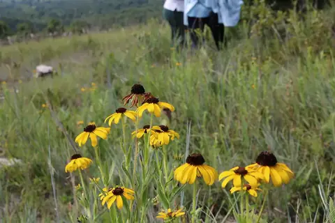
Photo: usfs_Eastern_Region · public domain · original source
Public-domain photos by U.S. federal agencies, taken in the place named on each card.
All 45 areas, largest first
- National Forest land
Mark Twain National Forest
1,508,908 acres
U.S. Forest Service (USDA) · Oregon County, Ripley County + 27 more
Open access - Army Corps of Engineers project land
Harry Truman Recreation Area
165,681 acres
U.S. Army Corps of Engineers · Henry County, Benton County + 2 more
Open access - Army Corps of Engineers project land
Stockton Recreation Area
59,741 acres
U.S. Army Corps of Engineers · Dade County, Cedar County + 1 more
Open access - Army Corps of Engineers project land
Table Rock Recreation Area
57,035 acres
U.S. Army Corps of Engineers · Stone County, Barry County + 1 more
Open access - Army Corps of Engineers project land
Bull Shoals Recreation Area
37,466 acres
U.S. Army Corps of Engineers · Taney County, Ozark County
Open access - National Wildlife Refuge
Mingo National Wildlife Refuge
21,657 acres
U.S. Fish and Wildlife Service · Stoddard County, Wayne County
Restricted access - Army Corps of Engineers project land
Smithville Recreation Area
19,845 acres
U.S. Army Corps of Engineers · Clay County, Clinton County
Open access - Army Corps of Engineers project land
Clearwater Recreation Area
18,714 acres
U.S. Army Corps of Engineers · Reynolds County, Wayne County
Open access - Army Corps of Engineers project land
Pomme De Terre Recreation Area
18,390 acres
U.S. Army Corps of Engineers · Hickory County, Polk County
Open access - National Wildlife Refuge
Swan Lake National Wildlife Refuge
11,024 acres
U.S. Fish and Wildlife Service · Chariton County
Restricted access - National Wildlife Refuge
Big Muddy National Fish And Wildlife Refuge
10,936 acres
U.S. Fish and Wildlife Service · Saline County, Howard County + 7 more
Restricted access - Army Corps of Engineers project land
Long Branch Recreation Area
7,607 acres
U.S. Army Corps of Engineers · Macon County
Open access - National Wildlife Refuge
Loess Bluffs National Wildlife Refuge
7,444 acres
U.S. Fish and Wildlife Service · Holt County
Restricted access - Army Corps of Engineers project land
Norfork Recreation Area
5,098 acres
U.S. Army Corps of Engineers · Ozark County
Open access - Army Corps of Engineers project land
Longview Recreation Area
4,760 acres
U.S. Army Corps of Engineers · Jackson County
Open access - National Wildlife Refuge
Clarence Cannon National Wildlife Refuge
3,752 acres
U.S. Fish and Wildlife Service · Pike County
Restricted access - State wildlife / game area
Reed (James A.) Memorial Wildlife Area
3,091 acres
Not recorded · Jackson County
Restricted access - Army Corps of Engineers project land
Ms Rv Pools 11-22 Recreation Area
3,033 acres
U.S. Army Corps of Engineers · Marion County, Lewis County + 1 more
Open access - National Wildlife Refuge
Great River National Wildlife Refuge
2,737 acres
U.S. Fish and Wildlife Service · Clark County, Pike County
Restricted access - State forest
Busiek State Forest And Wildife Area
2,494 acres
Not recorded · Christian County
Open access - National Wildlife Refuge
Middle Mississippi River National Wildlife Refuge
2,032 acres
U.S. Fish and Wildlife Service · Jefferson County, Perry County
Restricted access - State wildlife / game area
Linscomb Wildlife Area
1,919 acres
Not recorded · St. Clair County
Restricted access - Other state land
Mcgee Family Ca
993 acres
State: department of conservation · Clinton County
Open access - National Forest land
Mark Twain Purchase Unit
910 acres
U.S. Forest Service (USDA) · Oregon County
Open access - State wildlife / game area
White (Wm. G. And E. P.) Memorial Wildlife Area
819 acres
Not recorded · Lincoln County
Restricted access - State wildlife / game area
Horton Farm Conservation Area
647 acres
State: department of conservation · Ste. Genevieve County
Open access - State wildlife / game area
Murphy (John F.) Memorial State Forest And Wildlife Area
326 acres
Not recorded · Hickory County
Restricted access - State wildlife / game area
Cover (Dan And Maureen) Memorial Wildlife Area
290 acres
Not recorded · Oregon County
Restricted access - National Forest land
Current River Purchase Unit
183 acres
U.S. Forest Service (USDA) · Ripley County
Open access - State wildlife / game area
Funk Memorial State Forest And Wildlife Area
181 acres
Not recorded · Iron County
Restricted access - State wildlife / game area
Ray (J. Thad) Memorial Wildlife Area
167 acres
Not recorded · Marion County
Restricted access - State wildlife / game area
Upper Mississippi Waterfowl Area
164 acres
Not recorded · St. Charles County
Restricted access - State wildlife / game area
Sears (F. O. And Leda J.) Memorial Wildlife Area
163 acres
Not recorded · Audrain County
Restricted access - State forest
Vanderhoef (Archie And Gracie) Memorial State Forest
145 acres
Not recorded · Howell County
Open access - National Wildlife Refuge
Pilot Knob National Wildlife Refuge
96 acres
U.S. Fish and Wildlife Service · Iron County
Restricted access - Army Corps of Engineers project land
Bledsoe Ferry Public Use Area
85 acres
U.S. Army Corps of Engineers · Benton County
Open access - State wildlife / game area
Willingham (Ruby Clark) Memorial Wildlife Area
70 acres
Not recorded · Monroe County
Restricted access - BLM public land
BLM Northeastern States District Office Public Lands
54 acres
Bureau of Land Management · Camden County, Ste. Genevieve County
Open access - National Forest land
Cedar Creek Purchase Unit
42 acres
U.S. Forest Service (USDA) · Boone County
Open access - National Wildlife Refuge
Ozark Cavefish National Wildlife Refuge
41 acres
U.S. Fish and Wildlife Service · Lawrence County, Newton County
Restricted access - State wildlife / game area
Logan (Caroline Sheridan) Memorial Wildlife Area
41 acres
Not recorded · Buchanan County, Andrew County
Restricted access
Acreage is calculated from simplified PAD-US boundaries for the portion inside Missouri. “Access” is the PAD-US public access field, not a statement about hunting. National wildlife refuges are generally coded “restricted” in PAD-US because of seasonal or area closures.