State guide
Public land that may allow hunting in Montana
166 named public land units in Montana from PAD-US 4.1: 80 state wildlife & game areas, 26 forests & grasslands, 36 wildlife refuges & WPAs, 12 BLM units, 11 lake & reservoir project lands, 1 other public land units. The largest are BLM Miles City Field Office Public Lands, Flathead National Forest, Lolo National Forest.
- 166listed areas
- 27.4Macres (approx.)
- 80state wildlife & game areas
Regulations & licenses: Montana Fish Wildlife & Parks
This site does not list seasons, bag limits, license or permit rules. Those change every year and differ by area. Check them with the state agency before you go, and confirm the specific area is open to the hunting you plan.
Where the listed areas are
One dot per area at its reference point; larger dots are larger areas. Outline: U.S. Census Bureau.
Acres by land type
Approximate acres for the portion of each unit inside Montana.
Photos from Montana public lands
All photo credits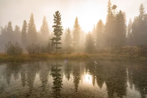
Photo: Forest Service, USDA · public domain · original source 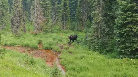
Photo: Forest Service - Northern Region · public domain · original source 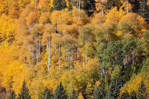
Photo: YellowstoneNPS · public domain · original source 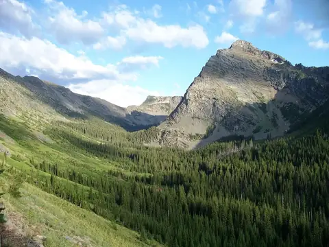
Photo: Forest Service - Northern Region · public domain · original source
Public-domain photos by U.S. federal agencies, taken in the place named on each card.
All 166 areas, largest first
- BLM public land
BLM Miles City Field Office Public Lands
2,757,675 acres
Bureau of Land Management · Carter County, Garfield County + 12 more
Open access - National Forest land
Flathead National Forest
2,414,257 acres
U.S. Forest Service (USDA) · Flathead County, Powell County + 4 more
Open access - National Forest land
Lolo National Forest
2,301,840 acres
U.S. Forest Service (USDA) · Missoula County, Mineral County + 6 more
Open access - National Forest land
Beaverhead National Forest
2,137,300 acres
U.S. Forest Service (USDA) · Beaverhead County, Madison County + 2 more
Open access - National Forest land
Lewis & Clark National Forest
1,873,483 acres
U.S. Forest Service (USDA) · Lewis and Clark County, Meagher County + 11 more
Open access - National Forest land
Gallatin National Forest
1,850,542 acres
U.S. Forest Service (USDA) · Park County, Gallatin County + 4 more
Open access - National Forest land
Kootenai National Forest
1,763,779 acres
U.S. Forest Service (USDA) · Lincoln County, Flathead County + 1 more
Open access - National Forest land
Deerlodge National Forest
1,228,467 acres
U.S. Forest Service (USDA) · Granite County, Jefferson County + 4 more
Open access - National Forest land
Bitterroot National Forest
1,127,049 acres
U.S. Forest Service (USDA) · Ravalli County, Missoula County
Open access - National Forest land
Custer National Forest
1,115,635 acres
U.S. Forest Service (USDA) · Powder River County, Carbon County + 5 more
Open access - BLM public land
BLM Malta Field Office Public Lands
1,029,388 acres
Bureau of Land Management · Phillips County
Open access - BLM public land
BLM Glasgow Field Office Public Lands
1,013,189 acres
Bureau of Land Management · Valley County
Open access - National Forest land
Helena National Forest
984,180 acres
U.S. Forest Service (USDA) · Lewis and Clark County, Broadwater County + 3 more
Open access - BLM public land
BLM Dillon Field Office Public Lands
905,698 acres
Bureau of Land Management · Beaverhead County, Madison County
Open access - BLM public land
BLM Lewistown Field Office Public Lands
641,163 acres
Bureau of Land Management · Petroleum County, Fergus County + 6 more
Open access - Army Corps of Engineers project land
Fort Peck Recreation Area
623,457 acres
U.S. Army Corps of Engineers · Garfield County, Valley County + 4 more
Open access - National Forest land
Kaniksu National Forest
457,134 acres
U.S. Forest Service (USDA) · Sanders County, Lincoln County
Open access - BLM public land
BLM Billings Field Office Public Lands
429,471 acres
Bureau of Land Management · Carbon County, Musselshell County + 5 more
Open access - BLM public land
BLM Havre Field Office Public Lands
395,256 acres
Bureau of Land Management · Blaine County, Chouteau County + 4 more
Open access - National Wildlife Refuge
Charles M. Russell National Wildlife Refuge
394,441 acres
U.S. Fish and Wildlife Service · Phillips County, Garfield County + 4 more
Restricted access - BLM public land
BLM Upper Missouri River Breaks National Monument Field Office Public Lands
374,511 acres
Bureau of Land Management · Blaine County, Fergus County + 2 more
Open access - BLM public land
BLM Butte Field Office Public Lands
323,060 acres
Bureau of Land Management · Jefferson County, Lewis and Clark County + 6 more
Open access - BLM public land
BLM Missoula Field Office Public Lands
175,605 acres
Bureau of Land Management · Powell County, Missoula County + 1 more
Open access - State forest
Stillwater State Forest
105,916 acres
State: department of natural resources · Flathead County, Lincoln County
Open access - State wildlife / game area
Blackfoot-Clearwater Wildlife Management Area
63,145 acres
State: fish and wildlife agency · Missoula County, Powell County
Restricted access - State wildlife / game area
Mount Haggin Wildlife Management Area
58,853 acres
State: fish and wildlife agency · Deer Lodge County, Silver Bow County
Restricted access - State forest
Swan River State Forest
56,379 acres
State: department of natural resources · Lake County
Open access - National Wildlife Refuge
Red Rock Lakes National Wildlife Refuge
51,438 acres
U.S. Fish and Wildlife Service · Beaverhead County, Madison County
Restricted access - National Wildlife Refuge
Ul Bend National Wildlife Refuge
39,121 acres
U.S. Fish and Wildlife Service · Phillips County
Restricted access - State wildlife / game area
Spotted Dog Wildlife Management Area
37,764 acres
State: fish and wildlife agency · Powell County
Restricted access - State wildlife / game area
Fish Creek Wildlife Management Area
36,174 acres
State: fish and wildlife agency · Mineral County
Restricted access - State wildlife / game area
Beartooth Wildlife Management Area
35,213 acres
State: fish and wildlife agency · Lewis and Clark County, Cascade County
Restricted access - National Wildlife Refuge
Medicine Lake National Wildlife Refuge
31,520 acres
U.S. Fish and Wildlife Service · Sheridan County, Roosevelt County
Restricted access - State wildlife / game area
Robb-Ledford Wildlife Management Area
28,213 acres
State: fish and wildlife agency · Madison County, Beaverhead County
Restricted access - National Recreation Area
Bighorn Canyon National Recreation Area
27,953 acres
National Park Service · Carbon County, Big Horn County
Open access - State forest
Clearwater State Forest
26,595 acres
State: department of natural resources · Missoula County
Open access - State wildlife / game area
Marshall Creek Wildlife Management Area
24,847 acres
State: fish and wildlife agency · Missoula County
Open access - Bureau of Reclamation project land
Canyon Ferry Lake
23,752 acres
Bureau of Reclamation · Broadwater County, Lewis and Clark County
Open access - Bureau of Reclamation project land
Hungry Horse Reservoir
22,905 acres
Bureau of Reclamation · Flathead County
Open access - State wildlife / game area
Sun River Wildlife Management Area
19,775 acres
State: fish and wildlife agency · Lewis and Clark County
Restricted access - Bureau of Reclamation project land
Lake Elwell
18,821 acres
Bureau of Reclamation · Liberty County, Toole County
Open access - State wildlife / game area
Blacktail Wildlife Management Area
17,906 acres
State: fish and wildlife agency · Beaverhead County
Restricted access - National Wildlife Refuge
Bowdoin National Wildlife Refuge
15,537 acres
U.S. Fish and Wildlife Service · Phillips County
Restricted access - State forest
Coal Creek State Forest
14,990 acres
State: department of natural resources · Flathead County
Open access - State forest
Sula State Forest
14,988 acres
State: department of natural resources · Ravalli County
Open access - State forest
Thompson River State Forest
13,745 acres
State: department of natural resources · Sanders County, Flathead County
Open access - Bureau of Reclamation project land
Fresno Reservoir
13,164 acres
Bureau of Reclamation · Hill County
Open access - National Wildlife Refuge
Benton Lake National Wildlife Refuge
12,350 acres
U.S. Fish and Wildlife Service · Cascade County, Chouteau County + 1 more
Restricted access - State wildlife / game area
Freezout Lake Wildlife Management Area
11,356 acres
State: fish and wildlife agency · Teton County
Restricted access - National Wildlife Refuge
Lake Mason National Wildlife Refuge
11,225 acres
U.S. Fish and Wildlife Service · Musselshell County
Restricted access - Waterfowl Production Area
Sheridan County Waterfowl Production Area Of Mt
10,764 acres
U.S. Fish and Wildlife Service · Sheridan County
Restricted access - State wildlife / game area
Blackleaf Wildlife Management Area
10,758 acres
State: fish and wildlife agency · Teton County
Restricted access - State wildlife / game area
Marshall Creek
10,300 acres
State: fish and wildlife agency · Missoula County
Restricted access - State wildlife / game area
Garrity Mountain Wildlife Management Area
10,112 acres
State: fish and wildlife agency · Deer Lodge County
Restricted access - State wildlife / game area
Judith River Wildlife Management Area
9,398 acres
State: fish and wildlife agency · Judith Basin County
Restricted access - State forest
Lincoln State Forest
8,655 acres
State: department of natural resources · Lewis and Clark County
Open access - State wildlife / game area
Gallatin Wildlife Management Area
8,644 acres
State: fish and wildlife agency · Gallatin County
Restricted access - Waterfowl Production Area
Phillips County Waterfowl Production Area
8,147 acres
U.S. Fish and Wildlife Service · Phillips County
Restricted access - National Wildlife Refuge
Lost Trail National Wildlife Refuge
7,905 acres
U.S. Fish and Wildlife Service · Flathead County
Restricted access - State wildlife / game area
Marias River Wildlife Management Area
7,788 acres
State: fish and wildlife agency · Toole County, Pondera County
Restricted access - State wildlife / game area
Wall Creek Wildlife Management Area
7,715 acres
State: fish and wildlife agency · Madison County
Restricted access - State wildlife / game area
Fleecer Mountain Wildlife Management Area
7,602 acres
State: fish and wildlife agency · Silver Bow County
Restricted access - State wildlife / game area
Beckman Wildlife Management Area
6,647 acres
State: fish and wildlife agency · Fergus County
Restricted access - State wildlife / game area
Threemile Wildlife Management Area
6,446 acres
State: fish and wildlife agency · Ravalli County
Restricted access - State wildlife / game area
Canyon Ferry Wildlife Management Area
5,937 acres
State: fish and wildlife agency · Broadwater County
Restricted access - Bureau of Reclamation project land
Nelson Reservoir
5,888 acres
Bureau of Reclamation · Phillips County
Open access - Waterfowl Production Area
Flathead County Waterfowl Production Area
5,345 acres
U.S. Fish and Wildlife Service · Flathead County
Restricted access - Bureau of Reclamation project land
Clark Canyon Reservoir
4,993 acres
Bureau of Reclamation · Beaverhead County
Open access - Waterfowl Production Area
Powell County Waterfowl Production Area
4,946 acres
U.S. Fish and Wildlife Service · Powell County
Restricted access - State wildlife / game area
Dome Mountain Wildlife Management Area
4,867 acres
State: fish and wildlife agency · Park County
Restricted access - Waterfowl Production Area
Toole County Waterfowl Production Area
4,588 acres
U.S. Fish and Wildlife Service · Toole County
Restricted access - State wildlife / game area
Yellowstone Wildlife Management Area
4,405 acres
State: fish and wildlife agency · Yellowstone County
Restricted access - State wildlife / game area
Warm Springs Wildlife Management Area
4,188 acres
State: fish and wildlife agency · Deer Lodge County
Restricted access - State wildlife / game area
Ninepipe Wildlife Management Area
4,150 acres
State: fish and wildlife agency · Lake County
Restricted access - State wildlife / game area
Lost River Wildlife Management Area
3,708 acres
State: fish and wildlife agency · Hill County
Restricted access - Waterfowl Production Area
Lake County Waterfowl Production Area Of Mt
3,555 acres
U.S. Fish and Wildlife Service · Lake County
Restricted access - State wildlife / game area
Bear Creek Wildlife Management Area
3,464 acres
State: fish and wildlife agency · Madison County
Restricted access - National Wildlife Refuge
Grass Lake National Wildlife Refuge
3,386 acres
U.S. Fish and Wildlife Service · Stillwater County
Restricted access - State wildlife / game area
Smith River Wildlife Management Area
3,368 acres
State: fish and wildlife agency · Meagher County
Restricted access - State wildlife / game area
Canyon Creek Wildlife Management Area
3,318 acres
State: fish and wildlife agency · Lewis and Clark County
Restricted access - State wildlife / game area
Big Lake Wildlife Management Area
3,266 acres
State: fish and wildlife agency · Stillwater County
Restricted access - State wildlife / game area
Ear Mountain Wildlife Management Area
3,038 acres
State: fish and wildlife agency · Teton County
Restricted access - National Wildlife Refuge
War Horse National Wildlife Refuge
2,852 acres
U.S. Fish and Wildlife Service · Petroleum County
Restricted access - National Wildlife Refuge
Lee Metcalf National Wildlife Refuge
2,827 acres
U.S. Fish and Wildlife Service · Ravalli County
Restricted access - State wildlife / game area
Beartooth
2,793 acres
State: fish and wildlife agency · Lewis and Clark County
Open access - State wildlife / game area
Fresno Reservoir Wildlife Management Area
2,691 acres
State: fish and wildlife agency · Hill County
Restricted access - Waterfowl Production Area
Blaine County Waterfowl Production Area
2,443 acres
U.S. Fish and Wildlife Service · Blaine County
Restricted access - State wildlife / game area
Calf Creek Wildlife Management Area
2,424 acres
State: fish and wildlife agency · Ravalli County
Restricted access - State wildlife / game area
Rookery Wildlife Management Area
2,295 acres
State: fish and wildlife agency · Hill County
Restricted access - Waterfowl Production Area
Chouteau County Waterfowl Production Area
2,075 acres
U.S. Fish and Wildlife Service · Chouteau County
Restricted access - National Wildlife Refuge
Swan River National Wildlife Refuge
1,954 acres
U.S. Fish and Wildlife Service · Lake County
Restricted access - State wildlife / game area
North Swan Valley Wildlife Management Area
1,893 acres
State: fish and wildlife agency · Lake County
Restricted access - Waterfowl Production Area
Stillwater County Waterfowl Production Area
1,737 acres
U.S. Fish and Wildlife Service · Stillwater County
Restricted access - State wildlife / game area
Fox Lake Wildlife Management Area
1,640 acres
State: fish and wildlife agency · Richland County
Restricted access - State wildlife / game area
Bull River Wildlife Management Area
1,586 acres
State: fish and wildlife agency · Sanders County, Lincoln County
Restricted access - State wildlife / game area
Seven Sisters Wildlife Management Area
1,570 acres
State: fish and wildlife agency · Richland County
Restricted access - State wildlife / game area
Ray Kuhns Wildlife Management Area
1,551 acres
State: fish and wildlife agency · Flathead County
Restricted access - State wildlife / game area
Mount Silcox Wildlife Management Area
1,544 acres
State: fish and wildlife agency · Sanders County
Restricted access - State wildlife / game area
Nevada Lake Wildlife Management Area
1,523 acres
State: fish and wildlife agency · Powell County
Restricted access - Waterfowl Production Area
Teton County Waterfowl Production Area
1,520 acres
U.S. Fish and Wildlife Service · Teton County
Restricted access - State wildlife / game area
Woods Ranch Wildlife Management Area
1,483 acres
State: fish and wildlife agency · Lincoln County
Restricted access - Bureau of Reclamation project land
Lake Como
1,439 acres
Bureau of Reclamation · Ravalli County
Open access - State wildlife / game area
Elk Island Wildlife Management Area
1,416 acres
State: fish and wildlife agency · Richland County
Restricted access - State wildlife / game area
Lost Creek Wildlife Management Area
1,408 acres
State: fish and wildlife agency · Deer Lodge County
Restricted access - State wildlife / game area
Haymaker Wildlife Management Area
1,338 acres
State: fish and wildlife agency · Wheatland County
Restricted access - State wildlife / game area
Sleeping Buffalo Wildlife Management Area
1,317 acres
State: fish and wildlife agency · Phillips County
Restricted access - State wildlife / game area
Isaac Homestead Wildlife Management Area
1,250 acres
State: fish and wildlife agency · Treasure County
Restricted access - State wildlife / game area
Aunt Molly Wildlife Management Area
1,182 acres
State: fish and wildlife agency · Powell County
Restricted access - Waterfowl Production Area
Daniels County Waterfowl Production Area
1,132 acres
U.S. Fish and Wildlife Service · Daniels County
Restricted access - State wildlife / game area
Big Lake 3
1,097 acres
State: fish and wildlife agency · Stillwater County
Open access - State wildlife / game area
West Kootenai Wildlife Management Area
919 acres
State: fish and wildlife agency · Lincoln County
Restricted access - Waterfowl Production Area
Golden Valley County Waterfowl Production Area
764 acres
U.S. Fish and Wildlife Service · Golden Valley County
Restricted access - Waterfowl Production Area
Cascade County Waterfowl Production Area
732 acres
U.S. Fish and Wildlife Service · Cascade County
Restricted access - National Wildlife Refuge
Hewitt Lake National Wildlife Refuge
721 acres
U.S. Fish and Wildlife Service · Phillips County
Restricted access - State wildlife / game area
Seven Sisters Wildlife Management Area 4
720 acres
State: fish and wildlife agency · Richland County
Open access - State wildlife / game area
Dodson Dam Wildlife Management Area
709 acres
State: fish and wildlife agency · Phillips County
Restricted access - Waterfowl Production Area
Pondera County Waterfowl Production Area
646 acres
U.S. Fish and Wildlife Service · Pondera County
Restricted access - State wildlife / game area
Silver Run Wildlife Management Area
645 acres
State: fish and wildlife agency · Carbon County
Restricted access - State wildlife / game area
Garrity Mountain
640 acres
State: fish and wildlife agency · Deer Lodge County
Restricted access - National Wildlife Refuge
Black Coulee National Wildlife Refuge
637 acres
U.S. Fish and Wildlife Service · Blaine County
Restricted access - Waterfowl Production Area
Musselshell County Waterfowl Production Area
548 acres
U.S. Fish and Wildlife Service · Musselshell County
Restricted access - State wildlife / game area
Grant Marsh Wildlife Management Area
538 acres
State: fish and wildlife agency · Big Horn County
Restricted access - Waterfowl Production Area
Yellowstone County Waterfowl Production Area
481 acres
U.S. Fish and Wildlife Service · Yellowstone County, Golden Valley County
Restricted access - State wildlife / game area
Full Curl Wildlife Management Area
440 acres
State: fish and wildlife agency · Sanders County
Restricted access - State wildlife / game area
Lake Helena Wildlife Management Area
430 acres
State: fish and wildlife agency · Lewis and Clark County
Restricted access - State wildlife / game area
North Shore Flathead Lake Wildlife Management Area
419 acres
State: fish and wildlife agency · Flathead County
Restricted access - State wildlife / game area
Cree Crossing Wildlife Management Area
404 acres
State: fish and wildlife agency · Phillips County
Restricted access - Bureau of Reclamation project land
Pishkun Reservoir
381 acres
Bureau of Reclamation · Teton County
Open access - Waterfowl Production Area
Hill County Waterfowl Production Area
372 acres
U.S. Fish and Wildlife Service · Hill County
Restricted access - State wildlife / game area
Vandalia Wildlife Management Area
324 acres
State: fish and wildlife agency · Valley County
Restricted access - State wildlife / game area
Kleinschmidt Lake Wildlife Habitat Protection Area
322 acres
State: fish and wildlife agency · Powell County
Restricted access - State wildlife / game area
Stucky Ridge Wildlife Management Area
291 acres
State: fish and wildlife agency · Deer Lodge County
Restricted access - National Forest land
Targhee National Forest
286 acres
U.S. Forest Service (USDA) · Beaverhead County, Gallatin County + 1 more
Open access - State wildlife / game area
Seven Sisters Wildlife Management Area 5
266 acres
State: fish and wildlife agency · Richland County
Open access - State wildlife / game area
Hinsdale Wildlife Management Area
261 acres
State: fish and wildlife agency · Valley County
Restricted access - National Forest land
Salmon National Forest
249 acres
U.S. Forest Service (USDA) · Ravalli County, Beaverhead County
Open access - State wildlife / game area
Flathead River Wildlife Habitat Protection Area
234 acres
State: fish and wildlife agency · Flathead County
Restricted access - National Forest land
Bighorn National Forest
220 acres
U.S. Forest Service (USDA) · Big Horn County
Open access - State wildlife / game area
Blue Eyed Nellie Wildlife Management Area
201 acres
State: fish and wildlife agency · Deer Lodge County
Restricted access - BLM public land
BLM Cody Field Office Public Lands
199 acres
Bureau of Land Management · Big Horn County, Carbon County
Open access - State wildlife / game area
Pablo Wildlife Management Area
195 acres
State: fish and wildlife agency · Lake County
Restricted access - State wildlife / game area
Amelia Island Wildlife Management Area
193 acres
State: fish and wildlife agency · Treasure County
Restricted access - Waterfowl Production Area
Roosevelt County Waterfowl Production Area
178 acres
U.S. Fish and Wildlife Service · Roosevelt County
Restricted access - State wildlife / game area
Big Lake
170 acres
State: fish and wildlife agency · Stillwater County
Open access - Bureau of Reclamation project land
Bighorn Lake
165 acres
Bureau of Reclamation · Big Horn County
Open access - State wildlife / game area
Kootenai Falls Wildlife Management Area
163 acres
State: fish and wildlife agency · Lincoln County
Restricted access - State wildlife / game area
Dodson South Canal Wildlife Management Area
161 acres
State: fish and wildlife agency · Phillips County
Restricted access - State wildlife / game area
Bowdoin Wildlife Habitat Protection Area
158 acres
State: fish and wildlife agency · Phillips County
Restricted access - National Wildlife Refuge
Hailstone National Wildlife Refuge
156 acres
U.S. Fish and Wildlife Service · Stillwater County
Restricted access - Bureau of Reclamation project land
Willow Creek Reservoir
132 acres
Bureau of Reclamation · Lewis and Clark County
Open access - State wildlife / game area
Flathead Lake Wildlife Habitat Protection Area
132 acres
State: fish and wildlife agency · Lake County
Restricted access - State wildlife / game area
Fresno Tailwater Wildlife Management Area
127 acres
State: fish and wildlife agency · Hill County
Restricted access - National Forest land
Clearwater National Forest
120 acres
U.S. Forest Service (USDA) · Mineral County, Ravalli County + 1 more
Open access - State wildlife / game area
Mount Jumbo Wildlife Management Area
117 acres
State: fish and wildlife agency · Missoula County
Restricted access - National Forest land
Aerial Fire Depot Other
112 acres
U.S. Forest Service (USDA) · Missoula County
Open access - State wildlife / game area
F Island Wildlife Habitat Protection Area
104 acres
State: fish and wildlife agency · Richland County
Restricted access - Waterfowl Production Area
Glacier County Waterfowl Production Area
92 acres
U.S. Fish and Wildlife Service · Glacier County
Restricted access - State wildlife / game area
Three Mile Wildlife Habitat Protection Area
88 acres
State: fish and wildlife agency · Dawson County
Restricted access - National Wildlife Refuge
Creedman Coulee National Wildlife Refuge
84 acres
U.S. Fish and Wildlife Service · Hill County
Restricted access - BLM public land
BLM Salmon Field Office Public Lands
80 acres
Bureau of Land Management · Beaverhead County
Open access - National Forest land
St. Joe National Forest
74 acres
U.S. Forest Service (USDA) · Mineral County
Open access - National Forest land
Coeur d'Alene National Forest
69 acres
U.S. Forest Service (USDA) · Sanders County, Mineral County
Open access - National Grassland
Little Missouri National Grassland
63 acres
U.S. Forest Service (USDA) · Richland County, Wibaux County + 1 more
Open access - State wildlife / game area
Dodson Creek Wildlife Management Area
53 acres
State: fish and wildlife agency · Phillips County
Restricted access - State wildlife / game area
Big Horn Viewing Site Wildlife Management Area
49 acres
State: fish and wildlife agency · Sanders County
Restricted access - Waterfowl Production Area
Petroleum County Waterfowl Production Area
41 acres
U.S. Fish and Wildlife Service · Petroleum County
Restricted access
Acreage is calculated from simplified PAD-US boundaries for the portion inside Montana. “Access” is the PAD-US public access field, not a statement about hunting. National wildlife refuges are generally coded “restricted” in PAD-US because of seasonal or area closures.
Browse by county
- Beaverhead County
- Big Horn County
- Blaine County
- Broadwater County
- Carbon County
- Cascade County
- Chouteau County
- Deer Lodge County
- Fergus County
- Flathead County
- Gallatin County
- Garfield County
- Glacier County
- Golden Valley County
- Granite County
- Hill County
- Jefferson County
- Judith Basin County
- Lake County
- Lewis And Clark County
- Lincoln County
- Madison County
- Mccone County
- Meagher County
- Mineral County
- Missoula County
- Musselshell County
- Park County
- Petroleum County
- Phillips County
- Pondera County
- Powell County
- Ravalli County
- Richland County
- Roosevelt County
- Sanders County
- Silver Bow County
- Stillwater County
- Sweet Grass County
- Teton County
- Toole County
- Treasure County
- Valley County
- Wheatland County
- Yellowstone County