State guide
Public land that may allow hunting in New Hampshire
38 named public land units in New Hampshire from PAD-US 4.1: 17 state wildlife & game areas, 13 forests & grasslands, 5 wildlife refuges & WPAs, 2 lake & reservoir project lands, 1 other public land units. The largest are White Mountain National Forest, White Mountain Purchase Unit, Umbagog National Wildlife Refuge.
- 38listed areas
- 798Kacres (approx.)
- 17state wildlife & game areas
Regulations & licenses: New Hampshire Fish and Game Department
This site does not list seasons, bag limits, license or permit rules. Those change every year and differ by area. Check them with the state agency before you go, and confirm the specific area is open to the hunting you plan.
Where the listed areas are
One dot per area at its reference point; larger dots are larger areas. Outline: U.S. Census Bureau.
Acres by land type
Approximate acres for the portion of each unit inside New Hampshire.
Photos from New Hampshire public lands
All photo credits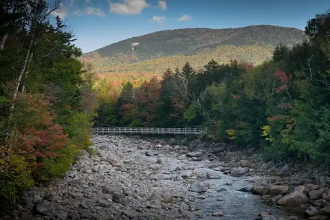
Photo: usfs_Eastern_Region · public domain · original source
Public-domain photos by U.S. federal agencies, taken in the place named on each card.
All 38 areas, largest first
- National Forest land
White Mountain National Forest
725,131 acres
U.S. Forest Service (USDA) · Grafton County, Coos County + 1 more
Open access - National Forest land
White Mountain Purchase Unit
29,283 acres
U.S. Forest Service (USDA) · Coos County, Carroll County + 1 more
Open access - National Wildlife Refuge
Umbagog National Wildlife Refuge
21,879 acres
U.S. Fish and Wildlife Service · Coos County
Restricted access - National Wildlife Refuge
Silvio O. Conte National Fish And Wildlife Refuge
7,928 acres
U.S. Fish and Wildlife Service · Coos County, Grafton County
Restricted access - State wildlife / game area
William B. Ruger Wildlife Management Area - South
1,904 acres
Not recorded · Sullivan County
Open access - Army Corps of Engineers project land
Surry Mountain Recreation Area
1,697 acres
U.S. Army Corps of Engineers · Cheshire County
Open access - National Wildlife Refuge
Wapack National Wildlife Refuge
1,660 acres
U.S. Fish and Wildlife Service · Hillsborough County
Restricted access - State wildlife / game area
William B. Ruger Wildlife Management Area - North
1,280 acres
Not recorded · Sullivan County
Open access - National Wildlife Refuge
Great Bay National Wildlife Refuge
1,115 acres
U.S. Fish and Wildlife Service · Rockingham County
Restricted access - State wildlife / game area
Lower Shaker Wildlife Management Area
1,103 acres
State: fish and wildlife agency · Grafton County
Restricted access - State forest
Hubbard Hill State Forest
742 acres
State: department of natural resources · Sullivan County
Open access - Army Corps of Engineers project land
Otter Brook Recreation Area
460 acres
U.S. Army Corps of Engineers · Cheshire County
Open access - State wildlife / game area
Richard Sargent Wildlife Management Area
374 acres
State: fish and wildlife agency · Rockingham County
Restricted access - State forest
Litchfield State Forest
338 acres
State: department of natural resources · Hillsborough County
Open access - State wildlife / game area
Upper Merrimack Oxbow Project
292 acres
State: fish and wildlife agency · Merrimack County
Open access - State wildlife / game area
Bellamy River Wildlife Management Area - West - Lot 1
262 acres
State: fish and wildlife agency · Strafford County
Restricted access - State forest
Connecticut River State Forest
227 acres
State: department of natural resources · Sullivan County
Open access - State wildlife / game area
Hinman Pond II
222 acres
State: fish and wildlife agency · Merrimack County
Restricted access - State forest
Urban Forestry Center
181 acres
State: department of natural resources · Rockingham County
Open access - State forest
Cilley State Forest
176 acres
State: department of natural resources · Merrimack County
Open access - State wildlife / game area
Dumpling Brook Wildlife Management Area
164 acres
State: fish and wildlife agency · Hillsborough County
Restricted access - State forest
Berry Brook Forest
158 acres
State: department of conservation · Strafford County
Open access - State wildlife / game area
Webster Lake Wildlife Management Area
149 acres
State: fish and wildlife agency · Merrimack County
Restricted access - State wildlife / game area
Hirst Wildlife Management Area
148 acres
State: fish and wildlife agency · Merrimack County
Restricted access - State wildlife / game area
Farrar Marsh Wildlife Management Area
138 acres
Not recorded · Hillsborough County
Open access - State forest
Russell-Shea State Forest
105 acres
State: department of natural resources · Merrimack County
Open access - State wildlife / game area
Kimball Hill Wildlife Management Area - Merrill
104 acres
Not recorded · Grafton County
Open access - State wildlife / game area
Currier Wildlife Management Area
97 acres
State: fish and wildlife agency · Rockingham County
Restricted access - Other state land
Souhegan River Watershed Site #33
94 acres
State: department of natural resources · Hillsborough County
Open access - State forest
Pages Corner State Forest
84 acres
State: department of natural resources · Merrimack County
Open access - State forest
Ballard State Forest
82 acres
State: department of natural resources · Rockingham County
Open access - National Wildlife Refuge
John Hay National Wildlife Refuge
81 acres
U.S. Fish and Wildlife Service · Merrimack County
Restricted access - State wildlife / game area
Saltmarsh Pond State Forest
71 acres
State: department of natural resources · Belknap County
Open access - State wildlife / game area
Merrymeeting Marsh Wildlife Management Area
58 acres
Not recorded · Belknap County
Open access - State wildlife / game area
Ellingwood Street Wildlife Management Area
54 acres
Not recorded · Rockingham County, Hillsborough County
Open access - State forest
Opechee Bay State Forest
48 acres
State: department of natural resources · Belknap County
Open access - State wildlife / game area
Sandy Point - Conway
45 acres
State: fish and wildlife agency · Rockingham County
Restricted access
Acreage is calculated from simplified PAD-US boundaries for the portion inside New Hampshire. “Access” is the PAD-US public access field, not a statement about hunting. National wildlife refuges are generally coded “restricted” in PAD-US because of seasonal or area closures.