State guide
Public land that may allow hunting in Oregon
118 named public land units in Oregon from PAD-US 4.1: 24 state wildlife & game areas, 20 forests & grasslands, 23 wildlife refuges & WPAs, 24 BLM units, 13 lake & reservoir project lands, 12 state trust / land board tracts, 2 other public land units. The largest are BLM Vale Malheur Field Office Public Lands, BLM Lakeview District Lakeview Field Office Public Lands, Willamette National Forest.
- 118listed areas
- 32.9Macres (approx.)
- 24state wildlife & game areas
Regulations & licenses: Oregon Department of Fish and Wildlife
This site does not list seasons, bag limits, license or permit rules. Those change every year and differ by area. Check them with the state agency before you go, and confirm the specific area is open to the hunting you plan.
Where the listed areas are
One dot per area at its reference point; larger dots are larger areas. Outline: U.S. Census Bureau.
Acres by land type
Approximate acres for the portion of each unit inside Oregon.
Photos from Oregon public lands
All photo credits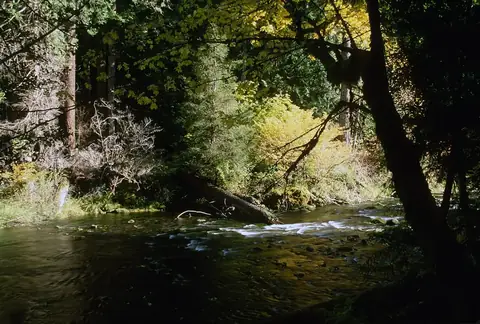
Photo: U.S. Forest Service- Pacific Northwest Region · public domain · original source 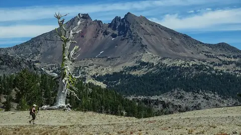
Photo: U.S. Forest Service- Pacific Northwest Region · public domain · original source 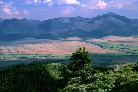
Photo: U.S. Forest Service- Pacific Northwest Region · public domain · original source 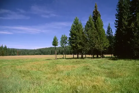
Photo: U.S. Forest Service- Pacific Northwest Region · public domain · original source
Public-domain photos by U.S. federal agencies, taken in the place named on each card.
All 118 areas, largest first
- BLM public land
BLM Vale Malheur Field Office Public Lands
4,641,446 acres
Bureau of Land Management · Malheur County, Harney County + 1 more
Open access - BLM public land
BLM Lakeview District Lakeview Field Office Public Lands
3,203,536 acres
Bureau of Land Management · Lake County, Harney County
Open access - National Forest land
Willamette National Forest
1,681,194 acres
U.S. Forest Service (USDA) · Lane County, Linn County + 3 more
Open access - BLM public land
BLM Burns Three Rivers Field Office Public Lands
1,661,764 acres
Bureau of Land Management · Harney County, Lake County + 2 more
Open access - National Forest land
Deschutes National Forest
1,612,279 acres
U.S. Forest Service (USDA) · Deschutes County, Klamath County + 3 more
Open access - BLM public land
BLM Burns Andrews Field Office Public Lands
1,602,347 acres
Bureau of Land Management · Harney County, Malheur County
Open access - National Forest land
Malheur National Forest
1,481,157 acres
U.S. Forest Service (USDA) · Grant County, Harney County + 1 more
Open access - National Forest land
Whitman National Forest
1,262,963 acres
U.S. Forest Service (USDA) · Baker County, Union County + 4 more
Open access - National Forest land
Fremont National Forest
1,204,197 acres
U.S. Forest Service (USDA) · Lake County, Klamath County
Open access - National Forest land
Umatilla National Forest
1,095,537 acres
U.S. Forest Service (USDA) · Umatilla County, Grant County + 4 more
Open access - National Forest land
Mt. Hood National Forest
1,068,370 acres
U.S. Forest Service (USDA) · Clackamas County, Hood River County + 4 more
Open access - National Forest land
Siskiyou National Forest
1,058,410 acres
U.S. Forest Service (USDA) · Curry County, Josephine County + 1 more
Open access - National Forest land
Winema National Forest
1,049,318 acres
U.S. Forest Service (USDA) · Klamath County
Open access - National Forest land
Wallowa National Forest
995,068 acres
U.S. Forest Service (USDA) · Wallowa County, Union County
Open access - National Forest land
Umpqua National Forest
986,004 acres
U.S. Forest Service (USDA) · Douglas County, Lane County + 1 more
Open access - BLM public land
BLM Prineville Central Oregon Field Office Public Lands
907,367 acres
Bureau of Land Management · Crook County, Grant County + 7 more
Open access - National Forest land
Ochoco National Forest
854,878 acres
U.S. Forest Service (USDA) · Crook County, Harney County + 2 more
Open access - BLM public land
BLM Prineville Deschutes Field Office Public Lands
744,107 acres
Bureau of Land Management · Deschutes County, Crook County + 5 more
Open access - National Forest land
Siuslaw National Forest
630,574 acres
U.S. Forest Service (USDA) · Lane County, Lincoln County + 6 more
Open access - State trust / land board land
Rangeland
623,054 acres
State: department of land · Malheur County, Harney County + 9 more
Open access - National Forest land
Rogue River National Forest
577,479 acres
U.S. Forest Service (USDA) · Jackson County, Klamath County + 2 more
Open access - BLM public land
BLM Vale Baker Field Office Public Lands
426,137 acres
Bureau of Land Management · Baker County, Umatilla County + 4 more
Open access - BLM public land
BLM Medford Grants Pass Field Office Public Lands
425,828 acres
Bureau of Land Management · Josephine County, Douglas County + 3 more
Open access - National Wildlife Refuge
Hart Mountain National Antelope Refuge
276,287 acres
U.S. Fish and Wildlife Service · Lake County
Restricted access - BLM public land
BLM Medford Ashland Field Office Public Lands
248,222 acres
Bureau of Land Management · Jackson County, Josephine County
Open access - BLM public land
BLM Roseburg District Swiftwater Field Office Public Lands
223,843 acres
Bureau of Land Management · Douglas County
Open access - BLM public land
BLM Lakeview Klamath Falls Field Office Public Lands
216,017 acres
Bureau of Land Management · Klamath County
Open access - BLM public land
BLM Medford Butte Falls Field Office Public Lands
202,022 acres
Bureau of Land Management · Jackson County, Josephine County
Open access - BLM public land
BLM Coos Bay Umpqua Field Office Public Lands
188,723 acres
Bureau of Land Management · Douglas County, Coos County
Open access - National Wildlife Refuge
Malheur National Wildlife Refuge
188,170 acres
U.S. Fish and Wildlife Service · Harney County
Restricted access - BLM public land
BLM Roseburg District South River Field Office Public Lands
184,985 acres
Bureau of Land Management · Douglas County
Open access - BLM public land
BLM Nw Oregon Cascades Field Office Public Lands
172,608 acres
Bureau of Land Management · Clackamas County, Linn County + 2 more
Open access - BLM public land
BLM Nw Oregon Siuslaw Field Office Public Lands
157,492 acres
Bureau of Land Management · Lane County, Douglas County
Open access - BLM public land
BLM Nw Oregon Upper Willamette Field Office Public Lands
152,847 acres
Bureau of Land Management · Lane County, Linn County + 1 more
Open access - BLM public land
BLM Nw Oregon Marys Peak Field Office Public Lands
128,272 acres
Bureau of Land Management · Benton County, Polk County + 2 more
Open access - BLM public land
BLM Coos Bay Myrtlewood Field Office Public Lands
123,300 acres
Bureau of Land Management · Coos County, Curry County + 1 more
Open access - National Grassland
Crooked River National Grassland
115,007 acres
U.S. Forest Service (USDA) · Jefferson County
Open access - BLM public land
BLM Nw Oregon Tillamook Field Office Public Lands
104,097 acres
Bureau of Land Management · Tillamook County, Yamhill County + 2 more
Open access - National Wildlife Refuge
Klamath Marsh National Wildlife Refuge
43,782 acres
U.S. Fish and Wildlife Service · Klamath County
Restricted access - State wildlife / game area
Phillip P. Schneider Wildlife Area
38,864 acres
State: fish and wildlife agency · Grant County
Open access - State wildlife / game area
White River Wildlife Area
29,537 acres
State: fish and wildlife agency · Wasco County
Open access - National Forest land
Klamath National Forest
26,841 acres
U.S. Forest Service (USDA) · Jackson County
Open access - National Wildlife Refuge
Upper Klamath National Wildlife Refuge
25,109 acres
U.S. Fish and Wildlife Service · Klamath County
Restricted access - State trust / land board land
Oregon State Trust Lands
22,169 acres
State: land board · Clatsop County, Union County + 6 more
Open access - State forest
Gilchrist Forest (East, Match Tracts 2,3,4)
20,515 acres
State: department of natural resources · Klamath County
Open access - National Wildlife Refuge
Lewis And Clark National Wildlife Refuge
12,963 acres
U.S. Fish and Wildlife Service · Clatsop County
Restricted access - State wildlife / game area
Summer Lake Wildlife Area
12,646 acres
State: fish and wildlife agency · Lake County
Open access - State wildlife / game area
Bridge Creek Wildlife Area
12,636 acres
State: fish and wildlife agency · Umatilla County
Open access - State wildlife / game area
Sauvie Island Wildlife Area
11,113 acres
State: fish and wildlife agency · Columbia County, Multnomah County
Open access - Bureau of Reclamation project land
Owyhee Reservoir
10,743 acres
Bureau of Reclamation · Malheur County
Open access - Bureau of Reclamation project land
Wickiup Reservoir
10,040 acres
Bureau of Reclamation · Deschutes County
Open access - State wildlife / game area
Wenaha Wildlife Area
9,592 acres
State: fish and wildlife agency · Wallowa County
Open access - State forest
Forest
8,464 acres
State: department of land · Grant County, Harney County + 9 more
Open access - State wildlife / game area
Lower Deschutes Wildlife Area
8,423 acres
State: fish and wildlife agency · Sherman County, Wasco County
Open access - State wildlife / game area
Elkhorn Wildlife Area
8,294 acres
State: fish and wildlife agency · Baker County, Union County
Open access - State trust / land board land
SPC Stewardship
7,779 acres
State: department of land · Coos County, Lake County + 8 more
Open access - National Wildlife Refuge
Lower Klamath National Wildlife Refuge
7,393 acres
U.S. Fish and Wildlife Service · Klamath County
Restricted access - State trust / land board land
Industrial/Commercial/Residential
6,237 acres
State: department of land · Deschutes County, Crook County + 5 more
Open access - National Wildlife Refuge
William L. Finley National Wildlife Refuge
5,698 acres
U.S. Fish and Wildlife Service · Benton County, Linn County
Restricted access - State wildlife / game area
Fern Ridge Wildlife Area
5,291 acres
State: fish and wildlife agency · Lane County
Open access - State trust / land board land
Agriculture
5,151 acres
State: department of land · Morrow County, Lake County + 4 more
Open access - Bureau of Reclamation project land
Prineville Reservoir
4,543 acres
Bureau of Reclamation · Crook County
Open access - State wildlife / game area
Ladd Marsh Wildlife Area
4,338 acres
State: fish and wildlife agency · Union County
Open access - National Wildlife Refuge
Bear Valley National Wildlife Refuge
4,245 acres
U.S. Fish and Wildlife Service · Klamath County
Restricted access - State wildlife / game area
Riverside Wildlife Area
3,978 acres
State: fish and wildlife agency · Malheur County, Harney County
Open access - Bureau of Reclamation project land
Warm Springs Reservoir
3,634 acres
Bureau of Reclamation · Harney County, Malheur County
Open access - Bureau of Reclamation project land
Gerber Reservoir
3,500 acres
Bureau of Reclamation · Klamath County
Open access - Bureau of Reclamation project land
Crane Prairie Reservoir
3,390 acres
Bureau of Reclamation · Deschutes County
Open access - State wildlife / game area
Klamath Wildlife Area
3,279 acres
State: fish and wildlife agency · Klamath County
Open access - National Wildlife Refuge
Julia Butler Hansen Refuge For The Columbian White-Tailed Deer
3,073 acres
U.S. Fish and Wildlife Service · Clatsop County, Columbia County
Restricted access - State wildlife / game area
Jewell Meadows Wildlife Area
2,940 acres
State: fish and wildlife agency · Clatsop County
Open access - National Wildlife Refuge
Ankeny National Wildlife Refuge
2,803 acres
U.S. Fish and Wildlife Service · Marion County
Restricted access - National Wildlife Refuge
Baskett Slough National Wildlife Refuge
2,513 acres
U.S. Fish and Wildlife Service · Polk County
Restricted access - Bureau of Reclamation project land
Phillips Reservoir
2,340 acres
Bureau of Reclamation · Baker County
Open access - Bureau of Reclamation project land
Howard Prairie Lake
2,162 acres
Bureau of Reclamation · Jackson County
Open access - State wildlife / game area
Denman Wildlife Area
2,086 acres
State: fish and wildlife agency · Jackson County
Open access - National Wildlife Refuge
Umatilla National Wildlife Refuge
1,831 acres
U.S. Fish and Wildlife Service · Morrow County
Restricted access - State wildlife / game area
E.E. Wilson Wildlife Area
1,773 acres
State: fish and wildlife agency · Benton County, Polk County
Open access - State trust / land board land
Longview Fibre Exchange
1,710 acres
State: land board · Tillamook County
Open access - National Wildlife Refuge
Tualatin River National Wildlife Refuge
1,327 acres
U.S. Fish and Wildlife Service · Washington County
Restricted access - National Wildlife Refuge
Mcnary National Wildlife Refuge
1,196 acres
U.S. Fish and Wildlife Service · Umatilla County
Restricted access - National Wildlife Refuge
Nestucca Bay National Wildlife Refuge
1,188 acres
U.S. Fish and Wildlife Service · Tillamook County
Restricted access - State trust / land board land
Not In Ownership
1,020 acres
State: land board · Washington County, Lincoln County + 3 more
Open access - State trust / land board land
Weyerhaeuser Deed
993 acres
State: land board · Tillamook County
Open access - Bureau of Reclamation project land
Henry Hagg Reservoir
939 acres
Bureau of Reclamation · Washington County
Open access - National Wildlife Refuge
Wapato Lake National Wildlife Refuge
917 acres
U.S. Fish and Wildlife Service · Washington County, Yamhill County
Restricted access - National Wildlife Refuge
Bandon Marsh National Wildlife Refuge
901 acres
U.S. Fish and Wildlife Service · Coos County
Restricted access - State trust / land board land
Mineral And Energy
835 acres
State: department of land · Lake County, Marion County
Open access - State wildlife / game area
Irrigon Wildlife Area
817 acres
State: fish and wildlife agency · Morrow County, Umatilla County
Open access - State wildlife / game area
Willow Creek Wildlife Area
780 acres
State: fish and wildlife agency · Gilliam County
Open access - National Wildlife Refuge
Sheldon National Wildlife Refuge
678 acres
U.S. Fish and Wildlife Service · Lake County
Restricted access - Bureau of Reclamation project land
Unity Reservoir
673 acres
Bureau of Reclamation · Baker County
Open access - National Forest land
Fifteenmile Creek Purchase Unit
545 acres
U.S. Forest Service (USDA) · Wasco County
Open access - National Wildlife Refuge
Siletz Bay National Wildlife Refuge
519 acres
U.S. Fish and Wildlife Service · Lincoln County
Restricted access - Bureau of Reclamation project land
Thief Valley Reservoir
480 acres
Bureau of Reclamation · Union County, Baker County + 2 more
Open access - National Wildlife Refuge
Cold Springs National Wildlife Refuge
434 acres
U.S. Fish and Wildlife Service · Umatilla County
Restricted access - Bureau of Reclamation project land
Hyatt Reservoir
433 acres
Bureau of Reclamation · Jackson County
Open access - National Wildlife Refuge
Oregon Islands National Wildlife Refuge
404 acres
U.S. Fish and Wildlife Service · Curry County, Coos County + 1 more
Restricted access - National Forest land
Mt. Hood Purchase Unit
345 acres
U.S. Forest Service (USDA) · Hood River County
Open access - State trust / land board land
Consolidated Deed
222 acres
State: land board · Tillamook County
Open access - State wildlife / game area
Kelly Slough
196 acres
State: fish and wildlife agency · Jackson County
Open access - Other state land
Sandy River - Cedar Creek Access
195 acres
State: other or unknown agency · Clackamas County
Open access - National Wildlife Refuge
Deer Flat National Wildlife Refuge
180 acres
U.S. Fish and Wildlife Service · Malheur County
Restricted access - State wildlife / game area
Coyote Springs Wildlife Area
171 acres
State: fish and wildlife agency · Morrow County
Open access - Bureau of Reclamation project land
Emigrant Lake
169 acres
Bureau of Reclamation · Jackson County
Open access - National Wildlife Refuge
Cape Meares National Wildlife Refuge
143 acres
U.S. Fish and Wildlife Service · Tillamook County
Restricted access - State wildlife / game area
Netarts Bay Shellfish Reserve
143 acres
State: fish and wildlife agency · Tillamook County
Open access - State wildlife / game area
Fisher Island
121 acres
State: fish and wildlife agency · Columbia County
Open access - State wildlife / game area
Flight's End
104 acres
State: fish and wildlife agency · Columbia County
Restricted access - State wildlife / game area
Power City Wildlife Area
103 acres
State: fish and wildlife agency · Umatilla County
Open access - State wildlife / game area
Rogers Wildlife Area
96 acres
State: fish and wildlife agency · Malheur County
Open access - BLM public land
BLM Owyhee Field Office Public Lands
95 acres
Bureau of Land Management · Malheur County
Open access - BLM public land
Abernethy Creek Open Space
80 acres
Bureau of Land Management · Clackamas County
Open access - BLM public land
BLM Humboldt River Field Office Public Lands
66 acres
Bureau of Land Management · Malheur County, Harney County
Open access
Acreage is calculated from simplified PAD-US boundaries for the portion inside Oregon. “Access” is the PAD-US public access field, not a statement about hunting. National wildlife refuges are generally coded “restricted” in PAD-US because of seasonal or area closures.
Browse by county
- Baker County
- Benton County
- Clackamas County
- Clatsop County
- Columbia County
- Coos County
- Crook County
- Curry County
- Deschutes County
- Douglas County
- Gilliam County
- Grant County
- Harney County
- Hood River County
- Jackson County
- Jefferson County
- Josephine County
- Klamath County
- Lake County
- Lane County
- Lincoln County
- Linn County
- Malheur County
- Marion County
- Morrow County
- Multnomah County
- Polk County
- Sherman County
- Tillamook County
- Umatilla County
- Union County
- Wallowa County
- Wasco County
- Washington County
- Wheeler County
- Yamhill County