State guide
Public land that may allow hunting in Vermont
130 named public land units in Vermont from PAD-US 4.1: 89 state wildlife & game areas, 36 forests & grasslands, 2 wildlife refuges & WPAs, 2 lake & reservoir project lands, 1 other public land units. The largest are Green Mountain National Forest, Mt. Mansfield State Forest, Silvio O. Conte National Fish And Wildlife Refuge.
- 130listed areas
- 681Kacres (approx.)
- 89state wildlife & game areas
Regulations & licenses: Vermont Fish and Wildlife Department
This site does not list seasons, bag limits, license or permit rules. Those change every year and differ by area. Check them with the state agency before you go, and confirm the specific area is open to the hunting you plan.
Where the listed areas are
One dot per area at its reference point; larger dots are larger areas. Outline: U.S. Census Bureau.
Acres by land type
Approximate acres for the portion of each unit inside Vermont.
Photos from Vermont public lands
All photo credits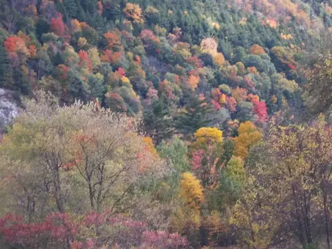
Photo: usfs_Eastern_Region · public domain · original source
Public-domain photos by U.S. federal agencies, taken in the place named on each card.
All 130 areas, largest first
- National Forest land
Green Mountain National Forest
412,472 acres
U.S. Forest Service (USDA) · Bennington County, Addison County + 4 more
Open access - State forest
Mt. Mansfield State Forest
29,436 acres
Not recorded · Lamoille County, Chittenden County + 1 more
Mixed (open and restricted parcels) - National Wildlife Refuge
Silvio O. Conte National Fish And Wildlife Refuge
27,118 acres
U.S. Fish and Wildlife Service · Essex County, Windham County
Restricted access - State forest
Groton State Forest
26,572 acres
Not recorded · Caledonia County, Washington County + 1 more
Open access - State forest
Coolidge State Forest
16,588 acres
Not recorded · Windsor County, Rutland County
Open access - State forest
C.C. Putnam State Forest
14,578 acres
Not recorded · Washington County, Lamoille County
Mixed (open and restricted parcels) - State wildlife / game area
Steam Mill Brook Wildlife Management Area
10,970 acres
Not recorded · Caledonia County
Open access - State wildlife / game area
Bill Sladyk Wildlife Management Area
8,996 acres
Not recorded · Essex County, Orleans County
Open access - State wildlife / game area
Arthur Davis Wildlife Management Area
7,960 acres
Not recorded · Windsor County
Open access - State forest
Willoughby State Forest
7,708 acres
Not recorded · Caledonia County, Orleans County
Open access - National Wildlife Refuge
Missisquoi National Wildlife Refuge
7,287 acres
U.S. Fish and Wildlife Service · Franklin County, Orleans County
Restricted access - State wildlife / game area
Les Newell Wildlife Management Area
6,189 acres
Not recorded · Windsor County
Open access - State forest
Long Trail State Forest
6,012 acres
Not recorded · Lamoille County, Orleans County + 1 more
Mixed (open and restricted parcels) - State wildlife / game area
Victory Basin Wildlife Management Area
5,372 acres
Not recorded · Essex County
Open access - State wildlife / game area
Dead Creek Wildlife Management Area
3,109 acres
Not recorded · Addison County
Mixed (open and restricted parcels) - State wildlife / game area
Wenlock Wildlife Management Area
2,578 acres
Not recorded · Essex County
Open access - State wildlife / game area
Pine Mountain Wildlife Management Area
2,489 acres
Not recorded · Orange County, Caledonia County
Open access - State forest
Camels Hump State Forest
2,356 acres
Not recorded · Chittenden County, Washington County + 1 more
Open access - State wildlife / game area
Hawks Mountain Wildlife Management Area
2,292 acres
Not recorded · Windsor County
Open access - State forest
Jay State Forest
2,177 acres
Not recorded · Orleans County
Mixed (open and restricted parcels) - State wildlife / game area
Pond Woods Wildlife Management Area
2,102 acres
Not recorded · Rutland County, Addison County
Open access - State wildlife / game area
Lewis Creek Wildlife Management Area
2,014 acres
Not recorded · Addison County
Open access - State wildlife / game area
Plymsbury Wildlife Management Area
1,917 acres
Not recorded · Rutland County, Windsor County
Mixed (open and restricted parcels) - State wildlife / game area
South Bay Wildlife Management Area
1,802 acres
Not recorded · Orleans County
Open access - National Forest land
Green Mountain Other
1,696 acres
U.S. Forest Service (USDA) · Essex County
Open access - State wildlife / game area
Huntington Gap Wildlife Management Area
1,594 acres
Not recorded · Chittenden County, Washington County
Mixed (open and restricted parcels) - State wildlife / game area
Sandbar Wildlife Management Area
1,551 acres
Not recorded · Chittenden County
Open access - State wildlife / game area
Roy Mountain Wildlife Management Area
1,530 acres
State: fish and wildlife agency · Caledonia County
Mixed (open and restricted parcels) - State wildlife / game area
Little Otter Creek Wildlife Management Area
1,386 acres
Not recorded · Addison County
Open access - State wildlife / game area
Roaring Brook Wildlife Management Area
1,380 acres
Not recorded · Windham County
Mixed (open and restricted parcels) - State wildlife / game area
Cornwall Swamp Wildlife Management Area
1,350 acres
Not recorded · Addison County
Open access - State wildlife / game area
Fairfield Swamp Wildlife Management Area
1,331 acres
Not recorded · Franklin County
Open access - State wildlife / game area
Blueberry Hill Wildlife Management Area
1,284 acres
Not recorded · Rutland County
Open access - State wildlife / game area
Tinmouth Channel Wildlife Management Area
1,227 acres
Not recorded · Rutland County
Open access - State wildlife / game area
Otter Creek Wildlife Management Area
1,211 acres
Not recorded · Rutland County
Open access - State wildlife / game area
Fred Johnson Wildlife Management Area
1,193 acres
Not recorded · Chittenden County, Addison County
Open access - State wildlife / game area
Mud Creek Wildlife Management Area
1,144 acres
Not recorded · Grand Isle County
Open access - State wildlife / game area
Bald Hill Wildlife Management Area
1,140 acres
Not recorded · Caledonia County, Orleans County
Open access - State wildlife / game area
Snake Mountain Wildlife Management Area
1,088 acres
Not recorded · Addison County
Open access - State wildlife / game area
Turner Hill Wildlife Management Area
1,078 acres
Not recorded · Windham County
Open access - State wildlife / game area
West Mountain Wildlife Management Area
1,065 acres
Not recorded · Essex County
Open access - State wildlife / game area
Atherton Meadows Wildlife Management Area
1,035 acres
Not recorded · Windham County
Open access - Army Corps of Engineers project land
Union Village Dam Recreation Area
999 acres
U.S. Army Corps of Engineers · Orange County
Open access - Army Corps of Engineers project land
Townshend Recreation Area
968 acres
U.S. Army Corps of Engineers · Windham County
Open access - State wildlife / game area
Robbins Mountain Wildlife Management Area
897 acres
Not recorded · Chittenden County
Open access - State wildlife / game area
Podunk Wildlife Management Area
891 acres
Not recorded · Orange County
Open access - State wildlife / game area
Windsor Prison Wildlife Management Area
851 acres
Not recorded · Windsor County
Open access - State wildlife / game area
Bird Mountain Wildlife Management Area
765 acres
Not recorded · Rutland County
Open access - State wildlife / game area
Lower Otter Creek Wildlife Management Area
741 acres
Not recorded · Addison County
Open access - State wildlife / game area
Tiny Pond Wildlife Management Area
708 acres
Not recorded · Windsor County, Rutland County
Open access - State wildlife / game area
Little Ascutney Wildlife Management Area
655 acres
Not recorded · Windsor County
Open access - State wildlife / game area
White River Wildlife Management Area
642 acres
Not recorded · Windsor County
Open access - State wildlife / game area
Knapp Brook Wildlife Management Area
640 acres
Not recorded · Windsor County
Mixed (open and restricted parcels) - State wildlife / game area
Middlesex Notch Wildlife Management Area
631 acres
Not recorded · Washington County
Open access - State wildlife / game area
Lemon Fair Wildlife Management Area
598 acres
Not recorded · Addison County
Open access - State wildlife / game area
Averill Mountain Wildlife Management Area
560 acres
Not recorded · Essex County
Open access - State wildlife / game area
Whipple Hollow Wildlife Management Area
506 acres
Not recorded · Rutland County
Open access - State wildlife / game area
Clover Hill Wildlife Management Area
497 acres
Not recorded · Orange County
Open access - State wildlife / game area
Maquam Bay Wildlife Management Area
444 acres
Not recorded · Franklin County
Open access - State wildlife / game area
Calendar Brook Wildlife Management Area
438 acres
Not recorded · Caledonia County
Open access - State wildlife / game area
East Creek Wildlife Management Area
436 acres
Not recorded · Addison County, Rutland County
Open access - State wildlife / game area
Whipstock Hill Wildlife Management Area
428 acres
Not recorded · Bennington County
Open access - State wildlife / game area
Rock River Wildlife Management Area
413 acres
Not recorded · Franklin County
Open access - State wildlife / game area
Wild Branch Wildlife Management Area
409 acres
Not recorded · Lamoille County
Open access - State wildlife / game area
Willoughby Falls Wildlife Management Area
387 acres
Not recorded · Orleans County
Mixed (open and restricted parcels) - State wildlife / game area
Riley Bostwick Wildlife Management Area
385 acres
Not recorded · Windsor County
Open access - State wildlife / game area
Richville Wildlife Management Area
320 acres
State: fish and wildlife agency · Addison County
Mixed (open and restricted parcels) - State wildlife / game area
Buck Lake Wildlife Management Area
306 acres
Not recorded · Washington County
Open access - State wildlife / game area
Whitney/Hospital Creek Wildlife Management Area
303 acres
Not recorded · Addison County
Open access - State wildlife / game area
Black Creek Wildlife Management Area
298 acres
Not recorded · Franklin County
Open access - State wildlife / game area
Brandon Swamp Wildlife Management Area
297 acres
Not recorded · Rutland County, Addison County
Open access - State wildlife / game area
Bonsawinno Wildlife Management Area
285 acres
Not recorded · Rutland County
Restricted access - State wildlife / game area
Johnson Farm Wildlife Management Area
284 acres
Not recorded · Essex County
Open access - State wildlife / game area
Gale Meadows Wildlife Management Area
280 acres
Not recorded · Bennington County, Windham County
Open access - State wildlife / game area
Ottauquechee Wildlife Management Area
266 acres
Not recorded · Windsor County
Open access - State wildlife / game area
Avery's Gore Wildlife Management Area
265 acres
Not recorded · Franklin County, Lamoille County
Open access - State wildlife / game area
Hubbardton Battlefield Wildlife Management Area
264 acres
Not recorded · Rutland County
Open access - State wildlife / game area
Washington Wildlife Management Area
261 acres
Not recorded · Orange County
Open access - State wildlife / game area
Levi Pond Wildlife Management Area
252 acres
Not recorded · Caledonia County
Open access - State wildlife / game area
East Hill Wildlife Management Area
251 acres
Not recorded · Lamoille County
Open access - State wildlife / game area
Rochester Wildlife Management Area
238 acres
Not recorded · Windsor County
Open access - State wildlife / game area
Lower Lamoille River Wildlife Management Area
229 acres
Not recorded · Chittenden County
Open access - State wildlife / game area
Elm Brook Wildlife Management Area
206 acres
Not recorded · Franklin County
Open access - State wildlife / game area
Skitchewaug Wildlife Management Area
206 acres
Not recorded · Windsor County
Open access - State wildlife / game area
Worcester Woods Wildlife Management Area
185 acres
Not recorded · Washington County
Open access - State wildlife / game area
Intervale Wildlife Management Area
151 acres
Not recorded · Chittenden County
Open access - State wildlife / game area
Pomainville Wildlife Management Area
149 acres
Not recorded · Rutland County
Open access - State wildlife / game area
Mallets Creek Wildlife Management Area
142 acres
Not recorded · Chittenden County
Open access - State wildlife / game area
South Stream Wildlife Management Area
142 acres
Not recorded · Bennington County
Open access - State wildlife / game area
Kesick Swamp Wildlife Management Area
135 acres
Not recorded · Bennington County
Open access - State wildlife / game area
Missing Link Wildlife Management Area
111 acres
Not recorded · Windham County
Open access - State wildlife / game area
Malletts Creek Wildlife Management Area
105 acres
Not recorded · Chittenden County
Open access - State wildlife / game area
Ward Marsh Wildlife Management Area
102 acres
Not recorded · Rutland County
Open access - State wildlife / game area
Marsh Pond Wildlife Management Area
97 acres
Not recorded · Rutland County
Open access - State wildlife / game area
Buczek Marsh Wildlife Management Area
96 acres
Not recorded · Rutland County
Open access - State wildlife / game area
Carmans Marsh Wildlife Management Area
94 acres
Not recorded · Franklin County
Open access - State wildlife / game area
Star Lake Wetlands (Wildlife Management Area)
94 acres
Not recorded · Rutland County
Open access - State wildlife / game area
Lewis Creek Streambank
92 acres
State: fish and wildlife agency · Chittenden County
Open access - State wildlife / game area
West Fairlee Wildlife Management Area
92 acres
Not recorded · Orange County
Open access - State wildlife / game area
Loves Marsh Wildlife Management Area
65 acres
Not recorded · Rutland County
Open access - State wildlife / game area
Weathersfield Wildlife Management Area
65 acres
Not recorded · Windsor County
Open access - State wildlife / game area
Fairlee Marsh Wildlife Management Area
59 acres
Not recorded · Orange County
Open access - State wildlife / game area
South Hero Marsh Wildlife Management Area
49 acres
Not recorded · Grand Isle County
Open access
Acreage is calculated from simplified PAD-US boundaries for the portion inside Vermont. “Access” is the PAD-US public access field, not a statement about hunting. National wildlife refuges are generally coded “restricted” in PAD-US because of seasonal or area closures.